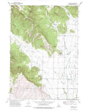
Kilgore Topo Map Idaho
To zoom in, hover over the map of Kilgore
USGS Topo Quad 44111d8 - 1:24,000 scale
| Topo Map Name: | Kilgore |
| USGS Topo Quad ID: | 44111d8 |
| Print Size: | ca. 21 1/4" wide x 27" high |
| Southeast Coordinates: | 44.375° N latitude / 111.875° W longitude |
| Map Center Coordinates: | 44.4375° N latitude / 111.9375° W longitude |
| U.S. State: | ID |
| Filename: | o44111d8.jpg |
| Download Map JPG Image: | Kilgore topo map 1:24,000 scale |
| Map Type: | Topographic |
| Topo Series: | 7.5´ |
| Map Scale: | 1:24,000 |
| Source of Map Images: | United States Geological Survey (USGS) |
| Alternate Map Versions: |
Kilgore ID 1972, updated 1976 Download PDF Buy paper map Kilgore ID 2011 Download PDF Buy paper map Kilgore ID 2013 Download PDF Buy paper map |
| FStopo: | US Forest Service topo Kilgore is available: Download FStopo PDF Download FStopo TIF |
1:24,000 Topo Quads surrounding Kilgore
> Back to 44111a1 at 1:100,000 scale
> Back to 44110a1 at 1:250,000 scale
> Back to U.S. Topo Maps home
Kilgore topo map: Gazetteer
Kilgore: Flats
Camas Meadows elevation 1933m 6341′Hirschi Flat elevation 2101m 6893′
Waters Flat elevation 2008m 6587′
Kilgore: Populated Places
Kilgore elevation 1930m 6332′Kilgore: Streams
Ching Creek elevation 1919m 6295′Dry Creek elevation 1918m 6292′
Fryingpan Creek elevation 2031m 6663′
Kay Creek elevation 2055m 6742′
Larkspur Creek elevation 2037m 6683′
Little Ching Creek elevation 1923m 6309′
Little Warm Creek elevation 1922m 6305′
Pasture Creek elevation 2071m 6794′
Spruce Creek elevation 2096m 6876′
Warm Creek elevation 1924m 6312′
Kilgore: Summits
Button Butte elevation 2045m 6709′Kilgore: Valleys
Bear Gulch elevation 1997m 6551′East Fork Bear Gulch elevation 2030m 6660′
McGarry Canyon elevation 1967m 6453′
Kilgore digital topo map on disk
Buy this Kilgore topo map showing relief, roads, GPS coordinates and other geographical features, as a high-resolution digital map file on DVD:


