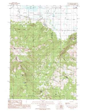
Slide Mountain Topo Map Montana
To zoom in, hover over the map of Slide Mountain
USGS Topo Quad 44111e7 - 1:24,000 scale
| Topo Map Name: | Slide Mountain |
| USGS Topo Quad ID: | 44111e7 |
| Print Size: | ca. 21 1/4" wide x 27" high |
| Southeast Coordinates: | 44.5° N latitude / 111.75° W longitude |
| Map Center Coordinates: | 44.5625° N latitude / 111.8125° W longitude |
| U.S. States: | MT, ID |
| Filename: | o44111e7.jpg |
| Download Map JPG Image: | Slide Mountain topo map 1:24,000 scale |
| Map Type: | Topographic |
| Topo Series: | 7.5´ |
| Map Scale: | 1:24,000 |
| Source of Map Images: | United States Geological Survey (USGS) |
| Alternate Map Versions: |
Slide Mountain MT 1988, updated 1988 Download PDF Buy paper map Slide Mountain MT 2011 Download PDF Buy paper map Slide Mountain MT 2014 Download PDF Buy paper map |
| FStopo: | US Forest Service topo Slide Mountain is available: Download FStopo PDF Download FStopo TIF |
1:24,000 Topo Quads surrounding Slide Mountain
> Back to 44111e1 at 1:100,000 scale
> Back to 44110a1 at 1:250,000 scale
> Back to U.S. Topo Maps home
Slide Mountain topo map: Gazetteer
Slide Mountain: Airports
Lakeview Airport elevation 2022m 6633′Slide Mountain: Lakes
Hancock Lake elevation 2416m 7926′Walking Fish Lake elevation 2235m 7332′
Slide Mountain: Populated Places
Lakeview elevation 2044m 6706′Slide Mountain: Post Offices
Lakeview Post Office (historical) elevation 2044m 6706′Magdalen Post Office (historical) elevation 2021m 6630′
Slide Mountain: Ranges
Western Centennial Mountains elevation 2862m 9389′Slide Mountain: Streams
Duff Creek elevation 2017m 6617′Humphry Creek elevation 2015m 6610′
Shambow Creek elevation 2019m 6624′
Spring Creek elevation 2176m 7139′
Slide Mountain: Summits
Baldy Mountain elevation 3008m 9868′Slide Mountain elevation 2992m 9816′
Slide Mountain elevation 2989m 9806′
Slide Mountain: Wells
14S02W22AACD01 Well elevation 2075m 6807′14S02W23BABA01 Well elevation 2042m 6699′
14S02W23BCA_01 Well elevation 2071m 6794′
14S02W23BDAA01 Well elevation 2037m 6683′
14S02W23BDDA01 Well elevation 2053m 6735′
14S02W23CAA_01 Well elevation 2050m 6725′
Slide Mountain digital topo map on disk
Buy this Slide Mountain topo map showing relief, roads, GPS coordinates and other geographical features, as a high-resolution digital map file on DVD:


