Winslow Creek Topo Map Montana
To zoom in, hover over the map of Winslow Creek
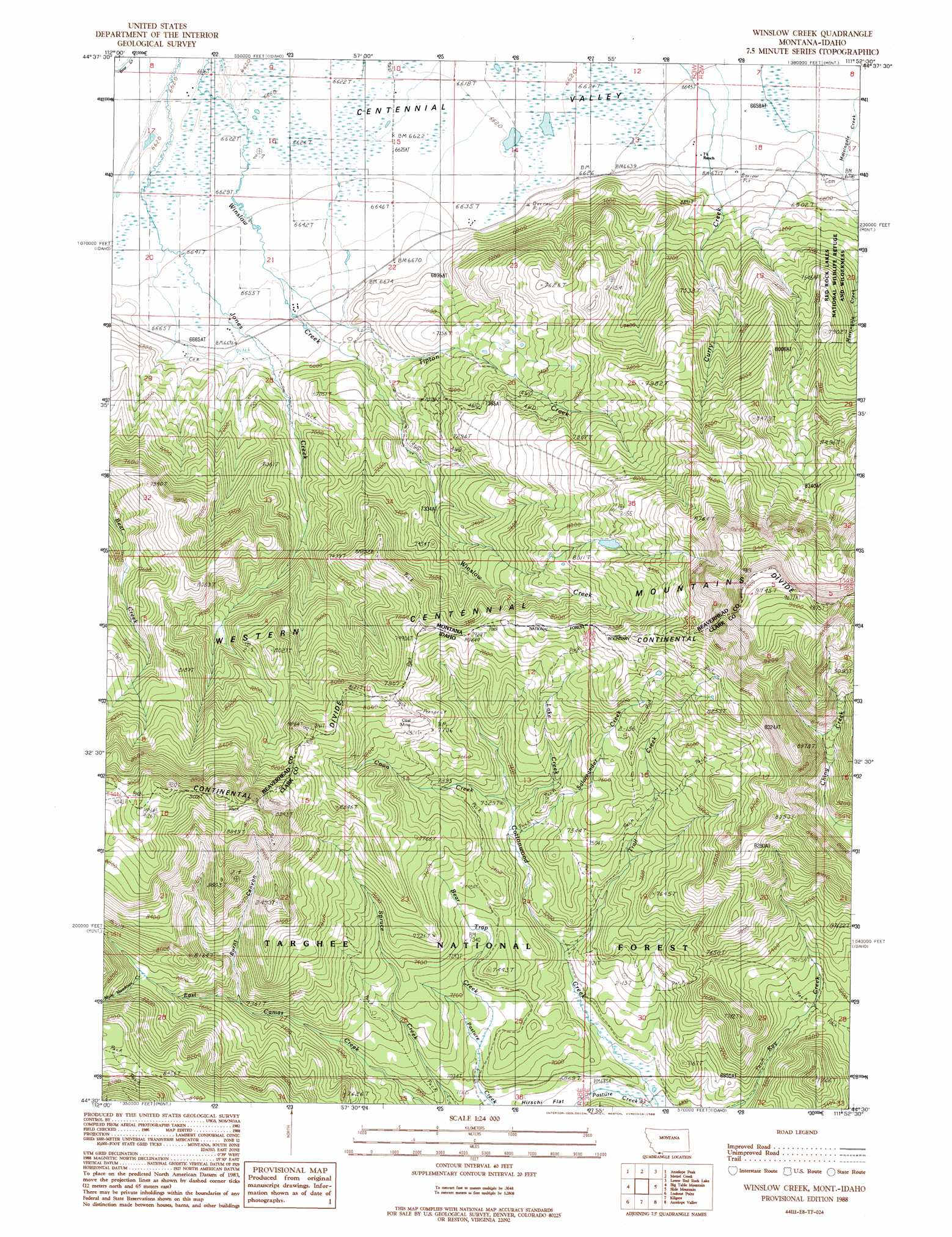
USGS Topo Quad 44111e8 - 1:24,000 scale
| Topo Map Name: | Winslow Creek |
| USGS Topo Quad ID: | 44111e8 |
| Print Size: | ca. 21 1/4" wide x 27" high |
| Southeast Coordinates: | 44.5° N latitude / 111.875° W longitude |
| Map Center Coordinates: | 44.5625° N latitude / 111.9375° W longitude |
| U.S. States: | MT, ID |
| Filename: | o44111e8.jpg |
| Download Map JPG Image: | Winslow Creek topo map 1:24,000 scale |
| Map Type: | Topographic |
| Topo Series: | 7.5´ |
| Map Scale: | 1:24,000 |
| Source of Map Images: | United States Geological Survey (USGS) |
| Alternate Map Versions: |
Winslow Creek MT 1988, updated 1988 Download PDF Buy paper map Winslow Creek MT 2011 Download PDF Buy paper map Winslow Creek MT 2014 Download PDF Buy paper map |
| FStopo: | US Forest Service topo Winslow Creek is available: Download FStopo PDF Download FStopo TIF |
1:24,000 Topo Quads surrounding Winslow Creek
Antone Peak |
Stonehouse Mountain |
Eureka Basin |
Windy Hill |
Freezeout Mountain |
Wolverine Creek |
Antelope Peak |
Metzel Creek |
Lower Red Rock Lake |
Elk Springs |
Corral Creek |
Big Table Mountain |
Winslow Creek |
Slide Mountain |
Upper Red Rock Lake |
Spencer North |
Lookout Point |
Kilgore |
Antelope Valley |
Sheridan Reservoir |
Spencer South |
Gardner Lake |
Idmon |
Pine Butte |
Crystal Butte |
> Back to 44111e1 at 1:100,000 scale
> Back to 44110a1 at 1:250,000 scale
> Back to U.S. Topo Maps home
Winslow Creek topo map: Gazetteer
Winslow Creek: Mines
Coal Mine elevation 2408m 7900′Winslow Creek: Springs
14S03W23BBD_01 Spring elevation 2024m 6640′Winslow Creek: Streams
Bear Trap Creek elevation 2157m 7076′Coon Creek elevation 2222m 7290′
Lake Creek elevation 2205m 7234′
Mule Meadows Creek elevation 2371m 7778′
Salamander Creek elevation 2201m 7221′
Tipton Creek elevation 2031m 6663′
Trail Creek elevation 2143m 7030′
Winslow Creek: Trails
Table Mountain Trail elevation 2546m 8353′Winslow Creek: Valleys
Burnt Canyon elevation 2251m 7385′Winslow Creek: Wells
14S03W13DBCB01 Well elevation 2035m 6676′14S03W21DDCC01 Well elevation 2039m 6689′
14S03W22CABD01 Well elevation 2036m 6679′
Winslow Creek digital topo map on disk
Buy this Winslow Creek topo map showing relief, roads, GPS coordinates and other geographical features, as a high-resolution digital map file on DVD: