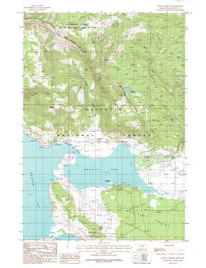
Mount Hebgen Topo Map Montana
To zoom in, hover over the map of Mount Hebgen
USGS Topo Quad 44111g2 - 1:24,000 scale
| Topo Map Name: | Mount Hebgen |
| USGS Topo Quad ID: | 44111g2 |
| Print Size: | ca. 21 1/4" wide x 27" high |
| Southeast Coordinates: | 44.75° N latitude / 111.125° W longitude |
| Map Center Coordinates: | 44.8125° N latitude / 111.1875° W longitude |
| U.S. State: | MT |
| Filename: | o44111g2.jpg |
| Download Map JPG Image: | Mount Hebgen topo map 1:24,000 scale |
| Map Type: | Topographic |
| Topo Series: | 7.5´ |
| Map Scale: | 1:24,000 |
| Source of Map Images: | United States Geological Survey (USGS) |
| Alternate Map Versions: |
Mount Hebgen MT 1986, updated 1986 Download PDF Buy paper map Mount Hebgen MT 2000, updated 2005 Download PDF Buy paper map Mount Hebgen MT 2011 Download PDF Buy paper map Mount Hebgen MT 2014 Download PDF Buy paper map |
| FStopo: | US Forest Service topo Mount Hebgen is available: Download FStopo PDF Download FStopo TIF |
1:24,000 Topo Quads surrounding Mount Hebgen
> Back to 44111e1 at 1:100,000 scale
> Back to 44110a1 at 1:250,000 scale
> Back to U.S. Topo Maps home
Mount Hebgen topo map: Gazetteer
Mount Hebgen: Bays
Grayling Arm elevation 1993m 6538′Mount Hebgen: Capes
Edwards Peninsula elevation 1993m 6538′Edwards Point elevation 1994m 6541′
Horse Butte Peninsula elevation 2091m 6860′
Rainbow Point elevation 1993m 6538′
Mount Hebgen: Channels
The Narrows elevation 1993m 6538′Mount Hebgen: Lakes
Johnson Lake elevation 2449m 8034′Rathbone Lake elevation 2328m 7637′
Whits Lakes elevation 2220m 7283′
Mount Hebgen: Populated Places
Grayling elevation 2014m 6607′Horse Butte Acres Trailer Court elevation 2003m 6571′
Lakeview elevation 1996m 6548′
Mount Hebgen: Post Offices
Grayling Post Office (historical) elevation 2014m 6607′Mount Hebgen: Ridges
Graycroft Ridge elevation 2593m 8507′Kirkwood Ridge elevation 2878m 9442′
Mount Hebgen: Springs
Corey Spring elevation 2004m 6574′Mount Hebgen: Streams
Cougar Creek elevation 1995m 6545′Cougar Creek elevation 1995m 6545′
Duck Creek elevation 1993m 6538′
Grayling Creek elevation 1993m 6538′
Red Canyon Creek elevation 1993m 6538′
Mount Hebgen: Summits
Horse Butte elevation 2138m 7014′Mount Hebgen elevation 2649m 8690′
Mount Hebgen: Trails
Little Tepee Creek Trail elevation 2385m 7824′Mount Hebgen: Valleys
Coal Canyon elevation 2092m 6863′Madison Valley elevation 2040m 6692′
Red Canyon Fault elevation 2178m 7145′
Mount Hebgen: Wells
12S04E11BDDC01 Well elevation 2003m 6571′12S04E12BCBB01 Well elevation 2014m 6607′
12S04E25ACDD01 Well elevation 2001m 6564′
12S05E17BDAA01 Well elevation 2002m 6568′
Mount Hebgen digital topo map on disk
Buy this Mount Hebgen topo map showing relief, roads, GPS coordinates and other geographical features, as a high-resolution digital map file on DVD:


