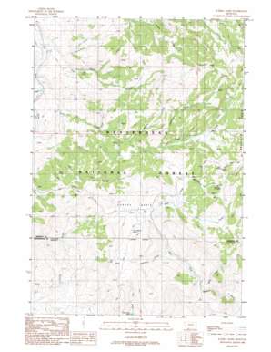
Eureka Basin Topo Map Montana
To zoom in, hover over the map of Eureka Basin
USGS Topo Quad 44111g8 - 1:24,000 scale
| Topo Map Name: | Eureka Basin |
| USGS Topo Quad ID: | 44111g8 |
| Print Size: | ca. 21 1/4" wide x 27" high |
| Southeast Coordinates: | 44.75° N latitude / 111.875° W longitude |
| Map Center Coordinates: | 44.8125° N latitude / 111.9375° W longitude |
| U.S. State: | MT |
| Filename: | o44111g8.jpg |
| Download Map JPG Image: | Eureka Basin topo map 1:24,000 scale |
| Map Type: | Topographic |
| Topo Series: | 7.5´ |
| Map Scale: | 1:24,000 |
| Source of Map Images: | United States Geological Survey (USGS) |
| Alternate Map Versions: |
Eureka Basin MT 1988, updated 1988 Download PDF Buy paper map Eureka Basin MT 1988, updated 1988 Download PDF Buy paper map Eureka Basin MT 1997, updated 2002 Download PDF Buy paper map Eureka Basin MT 2011 Download PDF Buy paper map Eureka Basin MT 2014 Download PDF Buy paper map |
| FStopo: | US Forest Service topo Eureka Basin is available: Download FStopo PDF Download FStopo TIF |
1:24,000 Topo Quads surrounding Eureka Basin
> Back to 44111e1 at 1:100,000 scale
> Back to 44110a1 at 1:250,000 scale
> Back to U.S. Topo Maps home
Eureka Basin topo map: Gazetteer
Eureka Basin: Basins
Eureka Basin elevation 2446m 8024′Eureka Basin: Springs
Lone Willow Spring elevation 2401m 7877′Long Creek Spring Number One elevation 2345m 7693′
Twin Springs elevation 2371m 7778′
Eureka Basin: Streams
Anderson Creek elevation 2352m 7716′Basin Creek elevation 2101m 6893′
Coal Creek elevation 2119m 6952′
Corral Creek elevation 2147m 7043′
Fox Creek elevation 2421m 7942′
Miner Creek elevation 2318m 7604′
Murphy Creek elevation 2311m 7582′
Perkins Creek elevation 2390m 7841′
Shovel Creek elevation 2131m 6991′
Eureka Basin digital topo map on disk
Buy this Eureka Basin topo map showing relief, roads, GPS coordinates and other geographical features, as a high-resolution digital map file on DVD:


