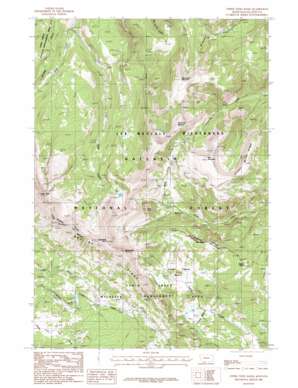
Upper Tepee Basin Topo Map Montana
To zoom in, hover over the map of Upper Tepee Basin
USGS Topo Quad 44111h2 - 1:24,000 scale
| Topo Map Name: | Upper Tepee Basin |
| USGS Topo Quad ID: | 44111h2 |
| Print Size: | ca. 21 1/4" wide x 27" high |
| Southeast Coordinates: | 44.875° N latitude / 111.125° W longitude |
| Map Center Coordinates: | 44.9375° N latitude / 111.1875° W longitude |
| U.S. State: | MT |
| Filename: | o44111h2.jpg |
| Download Map JPG Image: | Upper Tepee Basin topo map 1:24,000 scale |
| Map Type: | Topographic |
| Topo Series: | 7.5´ |
| Map Scale: | 1:24,000 |
| Source of Map Images: | United States Geological Survey (USGS) |
| Alternate Map Versions: |
Upper Tepee Basin MT 1986, updated 1986 Download PDF Buy paper map Upper Tepee Basin MT 1986, updated 1986 Download PDF Buy paper map Upper Tepee Basin MT 2000, updated 2005 Download PDF Buy paper map Upper Tepee Basin MT 2011 Download PDF Buy paper map Upper Tepee Basin MT 2014 Download PDF Buy paper map |
| FStopo: | US Forest Service topo Upper Tepee Basin is available: Download FStopo PDF Download FStopo TIF |
1:24,000 Topo Quads surrounding Upper Tepee Basin
> Back to 44111e1 at 1:100,000 scale
> Back to 44110a1 at 1:250,000 scale
> Back to U.S. Topo Maps home
Upper Tepee Basin topo map: Gazetteer
Upper Tepee Basin: Basins
Tepee Basin elevation 2475m 8120′Upper Tepee Basin elevation 2650m 8694′
Upper Tepee Basin: Parks
Cabin Creek Wildlife Management Area elevation 2760m 9055′Upper Tepee Basin: Ridges
Ernest Miller Ridge elevation 2983m 9786′Upper Tepee Basin: Streams
Burnt Fork elevation 2497m 8192′Little Sage Creek elevation 2242m 7355′
Upper Tepee Basin: Summits
Cone Peak elevation 2945m 9662′Monument Mountain elevation 3065m 10055′
Red Mountain elevation 3041m 9977′
Redstreak Peak elevation 3151m 10337′
Sage Peak elevation 3189m 10462′
Snowslide Mountain elevation 3053m 10016′
Tepee Point elevation 2868m 9409′
White Peak elevation 3120m 10236′
Upper Tepee Basin: Trails
Cabin Creek Divide Trail elevation 2582m 8471′Skyline Trail elevation 2996m 9829′
Upper Tepee Basin digital topo map on disk
Buy this Upper Tepee Basin topo map showing relief, roads, GPS coordinates and other geographical features, as a high-resolution digital map file on DVD:


