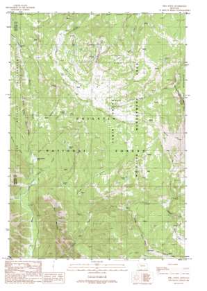
Pika Point Topo Map Montana
To zoom in, hover over the map of Pika Point
USGS Topo Quad 44111h3 - 1:24,000 scale
| Topo Map Name: | Pika Point |
| USGS Topo Quad ID: | 44111h3 |
| Print Size: | ca. 21 1/4" wide x 27" high |
| Southeast Coordinates: | 44.875° N latitude / 111.25° W longitude |
| Map Center Coordinates: | 44.9375° N latitude / 111.3125° W longitude |
| U.S. State: | MT |
| Filename: | o44111h3.jpg |
| Download Map JPG Image: | Pika Point topo map 1:24,000 scale |
| Map Type: | Topographic |
| Topo Series: | 7.5´ |
| Map Scale: | 1:24,000 |
| Source of Map Images: | United States Geological Survey (USGS) |
| Alternate Map Versions: |
Pika Point MT 1988, updated 1989 Download PDF Buy paper map Pika Point MT 1988, updated 1989 Download PDF Buy paper map Pika Point MT 2000, updated 2005 Download PDF Buy paper map Pika Point MT 2011 Download PDF Buy paper map Pika Point MT 2014 Download PDF Buy paper map |
| FStopo: | US Forest Service topo Pika Point is available: Download FStopo PDF Download FStopo TIF |
1:24,000 Topo Quads surrounding Pika Point
> Back to 44111e1 at 1:100,000 scale
> Back to 44110a1 at 1:250,000 scale
> Back to U.S. Topo Maps home
Pika Point topo map: Gazetteer
Pika Point: Basins
Carrot Basin elevation 2733m 8966′Sage Basin elevation 2765m 9071′
Sunlight Basin elevation 2695m 8841′
Pika Point: Capes
Lookout Point elevation 2855m 9366′Pika Point: Flats
Potamogeton Park elevation 2181m 7155′Pika Point: Lakes
Axolotl Lake elevation 2302m 7552′Juncus Lake elevation 2525m 8284′
Lightning Lake elevation 2610m 8562′
Lomna Lake elevation 2779m 9117′
Meadow Lake elevation 2599m 8526′
Minnie Lake elevation 2524m 8280′
Park Lake elevation 2640m 8661′
Rose Lake elevation 2619m 8592′
Turquoise Lake elevation 2775m 9104′
Pika Point: Ridges
Skyline Ridge elevation 2953m 9688′Wapiti Ridge elevation 2840m 9317′
Pika Point: Streams
Cub Creek elevation 2116m 6942′Forest Creek elevation 2161m 7089′
Gully Creek elevation 2312m 7585′
Hilgard Creek elevation 2224m 7296′
Middle Fork Cabin Creek elevation 2303m 7555′
Rose Creek elevation 2307m 7568′
Sentinel Creek elevation 2150m 7053′
South Fork Cabin Creek elevation 2357m 7732′
Timber Creek elevation 2095m 6873′
West Fork Beaver Creek elevation 2063m 6768′
Wyethia Creek elevation 2326m 7631′
Pika Point: Summits
Apex Point elevation 2755m 9038′Boat Mountain elevation 2730m 8956′
Pika Point elevation 2896m 9501′
Pika Point: Trails
Kirkwood Trail elevation 2636m 8648′Little Wapiti Creek Trail elevation 2549m 8362′
Wapiti Creek Trail elevation 2440m 8005′
Pika Point digital topo map on disk
Buy this Pika Point topo map showing relief, roads, GPS coordinates and other geographical features, as a high-resolution digital map file on DVD:


