Thunder Gulch Topo Map Idaho
To zoom in, hover over the map of Thunder Gulch
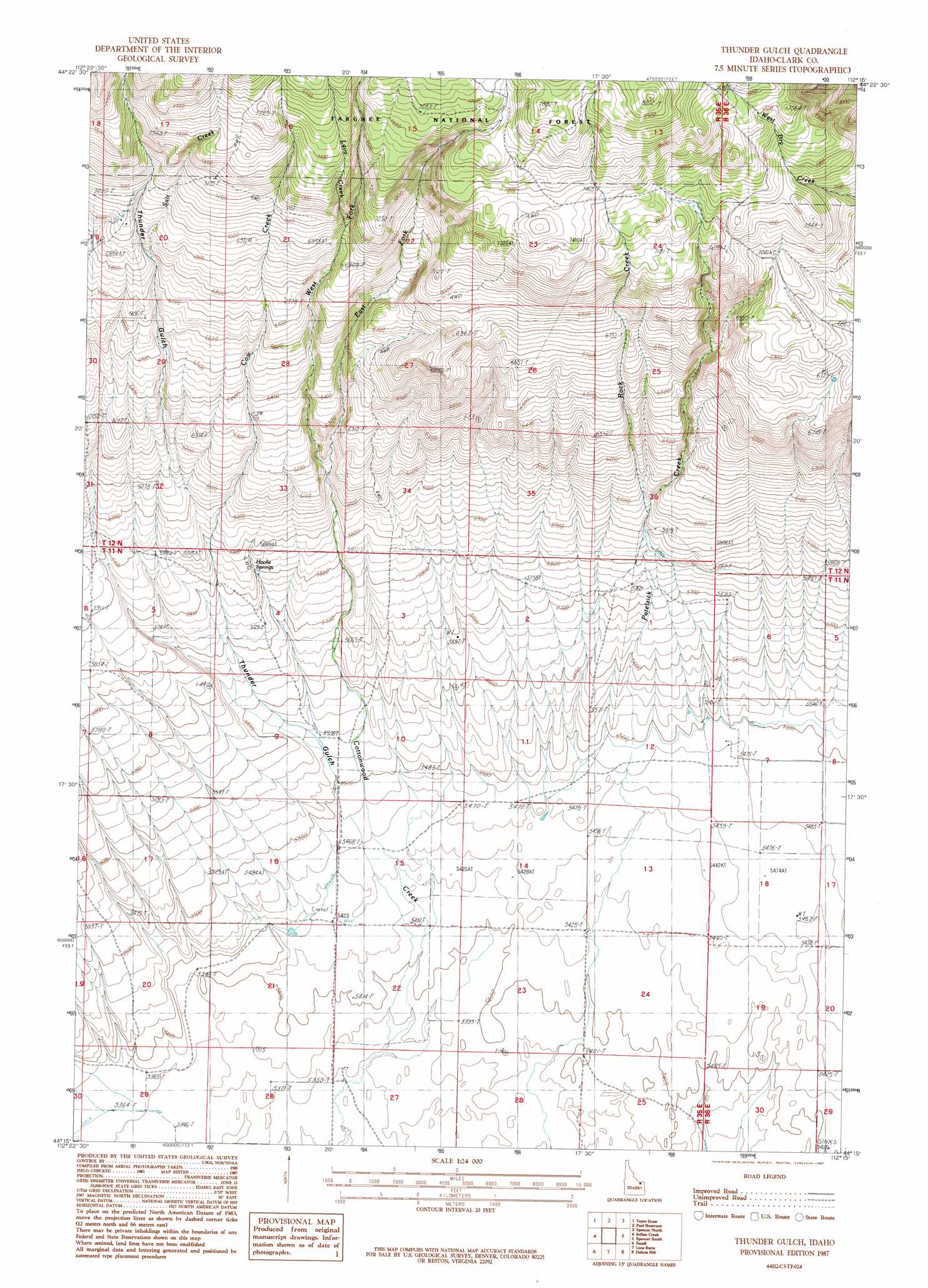
USGS Topo Quad 44112c3 - 1:24,000 scale
| Topo Map Name: | Thunder Gulch |
| USGS Topo Quad ID: | 44112c3 |
| Print Size: | ca. 21 1/4" wide x 27" high |
| Southeast Coordinates: | 44.25° N latitude / 112.25° W longitude |
| Map Center Coordinates: | 44.3125° N latitude / 112.3125° W longitude |
| U.S. State: | ID |
| Filename: | o44112c3.jpg |
| Download Map JPG Image: | Thunder Gulch topo map 1:24,000 scale |
| Map Type: | Topographic |
| Topo Series: | 7.5´ |
| Map Scale: | 1:24,000 |
| Source of Map Images: | United States Geological Survey (USGS) |
| Alternate Map Versions: |
Thunder Gulch ID 1987, updated 1987 Download PDF Buy paper map Thunder Gulch ID 2011 Download PDF Buy paper map Thunder Gulch ID 2013 Download PDF Buy paper map |
| FStopo: | US Forest Service topo Thunder Gulch is available: Download FStopo PDF Download FStopo TIF |
1:24,000 Topo Quads surrounding Thunder Gulch
Lima Peaks |
Snowline |
Monida |
Corral Creek |
Big Table Mountain |
Edie Creek |
Tepee Draw |
Paul Reservoir |
Spencer North |
Lookout Point |
Rocky Creek |
Indian Creek |
Thunder Gulch |
Spencer South |
Gardner Lake |
Lidy Hot Springs |
Small |
Lone Butte |
Dubois |
Dubois Ne |
Lidy Hot Springs Se |
Cedar Butte Sw |
Cedar Butte |
Camas |
Dubois Se |
> Back to 44112a1 at 1:100,000 scale
> Back to 44112a1 at 1:250,000 scale
> Back to U.S. Topo Maps home
Thunder Gulch topo map: Gazetteer
Thunder Gulch: Springs
Hoolie Springs elevation 1775m 5823′Thunder Gulch: Streams
Cow Creek elevation 1660m 5446′East Fork Cottonwood Creek elevation 1830m 6003′
Lava Creek elevation 2148m 7047′
Patelzick Creek elevation 1677m 5501′
Rock Creek elevation 1799m 5902′
Salt Creek elevation 2058m 6751′
West Fork Cottonwood Creek elevation 1830m 6003′
Thunder Gulch: Valleys
Thunder Gulch elevation 1689m 5541′Thunder Gulch digital topo map on disk
Buy this Thunder Gulch topo map showing relief, roads, GPS coordinates and other geographical features, as a high-resolution digital map file on DVD: