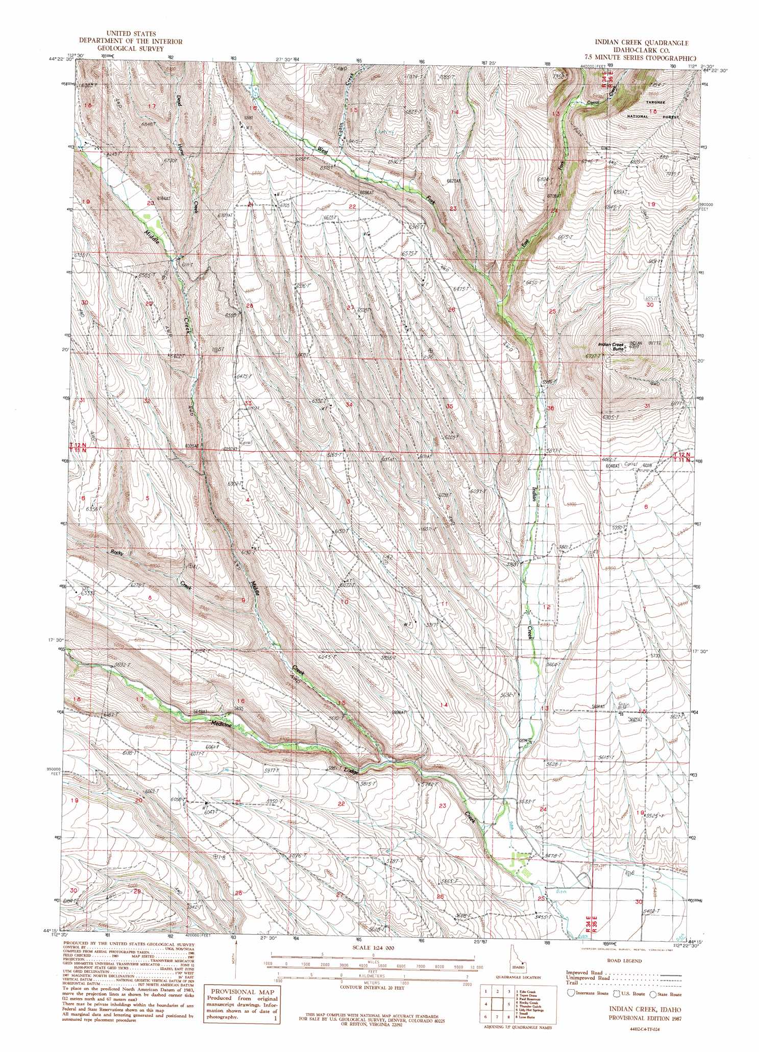
Indian Creek Topo Map Idaho
To zoom in, hover over the map of Indian Creek
USGS Topo Quad 44112c4 - 1:24,000 scale
| Topo Map Name: | Indian Creek |
| USGS Topo Quad ID: | 44112c4 |
| Print Size: | ca. 21 1/4" wide x 27" high |
| Southeast Coordinates: | 44.25° N latitude / 112.375° W longitude |
| Map Center Coordinates: | 44.3125° N latitude / 112.4375° W longitude |
| U.S. State: | ID |
| Filename: | o44112c4.jpg |
| Download Map JPG Image: | Indian Creek topo map 1:24,000 scale |
| Map Type: | Topographic |
| Topo Series: | 7.5´ |
| Map Scale: | 1:24,000 |
| Source of Map Images: | United States Geological Survey (USGS) |
| Alternate Map Versions: |
Indian Creek ID 1987, updated 1987 Download PDF Buy paper map Indian Creek ID 2011 Download PDF Buy paper map Indian Creek ID 2013 Download PDF Buy paper map |
| FStopo: | US Forest Service topo Indian Creek is available: Download FStopo PDF Download FStopo TIF |
1:24,000 Topo Quads surrounding Indian Creek
Gallagher Gulch |
Lima Peaks |
Snowline |
Monida |
Corral Creek |
Fritz Peak |
Edie Creek |
Tepee Draw |
Paul Reservoir |
Spencer North |
Heart Mountain |
Rocky Creek |
Indian Creek |
Thunder Gulch |
Spencer South |
Shamrock Gulch |
Lidy Hot Springs |
Small |
Lone Butte |
Dubois |
Snaky Canyon |
Lidy Hot Springs Se |
Cedar Butte Sw |
Cedar Butte |
Camas |
> Back to 44112a1 at 1:100,000 scale
> Back to 44112a1 at 1:250,000 scale
> Back to U.S. Topo Maps home
Indian Creek topo map: Gazetteer
Indian Creek: Streams
Cabin Creek elevation 1913m 6276′Corral Creek elevation 2018m 6620′
Dead Horse Creek elevation 1858m 6095′
East Fork Indian Creek elevation 1860m 6102′
Indian Creek elevation 1668m 5472′
Middle Creek elevation 1692m 5551′
Rocky Creek elevation 1744m 5721′
West Fork Indian Creek elevation 1850m 6069′
Indian Creek: Summits
Indian Creek Butte elevation 2119m 6952′Indian Creek digital topo map on disk
Buy this Indian Creek topo map showing relief, roads, GPS coordinates and other geographical features, as a high-resolution digital map file on DVD: