Lima Dam Topo Map Montana
To zoom in, hover over the map of Lima Dam
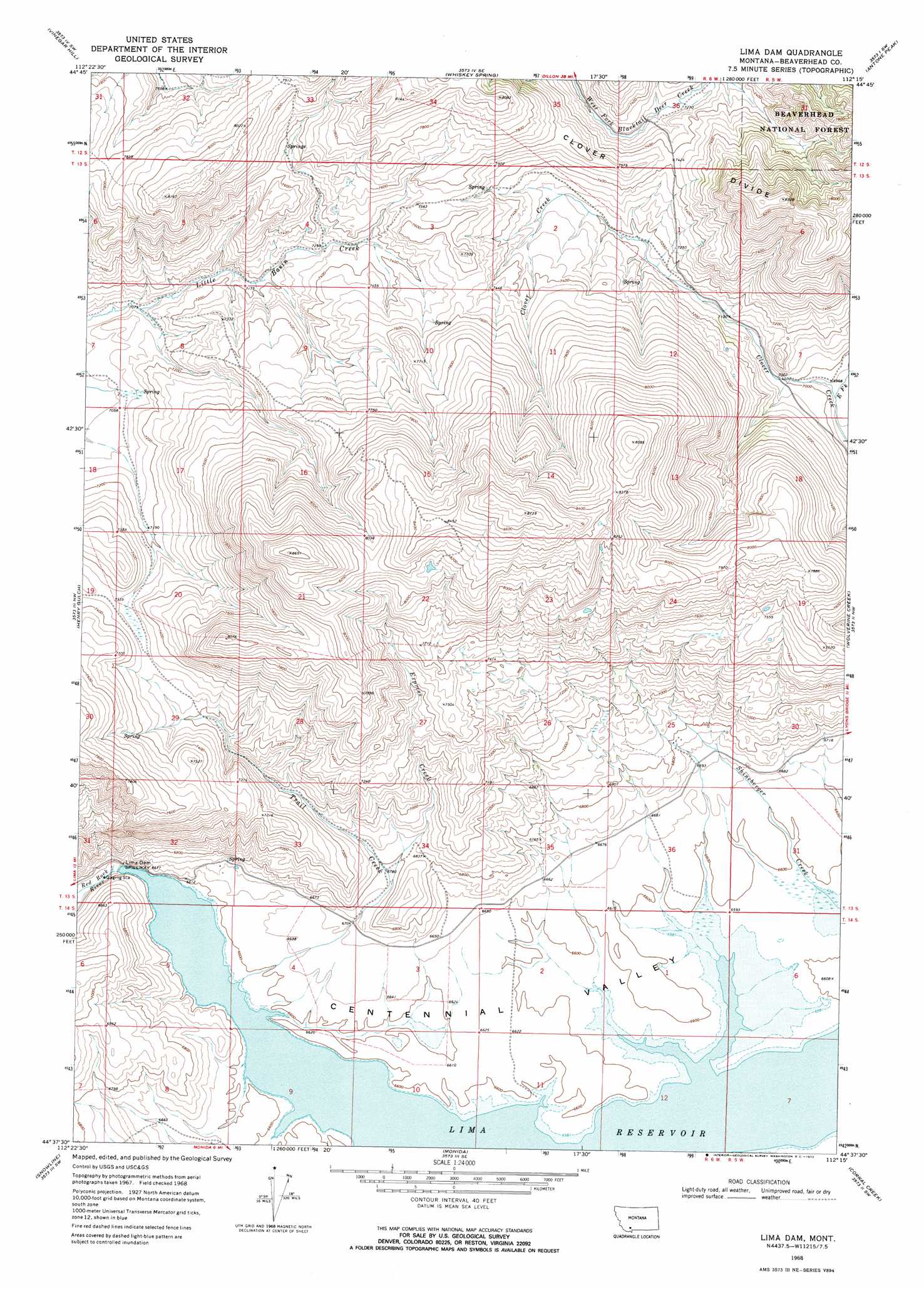
USGS Topo Quad 44112f3 - 1:24,000 scale
| Topo Map Name: | Lima Dam |
| USGS Topo Quad ID: | 44112f3 |
| Print Size: | ca. 21 1/4" wide x 27" high |
| Southeast Coordinates: | 44.625° N latitude / 112.25° W longitude |
| Map Center Coordinates: | 44.6875° N latitude / 112.3125° W longitude |
| U.S. State: | MT |
| Filename: | o44112f3.jpg |
| Download Map JPG Image: | Lima Dam topo map 1:24,000 scale |
| Map Type: | Topographic |
| Topo Series: | 7.5´ |
| Map Scale: | 1:24,000 |
| Source of Map Images: | United States Geological Survey (USGS) |
| Alternate Map Versions: |
Lima Dam MT 1968, updated 1972 Download PDF Buy paper map Lima Dam MT 1968, updated 1972 Download PDF Buy paper map Lima Dam MT 1997, updated 2002 Download PDF Buy paper map Lima Dam MT 2011 Download PDF Buy paper map Lima Dam MT 2014 Download PDF Buy paper map |
| FStopo: | US Forest Service topo Lima Dam is available: Download FStopo PDF Download FStopo TIF |
1:24,000 Topo Quads surrounding Lima Dam
Beech Creek |
Price Creek |
Price Creek Ne |
Swamp Creek |
Spur Mountain |
Rock Island Ranch |
Vinegar Hill |
Whiskey Spring |
Antone Peak |
Stonehouse Mountain |
Lima |
Henry Gulch |
Lima Dam |
Wolverine Creek |
Antelope Peak |
Lima Peaks |
Snowline |
Monida |
Corral Creek |
Big Table Mountain |
Edie Creek |
Tepee Draw |
Paul Reservoir |
Spencer North |
Lookout Point |
> Back to 44112e1 at 1:100,000 scale
> Back to 44112a1 at 1:250,000 scale
> Back to U.S. Topo Maps home
Lima Dam topo map: Gazetteer
Lima Dam: Dams
Lima Dam elevation 2011m 6597′Peru Dam elevation 2013m 6604′
Lima Dam: Reservoirs
Lima Reservoir elevation 2002m 6568′Lima Dam: Ridges
Clover Divide elevation 2261m 7417′Lima Dam: Streams
East Fork Clover Creek elevation 2117m 6945′Express Creek elevation 2062m 6765′
Trail Creek elevation 2013m 6604′
Lima Dam: Valleys
Centennial Valley elevation 2013m 6604′Lima Dam: Wells
13S06W25DBCB01 Well elevation 2070m 6791′Lima Dam digital topo map on disk
Buy this Lima Dam topo map showing relief, roads, GPS coordinates and other geographical features, as a high-resolution digital map file on DVD: