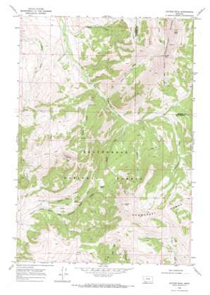
Antone Peak Topo Map Montana
To zoom in, hover over the map of Antone Peak
USGS Topo Quad 44112g2 - 1:24,000 scale
| Topo Map Name: | Antone Peak |
| USGS Topo Quad ID: | 44112g2 |
| Print Size: | ca. 21 1/4" wide x 27" high |
| Southeast Coordinates: | 44.75° N latitude / 112.125° W longitude |
| Map Center Coordinates: | 44.8125° N latitude / 112.1875° W longitude |
| U.S. State: | MT |
| Filename: | o44112g2.jpg |
| Download Map JPG Image: | Antone Peak topo map 1:24,000 scale |
| Map Type: | Topographic |
| Topo Series: | 7.5´ |
| Map Scale: | 1:24,000 |
| Source of Map Images: | United States Geological Survey (USGS) |
| Alternate Map Versions: |
Antone Peak MT 1968, updated 1972 Download PDF Buy paper map Antone Peak MT 1968, updated 1981 Download PDF Buy paper map Antone Peak MT 1997, updated 2002 Download PDF Buy paper map Antone Peak MT 2011 Download PDF Buy paper map Antone Peak MT 2014 Download PDF Buy paper map |
| FStopo: | US Forest Service topo Antone Peak is available: Download FStopo PDF Download FStopo TIF |
1:24,000 Topo Quads surrounding Antone Peak
> Back to 44112e1 at 1:100,000 scale
> Back to 44112a1 at 1:250,000 scale
> Back to U.S. Topo Maps home
Antone Peak topo map: Gazetteer
Antone Peak: Gaps
Antone Pass elevation 2618m 8589′Antone Peak: Springs
Seybold Spring elevation 2430m 7972′Antone Peak: Streams
Antone Creek elevation 2457m 8061′Bonita Fork elevation 2300m 7545′
Clark Fork elevation 2338m 7670′
Crows Nest Creek elevation 2228m 7309′
Indian Creek elevation 2216m 7270′
Lawrence Creek elevation 2327m 7634′
Meadow Creek elevation 2282m 7486′
Rough Creek elevation 2262m 7421′
Taylor Creek elevation 2130m 6988′
Two Meadows Creek elevation 2447m 8028′
Antone Peak: Summits
Antone Peak elevation 3113m 10213′Olson Peak elevation 3180m 10433′
Sawtooth Mountain elevation 3059m 10036′
Sunset Peak elevation 3215m 10547′
Antone Peak: Trails
Cornell Trail elevation 2657m 8717′Lodgepole Trail elevation 2468m 8097′
Sawtooth Trail elevation 2784m 9133′
Antone Peak digital topo map on disk
Buy this Antone Peak topo map showing relief, roads, GPS coordinates and other geographical features, as a high-resolution digital map file on DVD:


