Swamp Creek Topo Map Montana
To zoom in, hover over the map of Swamp Creek
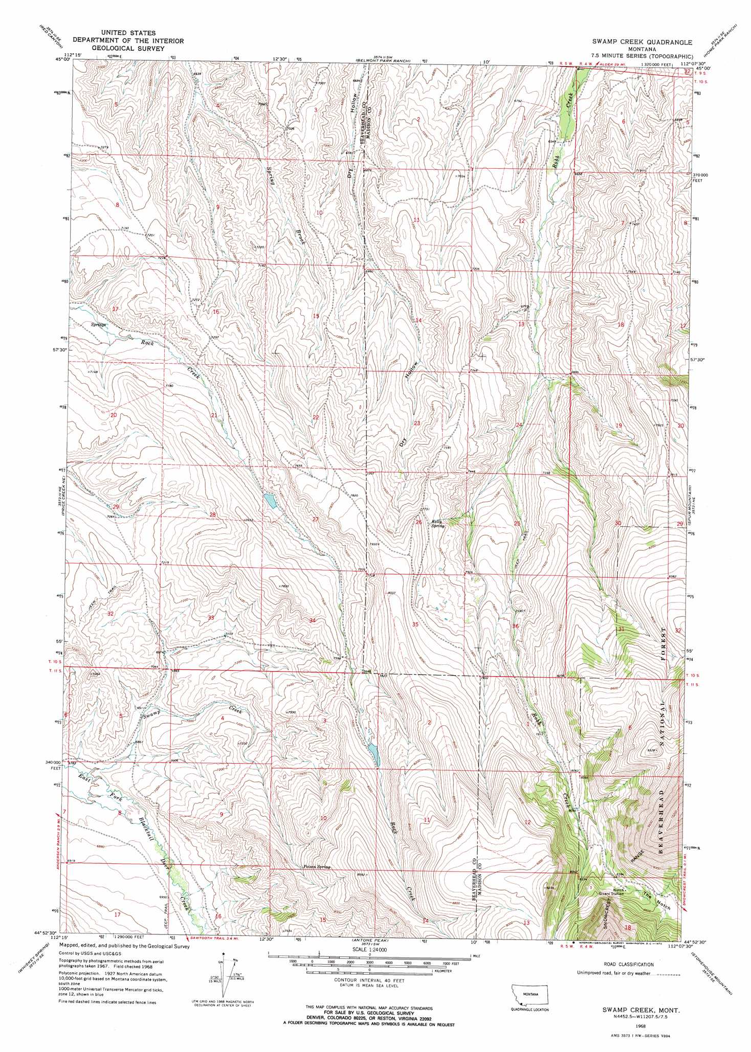
USGS Topo Quad 44112h2 - 1:24,000 scale
| Topo Map Name: | Swamp Creek |
| USGS Topo Quad ID: | 44112h2 |
| Print Size: | ca. 21 1/4" wide x 27" high |
| Southeast Coordinates: | 44.875° N latitude / 112.125° W longitude |
| Map Center Coordinates: | 44.9375° N latitude / 112.1875° W longitude |
| U.S. State: | MT |
| Filename: | o44112h2.jpg |
| Download Map JPG Image: | Swamp Creek topo map 1:24,000 scale |
| Map Type: | Topographic |
| Topo Series: | 7.5´ |
| Map Scale: | 1:24,000 |
| Source of Map Images: | United States Geological Survey (USGS) |
| Alternate Map Versions: |
Swamp Creek MT 1968, updated 1972 Download PDF Buy paper map Swamp Creek MT 1997, updated 2001 Download PDF Buy paper map Swamp Creek MT 2011 Download PDF Buy paper map Swamp Creek MT 2014 Download PDF Buy paper map |
| FStopo: | US Forest Service topo Swamp Creek is available: Download FStopo PDF Download FStopo TIF |
1:24,000 Topo Quads surrounding Swamp Creek
Christensen Ranch |
Mine Gulch |
Metzel Ranch |
Ruby Dam |
Cirque Lake |
Elk Gulch |
Red Canyon |
Belmont Park Ranch |
Home Park Ranch |
Warm Springs Creek |
Price Creek |
Price Creek Ne |
Swamp Creek |
Spur Mountain |
Iron Creek |
Vinegar Hill |
Whiskey Spring |
Antone Peak |
Stonehouse Mountain |
Eureka Basin |
Henry Gulch |
Lima Dam |
Wolverine Creek |
Antelope Peak |
Metzel Creek |
> Back to 44112e1 at 1:100,000 scale
> Back to 44112a1 at 1:250,000 scale
> Back to U.S. Topo Maps home
Swamp Creek topo map: Gazetteer
Swamp Creek: Dams
Mera Dam elevation 2386m 7828′Rock Creek Dam elevation 2315m 7595′
Swamp Creek: Gaps
The Notch elevation 2645m 8677′Swamp Creek: Mines
Chinatown Hand South Mine elevation 2509m 8231′Swamp Creek: Springs
Kelly Spring elevation 2336m 7664′Poison Spring elevation 2394m 7854′
Swamp Creek: Streams
Swamp Creek elevation 2071m 6794′Swamp Creek digital topo map on disk
Buy this Swamp Creek topo map showing relief, roads, GPS coordinates and other geographical features, as a high-resolution digital map file on DVD: