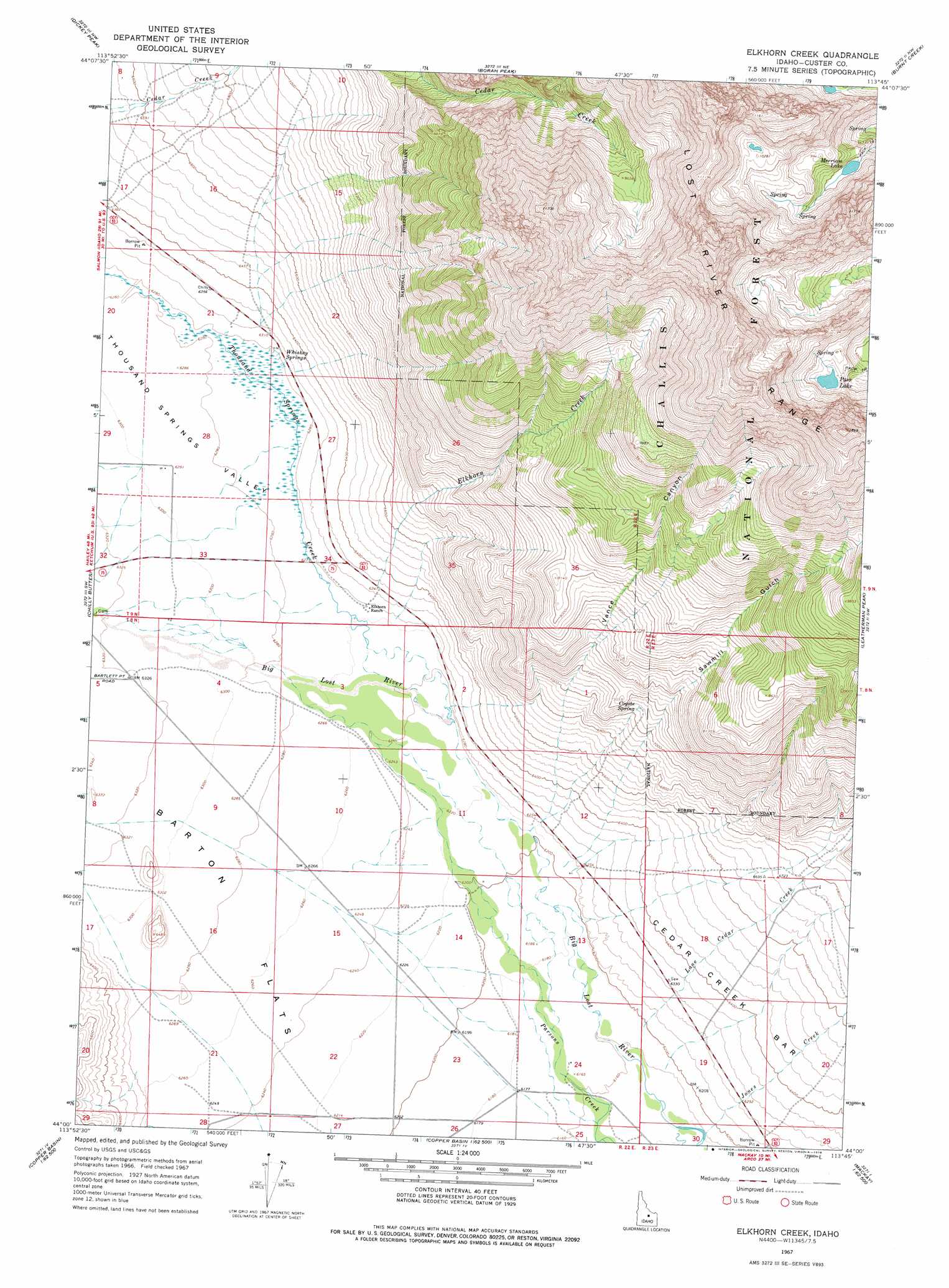
Elkhorn Creek Topo Map Idaho
To zoom in, hover over the map of Elkhorn Creek
USGS Topo Quad 44113a7 - 1:24,000 scale
| Topo Map Name: | Elkhorn Creek |
| USGS Topo Quad ID: | 44113a7 |
| Print Size: | ca. 21 1/4" wide x 27" high |
| Southeast Coordinates: | 44° N latitude / 113.75° W longitude |
| Map Center Coordinates: | 44.0625° N latitude / 113.8125° W longitude |
| U.S. State: | ID |
| Filename: | o44113a7.jpg |
| Download Map JPG Image: | Elkhorn Creek topo map 1:24,000 scale |
| Map Type: | Topographic |
| Topo Series: | 7.5´ |
| Map Scale: | 1:24,000 |
| Source of Map Images: | United States Geological Survey (USGS) |
| Alternate Map Versions: |
Elkhorn Creek ID 1967, updated 1971 Download PDF Buy paper map Elkhorn Creek ID 1967, updated 1978 Download PDF Buy paper map Elkhorn Creek ID 1967, updated 1978 Download PDF Buy paper map Elkhorn Creek ID 2011 Download PDF Buy paper map Elkhorn Creek ID 2013 Download PDF Buy paper map |
| FStopo: | US Forest Service topo Elkhorn Creek is available: Download FStopo PDF Download FStopo TIF |
1:24,000 Topo Quads surrounding Elkhorn Creek
Antelope Flat |
Grouse Creek Mountain |
Doublespring |
Spring Hill |
Donkey Creek |
Horse Basin |
Dickey Peak |
Borah Peak |
Burnt Creek |
Short Creek |
Jerry Peak |
Chilly Buttes |
Elkhorn Creek |
Leatherman Peak |
Massacre Mountain |
Harry Canyon |
Porphyry Peak |
Lehman Butte |
Mackay Reservoir |
Mackay |
Standhope Peak |
Big Black Dome |
Copper Basin Knob |
Shelly Mountain |
Big Blind Canyon |
> Back to 44113a1 at 1:100,000 scale
> Back to 44112a1 at 1:250,000 scale
> Back to U.S. Topo Maps home
Elkhorn Creek topo map: Gazetteer
Elkhorn Creek: Bars
Cedar Creek Bar elevation 1969m 6459′Elkhorn Creek: Flats
Barton Flats elevation 1913m 6276′Elkhorn Creek: Reservoirs
Merriam Lake elevation 2921m 9583′Pass Lake elevation 3071m 10075′
Elkhorn Creek: Springs
Coyote Spring elevation 2163m 7096′Whiskey Springs elevation 1922m 6305′
Elkhorn Creek: Streams
Elkhorn Creek elevation 1938m 6358′Jones Creek elevation 1876m 6154′
Lone Cedar Creek elevation 1884m 6181′
Thousand Springs Creek elevation 1902m 6240′
Elkhorn Creek: Valleys
Sawmill Gulch elevation 1896m 6220′Thousand Springs Valley elevation 1903m 6243′
Vance Canyon elevation 1896m 6220′
Elkhorn Creek digital topo map on disk
Buy this Elkhorn Creek topo map showing relief, roads, GPS coordinates and other geographical features, as a high-resolution digital map file on DVD: