Chilly Buttes Topo Map Idaho
To zoom in, hover over the map of Chilly Buttes
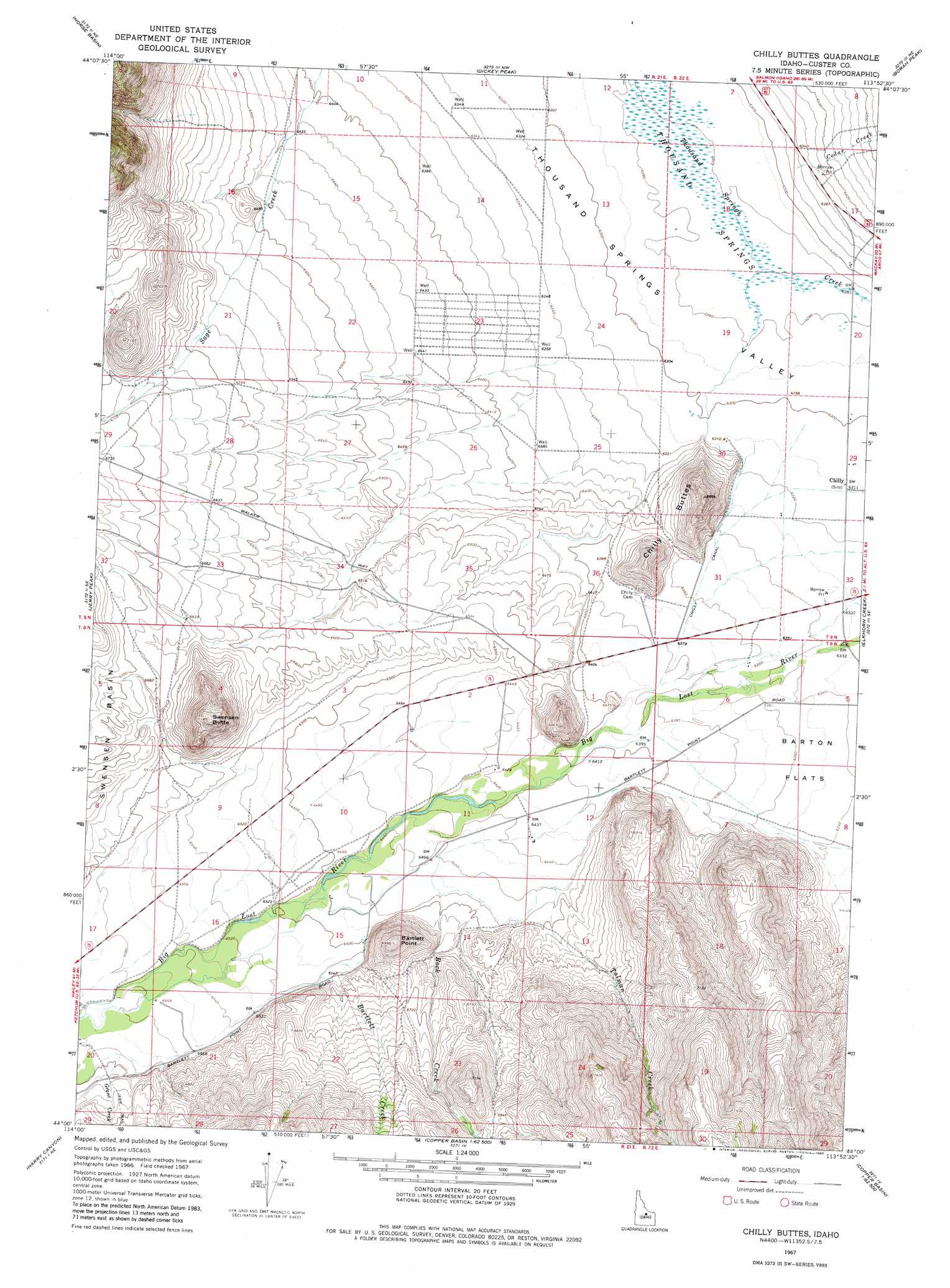
USGS Topo Quad 44113a8 - 1:24,000 scale
| Topo Map Name: | Chilly Buttes |
| USGS Topo Quad ID: | 44113a8 |
| Print Size: | ca. 21 1/4" wide x 27" high |
| Southeast Coordinates: | 44° N latitude / 113.875° W longitude |
| Map Center Coordinates: | 44.0625° N latitude / 113.9375° W longitude |
| U.S. State: | ID |
| Filename: | o44113a8.jpg |
| Download Map JPG Image: | Chilly Buttes topo map 1:24,000 scale |
| Map Type: | Topographic |
| Topo Series: | 7.5´ |
| Map Scale: | 1:24,000 |
| Source of Map Images: | United States Geological Survey (USGS) |
| Alternate Map Versions: |
Chilly Buttes ID 1967, updated 1971 Download PDF Buy paper map Chilly Buttes ID 2010 Download PDF Buy paper map Chilly Buttes ID 2013 Download PDF Buy paper map |
| FStopo: | US Forest Service topo Chilly Buttes is available: Download FStopo PDF Download FStopo TIF |
1:24,000 Topo Quads surrounding Chilly Buttes
Lone Pine Peak |
Antelope Flat |
Grouse Creek Mountain |
Doublespring |
Spring Hill |
The Paint Pot |
Horse Basin |
Dickey Peak |
Borah Peak |
Burnt Creek |
Herd Lake |
Jerry Peak |
Chilly Buttes |
Elkhorn Creek |
Leatherman Peak |
Herd Peak |
Harry Canyon |
Porphyry Peak |
Lehman Butte |
Mackay Reservoir |
Phi Kappa Mountain |
Standhope Peak |
Big Black Dome |
Copper Basin Knob |
Shelly Mountain |
> Back to 44113a1 at 1:100,000 scale
> Back to 44112a1 at 1:250,000 scale
> Back to U.S. Topo Maps home
Chilly Buttes topo map: Gazetteer
Chilly Buttes: Canals
Chilly Canal elevation 1938m 6358′Chilly Buttes: Cliffs
Bartlett Point elevation 2130m 6988′Chilly Buttes: Populated Places
Chilly elevation 1925m 6315′Chilly Buttes: Streams
Bartlett Creek elevation 1989m 6525′Cedar Creek elevation 1932m 6338′
Grant Creek elevation 2007m 6584′
Rock Creek elevation 1970m 6463′
Talman Creek elevation 1969m 6459′
Chilly Buttes: Summits
Chilly Buttes elevation 2077m 6814′Swensen Butte elevation 2184m 7165′
Chilly Buttes digital topo map on disk
Buy this Chilly Buttes topo map showing relief, roads, GPS coordinates and other geographical features, as a high-resolution digital map file on DVD: