Dickey Peak Topo Map Idaho
To zoom in, hover over the map of Dickey Peak
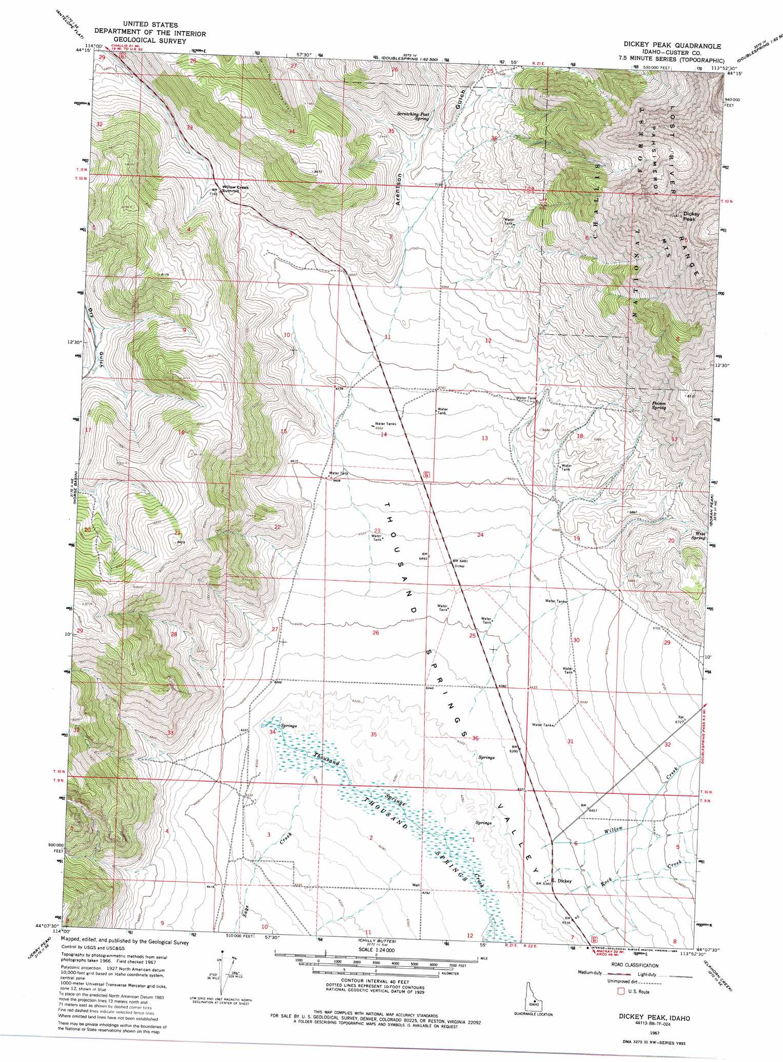
USGS Topo Quad 44113b8 - 1:24,000 scale
| Topo Map Name: | Dickey Peak |
| USGS Topo Quad ID: | 44113b8 |
| Print Size: | ca. 21 1/4" wide x 27" high |
| Southeast Coordinates: | 44.125° N latitude / 113.875° W longitude |
| Map Center Coordinates: | 44.1875° N latitude / 113.9375° W longitude |
| U.S. State: | ID |
| Filename: | o44113b8.jpg |
| Download Map JPG Image: | Dickey Peak topo map 1:24,000 scale |
| Map Type: | Topographic |
| Topo Series: | 7.5´ |
| Map Scale: | 1:24,000 |
| Source of Map Images: | United States Geological Survey (USGS) |
| Alternate Map Versions: |
Dickey Peak ID 1967, updated 1971 Download PDF Buy paper map Dickey Peak ID 1967, updated 1986 Download PDF Buy paper map Dickey Peak ID 2011 Download PDF Buy paper map Dickey Peak ID 2013 Download PDF Buy paper map |
| FStopo: | US Forest Service topo Dickey Peak is available: Download FStopo PDF Download FStopo TIF |
1:24,000 Topo Quads surrounding Dickey Peak
Bradbury Flat |
Little Antelope Flat |
Meadow Peak |
Mahogany Hill |
Donkey Hills Nw |
Lone Pine Peak |
Antelope Flat |
Grouse Creek Mountain |
Doublespring |
Spring Hill |
The Paint Pot |
Horse Basin |
Dickey Peak |
Borah Peak |
Burnt Creek |
Herd Lake |
Jerry Peak |
Chilly Buttes |
Elkhorn Creek |
Leatherman Peak |
Herd Peak |
Harry Canyon |
Porphyry Peak |
Lehman Butte |
Mackay Reservoir |
> Back to 44113a1 at 1:100,000 scale
> Back to 44112a1 at 1:250,000 scale
> Back to U.S. Topo Maps home
Dickey Peak topo map: Gazetteer
Dickey Peak: Populated Places
Dickey elevation 1934m 6345′Dickey Peak: Springs
Poison Spring elevation 2276m 7467′Scratching Post Spring elevation 2193m 7194′
West Spring elevation 2125m 6971′
Dickey Peak: Streams
Rock Creek elevation 1934m 6345′Sage Creek elevation 1918m 6292′
Willow Creek elevation 1937m 6354′
Dickey Peak: Summits
Dickey Peak elevation 3390m 11122′Willow Creek Summit elevation 2185m 7168′
Dickey Peak: Swamps
Thousand Springs elevation 1916m 6286′Dickey Peak: Valleys
Arentson Gulch elevation 2115m 6938′Dickey Peak digital topo map on disk
Buy this Dickey Peak topo map showing relief, roads, GPS coordinates and other geographical features, as a high-resolution digital map file on DVD: