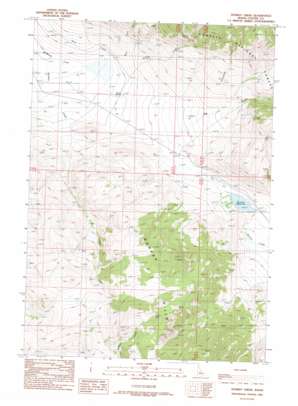
Donkey Creek Topo Map Idaho
To zoom in, hover over the map of Donkey Creek
USGS Topo Quad 44113c5 - 1:24,000 scale
| Topo Map Name: | Donkey Creek |
| USGS Topo Quad ID: | 44113c5 |
| Print Size: | ca. 21 1/4" wide x 27" high |
| Southeast Coordinates: | 44.25° N latitude / 113.5° W longitude |
| Map Center Coordinates: | 44.3125° N latitude / 113.5625° W longitude |
| U.S. State: | ID |
| Filename: | o44113c5.jpg |
| Download Map JPG Image: | Donkey Creek topo map 1:24,000 scale |
| Map Type: | Topographic |
| Topo Series: | 7.5´ |
| Map Scale: | 1:24,000 |
| Source of Map Images: | United States Geological Survey (USGS) |
| Alternate Map Versions: |
Donkey Creek ID 1989, updated 1989 Download PDF Buy paper map Donkey Creek ID 2011 Download PDF Buy paper map Donkey Creek ID 2013 Download PDF Buy paper map |
| FStopo: | US Forest Service topo Donkey Creek is available: Download FStopo PDF Download FStopo TIF |
1:24,000 Topo Quads surrounding Donkey Creek
> Back to 44113a1 at 1:100,000 scale
> Back to 44112a1 at 1:250,000 scale
> Back to U.S. Topo Maps home
Donkey Creek topo map: Gazetteer
Donkey Creek: Dams
Summit Dam elevation 2011m 6597′Donkey Creek: Reservoirs
Summit Reservoir elevation 2011m 6597′Donkey Creek: Springs
Graves Spring elevation 1955m 6414′Donkey Creek: Streams
Bear Creek elevation 1930m 6332′Ditch Creek elevation 1934m 6345′
Donkey Creek elevation 1890m 6200′
Hillside Creek elevation 1939m 6361′
Snowslide Creek elevation 2142m 7027′
Donkey Creek: Valleys
Big Gulch elevation 1954m 6410′Cooney Canyon elevation 2213m 7260′
Donkey Creek digital topo map on disk
Buy this Donkey Creek topo map showing relief, roads, GPS coordinates and other geographical features, as a high-resolution digital map file on DVD:


