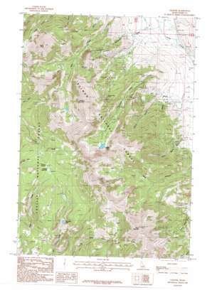
Gilmore Topo Map Idaho
To zoom in, hover over the map of Gilmore
USGS Topo Quad 44113d3 - 1:24,000 scale
| Topo Map Name: | Gilmore |
| USGS Topo Quad ID: | 44113d3 |
| Print Size: | ca. 21 1/4" wide x 27" high |
| Southeast Coordinates: | 44.375° N latitude / 113.25° W longitude |
| Map Center Coordinates: | 44.4375° N latitude / 113.3125° W longitude |
| U.S. State: | ID |
| Filename: | o44113d3.jpg |
| Download Map JPG Image: | Gilmore topo map 1:24,000 scale |
| Map Type: | Topographic |
| Topo Series: | 7.5´ |
| Map Scale: | 1:24,000 |
| Source of Map Images: | United States Geological Survey (USGS) |
| Alternate Map Versions: |
Gilmore ID 1987, updated 1987 Download PDF Buy paper map Gilmore ID 2011 Download PDF Buy paper map Gilmore ID 2013 Download PDF Buy paper map |
| FStopo: | US Forest Service topo Gilmore is available: Download FStopo PDF Download FStopo TIF |
1:24,000 Topo Quads surrounding Gilmore
> Back to 44113a1 at 1:100,000 scale
> Back to 44112a1 at 1:250,000 scale
> Back to U.S. Topo Maps home
Gilmore topo map: Gazetteer
Gilmore: Flats
Firbox Meadows elevation 2793m 9163′Firebox Meadows elevation 2738m 8982′
Gilmore: Gaps
Firebox Summit elevation 2753m 9032′Gilmore: Mines
Brown Bull Mine elevation 2778m 9114′Hilltop Mine elevation 2570m 8431′
Iron Dyke Mine elevation 2484m 8149′
Latest Out Mine elevation 2533m 8310′
Mountain Boy Mine elevation 2575m 8448′
Portland Mine elevation 2901m 9517′
Ridgeway Mine elevation 2548m 8359′
Gilmore: Populated Places
Gilmore elevation 2180m 7152′Gilmore: Reservoirs
Meadow Lake elevation 2787m 9143′Mill Creek Lake elevation 2538m 8326′
Gilmore: Streams
Meadow Lake Creek elevation 2087m 6847′Gilmore: Summits
Negro Peak elevation 3175m 10416′Portland Mountain elevation 3280m 10761′
Sheep Mountain elevation 3311m 10862′
Gilmore: Valleys
Federal Gulch elevation 2183m 7162′Liberty Gulch elevation 2167m 7109′
Long Canyon elevation 2221m 7286′
Shortys Gulch elevation 2184m 7165′
Silver Moon Gulch elevation 2229m 7312′
Sourdough Gulch elevation 2073m 6801′
Gilmore digital topo map on disk
Buy this Gilmore topo map showing relief, roads, GPS coordinates and other geographical features, as a high-resolution digital map file on DVD:


