Mogg Mountain Topo Map Idaho
To zoom in, hover over the map of Mogg Mountain
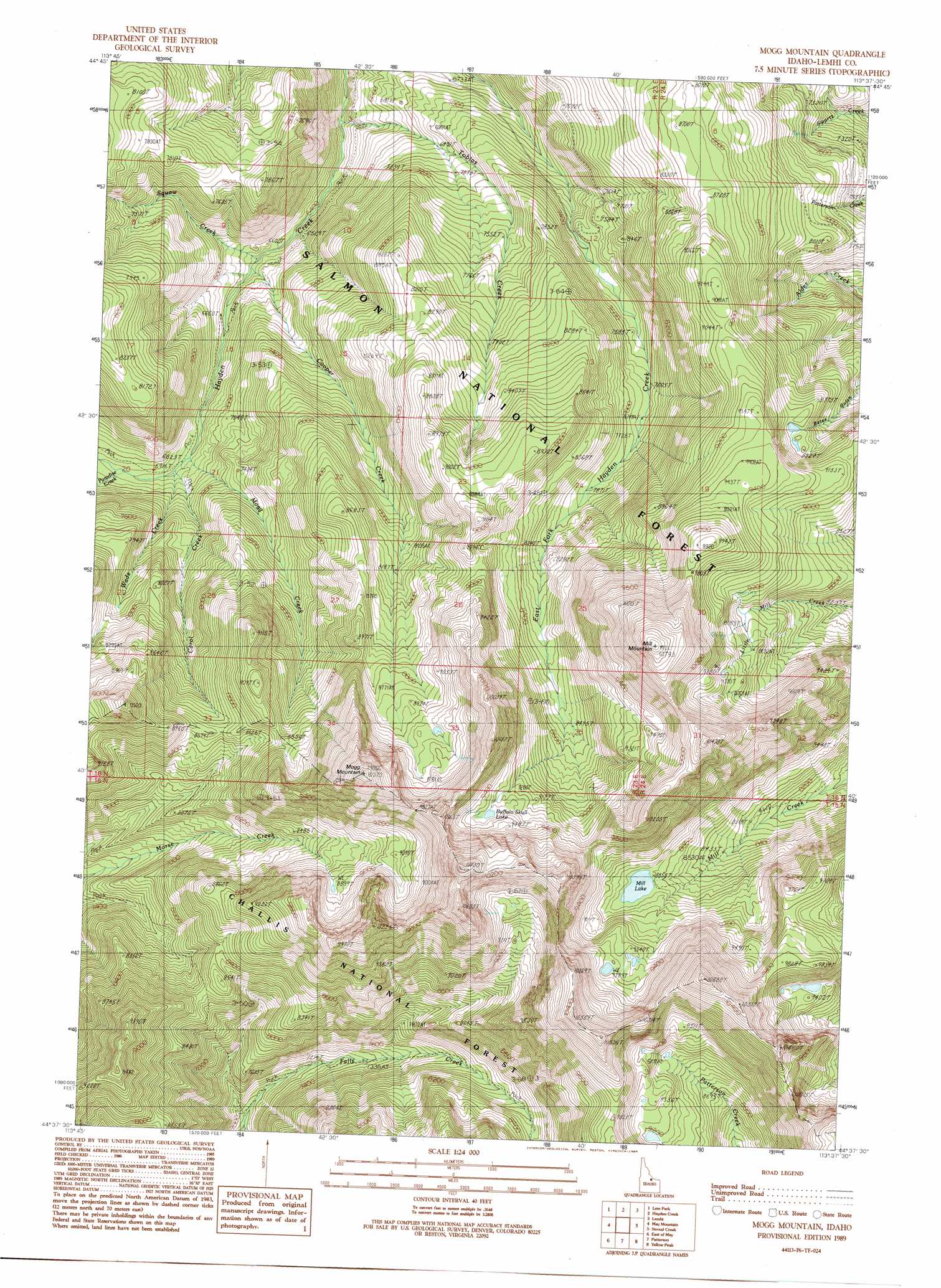
USGS Topo Quad 44113f6 - 1:24,000 scale
| Topo Map Name: | Mogg Mountain |
| USGS Topo Quad ID: | 44113f6 |
| Print Size: | ca. 21 1/4" wide x 27" high |
| Southeast Coordinates: | 44.625° N latitude / 113.625° W longitude |
| Map Center Coordinates: | 44.6875° N latitude / 113.6875° W longitude |
| U.S. State: | ID |
| Filename: | o44113f6.jpg |
| Download Map JPG Image: | Mogg Mountain topo map 1:24,000 scale |
| Map Type: | Topographic |
| Topo Series: | 7.5´ |
| Map Scale: | 1:24,000 |
| Source of Map Images: | United States Geological Survey (USGS) |
| Alternate Map Versions: |
Mogg Mountain ID 1989, updated 1989 Download PDF Buy paper map Mogg Mountain ID 2011 Download PDF Buy paper map Mogg Mountain ID 2013 Download PDF Buy paper map |
| FStopo: | US Forest Service topo Mogg Mountain is available: Download FStopo PDF Download FStopo TIF |
1:24,000 Topo Quads surrounding Mogg Mountain
Goldbug Ridge |
Poison Peak |
Tendoy |
Agency Creek |
Lemhi Pass |
Allison Creek |
Lem Peak |
Hayden Creek |
Lemhi |
Goat Mountain |
Ennis Gulch |
May Mountain |
Mogg Mountain |
Stroud Creek |
West Of Leadore |
May |
East Of May |
Patterson |
Yellow Peak |
Sheephorn Peak |
Meadow Peak |
Mahogany Hill |
Donkey Hills Nw |
Big Creek Peak |
Iron Creek Point |
> Back to 44113e1 at 1:100,000 scale
> Back to 44112a1 at 1:250,000 scale
> Back to U.S. Topo Maps home
Mogg Mountain topo map: Gazetteer
Mogg Mountain: Dams
Mill Creek Lake Dam elevation 2700m 8858′Mogg Mountain: Lakes
Buffulo Skull Lake elevation 2845m 9333′Mill Lake elevation 2700m 8858′
Mogg Mountain: Streams
Carol Creek elevation 2084m 6837′Cooper Creek elevation 1981m 6499′
Mogg Creek elevation 2075m 6807′
Paradise Creek elevation 2126m 6975′
Squaw Creek elevation 2015m 6610′
Tobias Creek elevation 1935m 6348′
Wade Creek elevation 2092m 6863′
Mogg Mountain: Summits
Mill Mountain elevation 3271m 10731′Mogg Mountain elevation 3168m 10393′
Mogg Mountain digital topo map on disk
Buy this Mogg Mountain topo map showing relief, roads, GPS coordinates and other geographical features, as a high-resolution digital map file on DVD: