Ennis Gulch Topo Map Idaho
To zoom in, hover over the map of Ennis Gulch
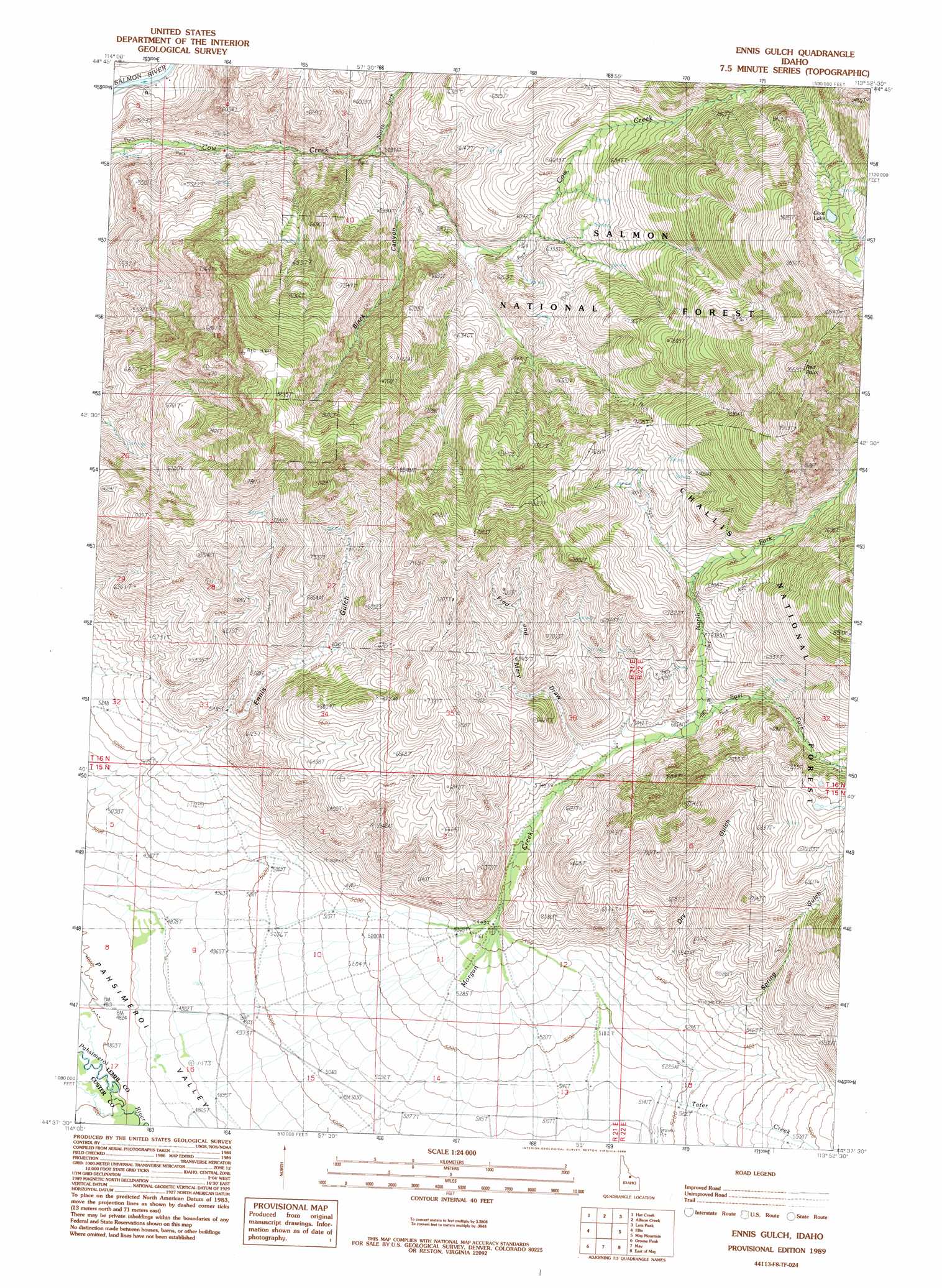
USGS Topo Quad 44113f8 - 1:24,000 scale
| Topo Map Name: | Ennis Gulch |
| USGS Topo Quad ID: | 44113f8 |
| Print Size: | ca. 21 1/4" wide x 27" high |
| Southeast Coordinates: | 44.625° N latitude / 113.875° W longitude |
| Map Center Coordinates: | 44.6875° N latitude / 113.9375° W longitude |
| U.S. State: | ID |
| Filename: | o44113f8.jpg |
| Download Map JPG Image: | Ennis Gulch topo map 1:24,000 scale |
| Map Type: | Topographic |
| Topo Series: | 7.5´ |
| Map Scale: | 1:24,000 |
| Source of Map Images: | United States Geological Survey (USGS) |
| Alternate Map Versions: |
Ennis Gulch ID 1989, updated 1989 Download PDF Buy paper map Ennis Gulch ID 2011 Download PDF Buy paper map Ennis Gulch ID 2013 Download PDF Buy paper map |
| FStopo: | US Forest Service topo Ennis Gulch is available: Download FStopo PDF Download FStopo TIF |
1:24,000 Topo Quads surrounding Ennis Gulch
Taylor Mountain |
Degan Mountain |
Goldbug Ridge |
Poison Peak |
Tendoy |
Wards Butte |
Hat Creek |
Allison Creek |
Lem Peak |
Hayden Creek |
Gooseberry Creek |
Ellis |
Ennis Gulch |
May Mountain |
Mogg Mountain |
Challis |
Grouse Peak |
May |
East Of May |
Patterson |
Bradbury Flat |
Little Antelope Flat |
Meadow Peak |
Mahogany Hill |
Donkey Hills Nw |
> Back to 44113e1 at 1:100,000 scale
> Back to 44112a1 at 1:250,000 scale
> Back to U.S. Topo Maps home
Ennis Gulch topo map: Gazetteer
Ennis Gulch: Cliffs
Red Point elevation 3019m 9904′Ennis Gulch: Lakes
Goat Lake elevation 2707m 8881′Ennis Gulch: Streams
East Fork Morgan Creek elevation 1985m 6512′North Fork Cow Creek elevation 1587m 5206′
North Fork Morgan Creek elevation 1845m 6053′
Tater Creek elevation 1572m 5157′
Ennis Gulch: Valleys
Black Canyon elevation 1631m 5351′Dry Gulch elevation 1593m 5226′
Spring Gulch elevation 1586m 5203′
Ennis Gulch digital topo map on disk
Buy this Ennis Gulch topo map showing relief, roads, GPS coordinates and other geographical features, as a high-resolution digital map file on DVD: