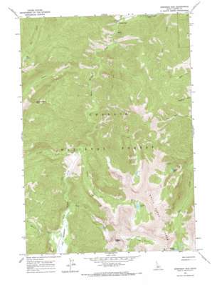
Robinson Bar Topo Map Idaho
To zoom in, hover over the map of Robinson Bar
USGS Topo Quad 44114b6 - 1:24,000 scale
| Topo Map Name: | Robinson Bar |
| USGS Topo Quad ID: | 44114b6 |
| Print Size: | ca. 21 1/4" wide x 27" high |
| Southeast Coordinates: | 44.125° N latitude / 114.625° W longitude |
| Map Center Coordinates: | 44.1875° N latitude / 114.6875° W longitude |
| U.S. State: | ID |
| Filename: | o44114b6.jpg |
| Download Map JPG Image: | Robinson Bar topo map 1:24,000 scale |
| Map Type: | Topographic |
| Topo Series: | 7.5´ |
| Map Scale: | 1:24,000 |
| Source of Map Images: | United States Geological Survey (USGS) |
| Alternate Map Versions: |
Robinson Bar ID 1964, updated 1965 Download PDF Buy paper map Robinson Bar ID 1964, updated 1973 Download PDF Buy paper map Robinson Bar ID 2011 Download PDF Buy paper map Robinson Bar ID 2013 Download PDF Buy paper map |
| FStopo: | US Forest Service topo Robinson Bar is available: Download FStopo PDF Download FStopo TIF |
1:24,000 Topo Quads surrounding Robinson Bar
> Back to 44114a1 at 1:100,000 scale
> Back to 44114a1 at 1:250,000 scale
> Back to U.S. Topo Maps home
Robinson Bar topo map: Gazetteer
Robinson Bar: Basins
Iron Basin elevation 2864m 9396′Robinson Bar: Flats
The Meadows elevation 2209m 7247′Robinson Bar: Lakes
Bear Lake elevation 2716m 8910′Elk Lake elevation 2556m 8385′
Hoodoo Lake elevation 2641m 8664′
Swim Lake elevation 2704m 8871′
Robinson Bar: Populated Places
Robinson Bar elevation 1818m 5964′Robinson Bar: Springs
Slate Creek Hot Spring elevation 2148m 7047′Robinson Bar: Streams
Bear Lake Creek elevation 2158m 7080′Garland Creek elevation 2086m 6843′
Martin Creek elevation 2206m 7237′
Pigtail Creek elevation 2214m 7263′
Prospect Creek elevation 1919m 6295′
Swim Creek elevation 2062m 6765′
Robinson Bar: Summits
Robinson Bar Peak elevation 2995m 9826′Watson Peak elevation 3176m 10419′
Robinson Bar digital topo map on disk
Buy this Robinson Bar topo map showing relief, roads, GPS coordinates and other geographical features, as a high-resolution digital map file on DVD:


