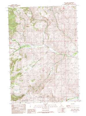
Pats Creek Topo Map Idaho
To zoom in, hover over the map of Pats Creek
USGS Topo Quad 44114e3 - 1:24,000 scale
| Topo Map Name: | Pats Creek |
| USGS Topo Quad ID: | 44114e3 |
| Print Size: | ca. 21 1/4" wide x 27" high |
| Southeast Coordinates: | 44.5° N latitude / 114.25° W longitude |
| Map Center Coordinates: | 44.5625° N latitude / 114.3125° W longitude |
| U.S. State: | ID |
| Filename: | o44114e3.jpg |
| Download Map JPG Image: | Pats Creek topo map 1:24,000 scale |
| Map Type: | Topographic |
| Topo Series: | 7.5´ |
| Map Scale: | 1:24,000 |
| Source of Map Images: | United States Geological Survey (USGS) |
| Alternate Map Versions: |
Pats Creek ID 1989, updated 1989 Download PDF Buy paper map Pats Creek ID 2011 Download PDF Buy paper map Pats Creek ID 2013 Download PDF Buy paper map |
| FStopo: | US Forest Service topo Pats Creek is available: Download FStopo PDF Download FStopo TIF |
1:24,000 Topo Quads surrounding Pats Creek
> Back to 44114e1 at 1:100,000 scale
> Back to 44114a1 at 1:250,000 scale
> Back to U.S. Topo Maps home
Pats Creek topo map: Gazetteer
Pats Creek: Flats
Jeffs Flats elevation 1913m 6276′Pats Creek: Lakes
Slab Barn Lake elevation 2194m 7198′Pats Creek: Streams
Bear Creek elevation 1748m 5734′Eddy Creek elevation 1645m 5396′
First Spring Creek elevation 1611m 5285′
Jeffs Creek elevation 1631m 5351′
Mill Creek elevation 1585m 5200′
Pats Creek elevation 1709m 5606′
Second Spring Creek elevation 1780m 5839′
White Valley Creek elevation 1727m 5666′
Pats Creek: Valleys
Big Hill Gulch elevation 1940m 6364′John Gulch elevation 1738m 5702′
Pats Creek digital topo map on disk
Buy this Pats Creek topo map showing relief, roads, GPS coordinates and other geographical features, as a high-resolution digital map file on DVD:


