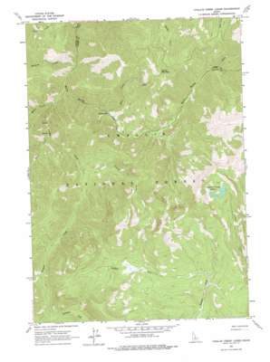
Challis Creek Lakes Topo Map Idaho
To zoom in, hover over the map of Challis Creek Lakes
USGS Topo Quad 44114e5 - 1:24,000 scale
| Topo Map Name: | Challis Creek Lakes |
| USGS Topo Quad ID: | 44114e5 |
| Print Size: | ca. 21 1/4" wide x 27" high |
| Southeast Coordinates: | 44.5° N latitude / 114.5° W longitude |
| Map Center Coordinates: | 44.5625° N latitude / 114.5625° W longitude |
| U.S. State: | ID |
| Filename: | o44114e5.jpg |
| Download Map JPG Image: | Challis Creek Lakes topo map 1:24,000 scale |
| Map Type: | Topographic |
| Topo Series: | 7.5´ |
| Map Scale: | 1:24,000 |
| Source of Map Images: | United States Geological Survey (USGS) |
| Alternate Map Versions: |
Challis Creek Lakes ID 1963, updated 1964 Download PDF Buy paper map Challis Creek Lakes ID 1963, updated 1978 Download PDF Buy paper map Challis Creek Lakes ID 2011 Download PDF Buy paper map Challis Creek Lakes ID 2013 Download PDF Buy paper map |
| FStopo: | US Forest Service topo Challis Creek Lakes is available: Download FStopo PDF Download FStopo TIF |
1:24,000 Topo Quads surrounding Challis Creek Lakes
> Back to 44114e1 at 1:100,000 scale
> Back to 44114a1 at 1:250,000 scale
> Back to U.S. Topo Maps home
Challis Creek Lakes topo map: Gazetteer
Challis Creek Lakes: Dams
Challis Creek Dam elevation 2737m 8979′Challis Creek Lakes: Mines
Parker Mine elevation 2398m 7867′Challis Creek Lakes: Reservoirs
Challis Creek Lakes elevation 2737m 8979′Challis Creek Lakes: Streams
Kerr Creek elevation 1919m 6295′McKee Creek elevation 1878m 6161′
Parker Creek elevation 1805m 5921′
Pierson Creek elevation 2006m 6581′
Rush Creek elevation 1930m 6332′
South Fork Warm Spring Creek elevation 2039m 6689′
Trapper Creek elevation 1853m 6079′
Wickiup Creek elevation 1825m 5987′
Challis Creek Lakes: Summits
Parker Mountain elevation 2777m 9110′Challis Creek Lakes digital topo map on disk
Buy this Challis Creek Lakes topo map showing relief, roads, GPS coordinates and other geographical features, as a high-resolution digital map file on DVD:


