Pinyon Peak Topo Map Idaho
To zoom in, hover over the map of Pinyon Peak
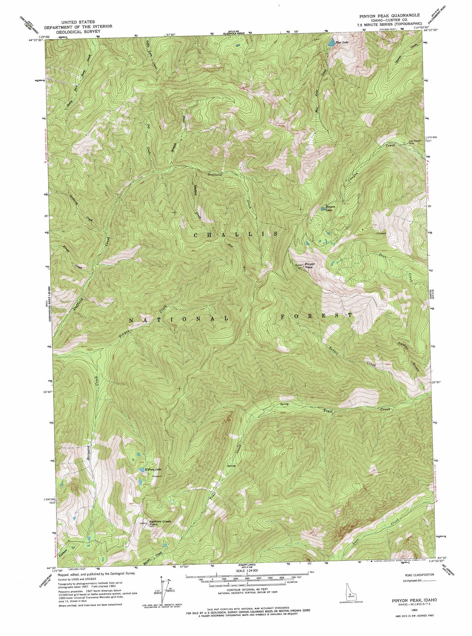
USGS Topo Quad 44114e8 - 1:24,000 scale
| Topo Map Name: | Pinyon Peak |
| USGS Topo Quad ID: | 44114e8 |
| Print Size: | ca. 21 1/4" wide x 27" high |
| Southeast Coordinates: | 44.5° N latitude / 114.875° W longitude |
| Map Center Coordinates: | 44.5625° N latitude / 114.9375° W longitude |
| U.S. State: | ID |
| Filename: | o44114e8.jpg |
| Download Map JPG Image: | Pinyon Peak topo map 1:24,000 scale |
| Map Type: | Topographic |
| Topo Series: | 7.5´ |
| Map Scale: | 1:24,000 |
| Source of Map Images: | United States Geological Survey (USGS) |
| Alternate Map Versions: |
Pinyon Peak ID 1963, updated 1964 Download PDF Buy paper map Pinyon Peak ID 1963, updated 1978 Download PDF Buy paper map Pinyon Peak ID 1963, updated 1978 Download PDF Buy paper map Pinyon Peak ID 2011 Download PDF Buy paper map Pinyon Peak ID 2013 Download PDF Buy paper map |
| FStopo: | US Forest Service topo Pinyon Peak is available: Download FStopo PDF Download FStopo TIF |
1:24,000 Topo Quads surrounding Pinyon Peak
Big Baldy |
Pungo Mountain |
Norton Ridge |
Ramey Hill |
Sleeping Deer Mountain |
Artillery Dome |
Little Soldier Mountain |
Sliderock Ridge |
Falconberry Peak |
Rock Creek |
Soldier Creek |
Greyhound Mountain |
Pinyon Peak |
Casto |
Sherman Peak |
Cape Horn Lakes |
Langer Peak |
Knapp Lakes |
Mount Jordan |
Custer |
Banner Summit |
Elk Meadow |
Basin Butte |
East Basin Creek |
Sunbeam |
> Back to 44114e1 at 1:100,000 scale
> Back to 44114a1 at 1:250,000 scale
> Back to U.S. Topo Maps home
Pinyon Peak topo map: Gazetteer
Pinyon Peak: Cliffs
Feltham Creek Point elevation 2738m 8982′Pinyon Peak: Lakes
Blue Lake elevation 1970m 6463′Kidney Lake elevation 2486m 8156′
Pinyon Lake elevation 2569m 8428′
Pinyon Peak: Mines
Lost Packer Mine elevation 2194m 7198′Sunrise Mine (historical) elevation 2730m 8956′
Pinyon Peak: Streams
Corduroy Creek elevation 2031m 6663′Deadfall Creek elevation 2144m 7034′
Fox Creek elevation 2097m 6879′
Pinyon Creek elevation 1991m 6532′
Placer Creek elevation 1999m 6558′
Rabbit Creek elevation 1857m 6092′
Scratch Creek elevation 2112m 6929′
Pinyon Peak: Summits
Pinyon Peak elevation 3001m 9845′Pinyon Peak: Valleys
Packer Gulch elevation 1838m 6030′Pinyon Peak digital topo map on disk
Buy this Pinyon Peak topo map showing relief, roads, GPS coordinates and other geographical features, as a high-resolution digital map file on DVD: