Tyee Mountain Topo Map Idaho
To zoom in, hover over the map of Tyee Mountain
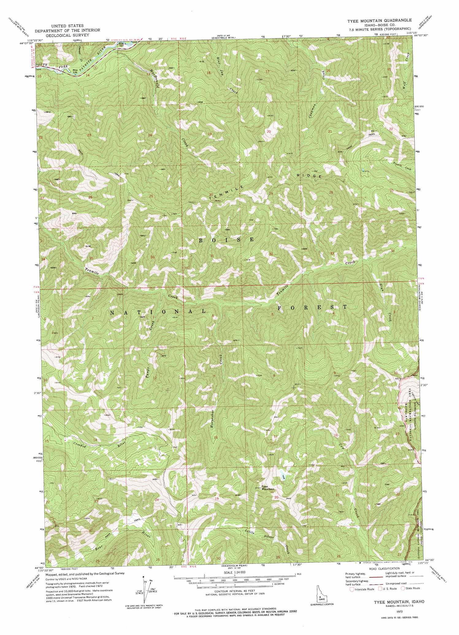
USGS Topo Quad 44115a3 - 1:24,000 scale
| Topo Map Name: | Tyee Mountain |
| USGS Topo Quad ID: | 44115a3 |
| Print Size: | ca. 21 1/4" wide x 27" high |
| Southeast Coordinates: | 44° N latitude / 115.25° W longitude |
| Map Center Coordinates: | 44.0625° N latitude / 115.3125° W longitude |
| U.S. State: | ID |
| Filename: | o44115a3.jpg |
| Download Map JPG Image: | Tyee Mountain topo map 1:24,000 scale |
| Map Type: | Topographic |
| Topo Series: | 7.5´ |
| Map Scale: | 1:24,000 |
| Source of Map Images: | United States Geological Survey (USGS) |
| Alternate Map Versions: |
Tyee Mountain ID 1972, updated 1976 Download PDF Buy paper map Tyee Mountain ID 2011 Download PDF Buy paper map Tyee Mountain ID 2013 Download PDF Buy paper map |
| FStopo: | US Forest Service topo Tyee Mountain is available: Download FStopo PDF Download FStopo TIF |
1:24,000 Topo Quads surrounding Tyee Mountain
Whitehawk Mountain |
Cache Creek |
Bull Trout Point |
Banner Summit |
Elk Meadow |
Miller Mountain West |
Miller Mountain East |
Eightmile Mountain |
Grandjean |
Stanley Lake |
Lowman |
Jackson Peak |
Tyee Mountain |
Edaho Mountain |
Warbonnet Peak |
Big Owl Creek |
Bear River |
Swanholm Peak |
Nahneke Mountain |
Mount Everly |
Barber Flat |
Grand Mountain |
Phifer Creek |
Atlanta West |
Atlanta East |
> Back to 44115a1 at 1:100,000 scale
> Back to 44114a1 at 1:250,000 scale
> Back to U.S. Topo Maps home
Tyee Mountain topo map: Gazetteer
Tyee Mountain: Ridges
Tenmile Ridge elevation 2336m 7664′Tyee Mountain: Streams
Casner Creek elevation 1350m 4429′Hiyu Creek elevation 2066m 6778′
Horseshoe Creek elevation 1950m 6397′
Pungo Creek elevation 1843m 6046′
Tyee Mountain: Summits
Tyee Mountain elevation 2660m 8727′Tyee Mountain digital topo map on disk
Buy this Tyee Mountain topo map showing relief, roads, GPS coordinates and other geographical features, as a high-resolution digital map file on DVD: