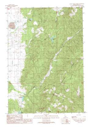
Skunk Creek Summit Topo Map Idaho
To zoom in, hover over the map of Skunk Creek Summit
USGS Topo Quad 44115d8 - 1:24,000 scale
| Topo Map Name: | Skunk Creek Summit |
| USGS Topo Quad ID: | 44115d8 |
| Print Size: | ca. 21 1/4" wide x 27" high |
| Southeast Coordinates: | 44.375° N latitude / 115.875° W longitude |
| Map Center Coordinates: | 44.4375° N latitude / 115.9375° W longitude |
| U.S. State: | ID |
| Filename: | o44115d8.jpg |
| Download Map JPG Image: | Skunk Creek Summit topo map 1:24,000 scale |
| Map Type: | Topographic |
| Topo Series: | 7.5´ |
| Map Scale: | 1:24,000 |
| Source of Map Images: | United States Geological Survey (USGS) |
| Alternate Map Versions: |
Skunk Creek Summit ID 1988, updated 1988 Download PDF Buy paper map Skunk Creek Summit ID 2011 Download PDF Buy paper map Skunk Creek Summit ID 2013 Download PDF Buy paper map |
| FStopo: | US Forest Service topo Skunk Creek Summit is available: Download FStopo PDF Download FStopo TIF |
1:24,000 Topo Quads surrounding Skunk Creek Summit
> Back to 44115a1 at 1:100,000 scale
> Back to 44114a1 at 1:250,000 scale
> Back to U.S. Topo Maps home
Skunk Creek Summit topo map: Gazetteer
Skunk Creek Summit: Dams
Corral Creek Dam elevation 1600m 5249′Herrick Dam elevation 1481m 4858′
Pitkin Dam elevation 1463m 4799′
Warren Diversion Dam elevation 1459m 4786′
Skunk Creek Summit: Lakes
Warner Pond elevation 1458m 4783′Skunk Creek Summit: Reservoirs
Corral Creek Reservoir elevation 1600m 5249′East Mountain Reservoir elevation 1463m 4799′
Herrick Reservoir elevation 1481m 4858′
Warren Pond elevation 1459m 4786′
Skunk Creek Summit: Streams
Ditch Creek elevation 1495m 4904′Skunk Creek elevation 1450m 4757′
Skunk Creek Summit: Summits
Skunk Creek Summit elevation 2171m 7122′Skunk Creek Summit: Trails
Skunk Creek Trail elevation 1672m 5485′Skunk Creek Summit digital topo map on disk
Buy this Skunk Creek Summit topo map showing relief, roads, GPS coordinates and other geographical features, as a high-resolution digital map file on DVD:


