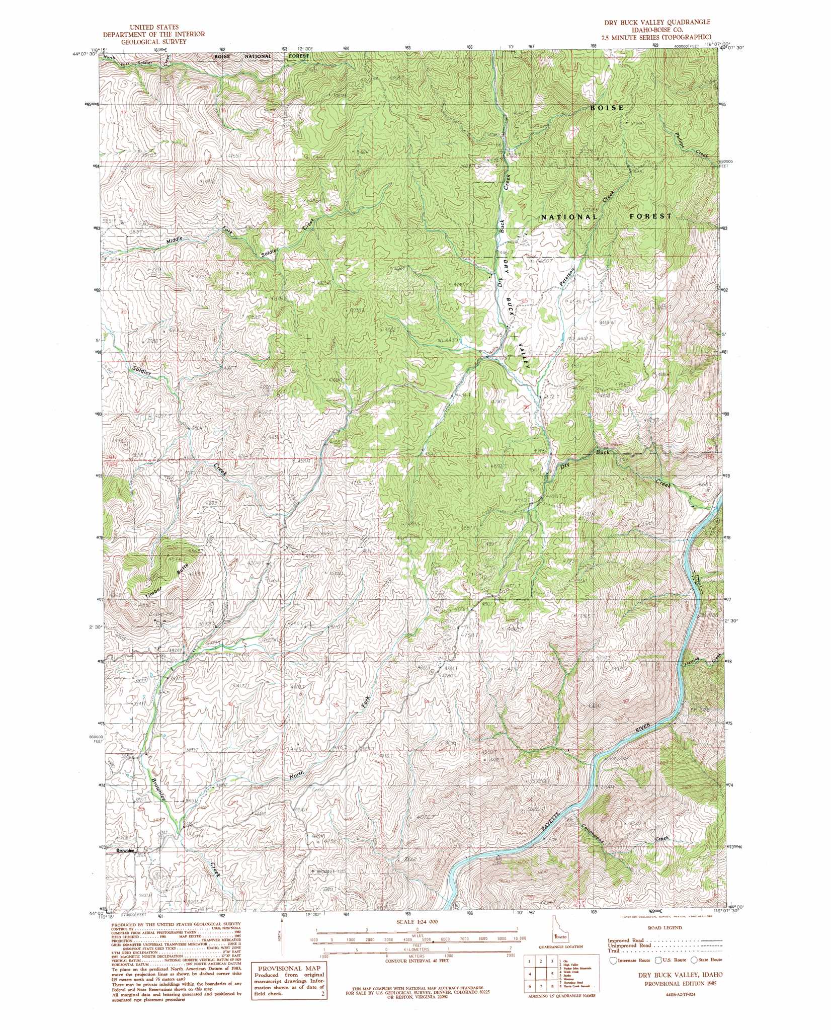
Dry Buck Valley Topo Map Idaho
To zoom in, hover over the map of Dry Buck Valley
USGS Topo Quad 44116a2 - 1:24,000 scale
| Topo Map Name: | Dry Buck Valley |
| USGS Topo Quad ID: | 44116a2 |
| Print Size: | ca. 21 1/4" wide x 27" high |
| Southeast Coordinates: | 44° N latitude / 116.125° W longitude |
| Map Center Coordinates: | 44.0625° N latitude / 116.1875° W longitude |
| U.S. State: | ID |
| Filename: | o44116a2.jpg |
| Download Map JPG Image: | Dry Buck Valley topo map 1:24,000 scale |
| Map Type: | Topographic |
| Topo Series: | 7.5´ |
| Map Scale: | 1:24,000 |
| Source of Map Images: | United States Geological Survey (USGS) |
| Alternate Map Versions: |
Dry Buck Valley ID 1985, updated 1986 Download PDF Buy paper map Dry Buck Valley ID 2011 Download PDF Buy paper map Dry Buck Valley ID 2013 Download PDF Buy paper map |
| FStopo: | US Forest Service topo Dry Buck Valley is available: Download FStopo PDF Download FStopo TIF |
1:24,000 Topo Quads surrounding Dry Buck Valley
Riley Butte |
Dodson Pass |
Sage Hen Reservoir |
Smiths Ferry |
Sixmile Point |
Coonrod Gulch |
Ola |
High Valley |
Packer John Mountain |
Pyle Creek |
Squaw Butte |
Webb Creek |
Dry Buck Valley |
Banks |
Garden Valley |
Northeast Emmett |
Montour |
Horseshoe Bend |
Harris Creek Summit |
Placerville |
Southeast Emmett |
Pearl |
Cartwright Canyon |
Shafer Butte |
Warm Springs Point |
> Back to 44116a1 at 1:100,000 scale
> Back to 44116a1 at 1:250,000 scale
> Back to U.S. Topo Maps home
Dry Buck Valley topo map: Gazetteer
Dry Buck Valley: Populated Places
Brownlee elevation 1163m 3815′Dry Buck Valley: Streams
Cottonwood Creek elevation 826m 2709′Dry Buck Creek elevation 842m 2762′
Fleming Creek elevation 835m 2739′
North Fork Brownlee Creek elevation 1139m 3736′
Peterson Creek elevation 1334m 4376′
Dry Buck Valley: Summits
Timber Butte elevation 1478m 4849′Dry Buck Valley: Valleys
Dry Buck Valley elevation 1396m 4580′Dry Buck Valley digital topo map on disk
Buy this Dry Buck Valley topo map showing relief, roads, GPS coordinates and other geographical features, as a high-resolution digital map file on DVD: