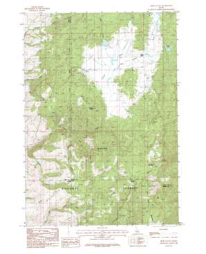
High Valley Topo Map Idaho
To zoom in, hover over the map of High Valley
USGS Topo Quad 44116b2 - 1:24,000 scale
| Topo Map Name: | High Valley |
| USGS Topo Quad ID: | 44116b2 |
| Print Size: | ca. 21 1/4" wide x 27" high |
| Southeast Coordinates: | 44.125° N latitude / 116.125° W longitude |
| Map Center Coordinates: | 44.1875° N latitude / 116.1875° W longitude |
| U.S. State: | ID |
| Filename: | o44116b2.jpg |
| Download Map JPG Image: | High Valley topo map 1:24,000 scale |
| Map Type: | Topographic |
| Topo Series: | 7.5´ |
| Map Scale: | 1:24,000 |
| Source of Map Images: | United States Geological Survey (USGS) |
| Alternate Map Versions: |
High Valley ID 1985, updated 1986 Download PDF Buy paper map High Valley ID 2011 Download PDF Buy paper map High Valley ID 2013 Download PDF Buy paper map |
| FStopo: | US Forest Service topo High Valley is available: Download FStopo PDF Download FStopo TIF |
1:24,000 Topo Quads surrounding High Valley
> Back to 44116a1 at 1:100,000 scale
> Back to 44116a1 at 1:250,000 scale
> Back to U.S. Topo Maps home
High Valley topo map: Gazetteer
High Valley: Airports
Hidden Lakes Airport elevation 1476m 4842′High Valley Bills Airport elevation 1488m 4881′
High Valley: Dams
Beal Number Three Dam elevation 1527m 5009′Hidden Lake Dam elevation 1688m 5538′
Holbrook Dam elevation 1518m 4980′
Woodall Dam elevation 1487m 4878′
High Valley: Flats
Dry Buck Meadow elevation 1779m 5836′High Valley: Gaps
Dry Buck Summit elevation 1806m 5925′High Valley: Lakes
Mud Lake elevation 1689m 5541′High Valley: Populated Places
High Valley elevation 1480m 4855′High Valley: Reservoirs
Hidden Lake elevation 1688m 5538′High Valley: Streams
Long Pine Creek elevation 1271m 4169′North Fork Little Squaw Creek elevation 1474m 4835′
Padget Creek elevation 1476m 4842′
Shirts Creek elevation 1215m 3986′
High Valley: Summits
Cook Knob elevation 1973m 6473′Dry Buck Mountain elevation 1870m 6135′
Fletcher Butte elevation 1728m 5669′
Ola Summit elevation 1503m 4931′
High Valley: Trails
Big Eddy Trail elevation 1688m 5538′Dry Buck Mountain Trail elevation 1805m 5921′
Shirts Creek Trail elevation 1561m 5121′
High Valley: Valleys
High Valley elevation 1473m 4832′Timber Gulch elevation 1024m 3359′
High Valley digital topo map on disk
Buy this High Valley topo map showing relief, roads, GPS coordinates and other geographical features, as a high-resolution digital map file on DVD:


