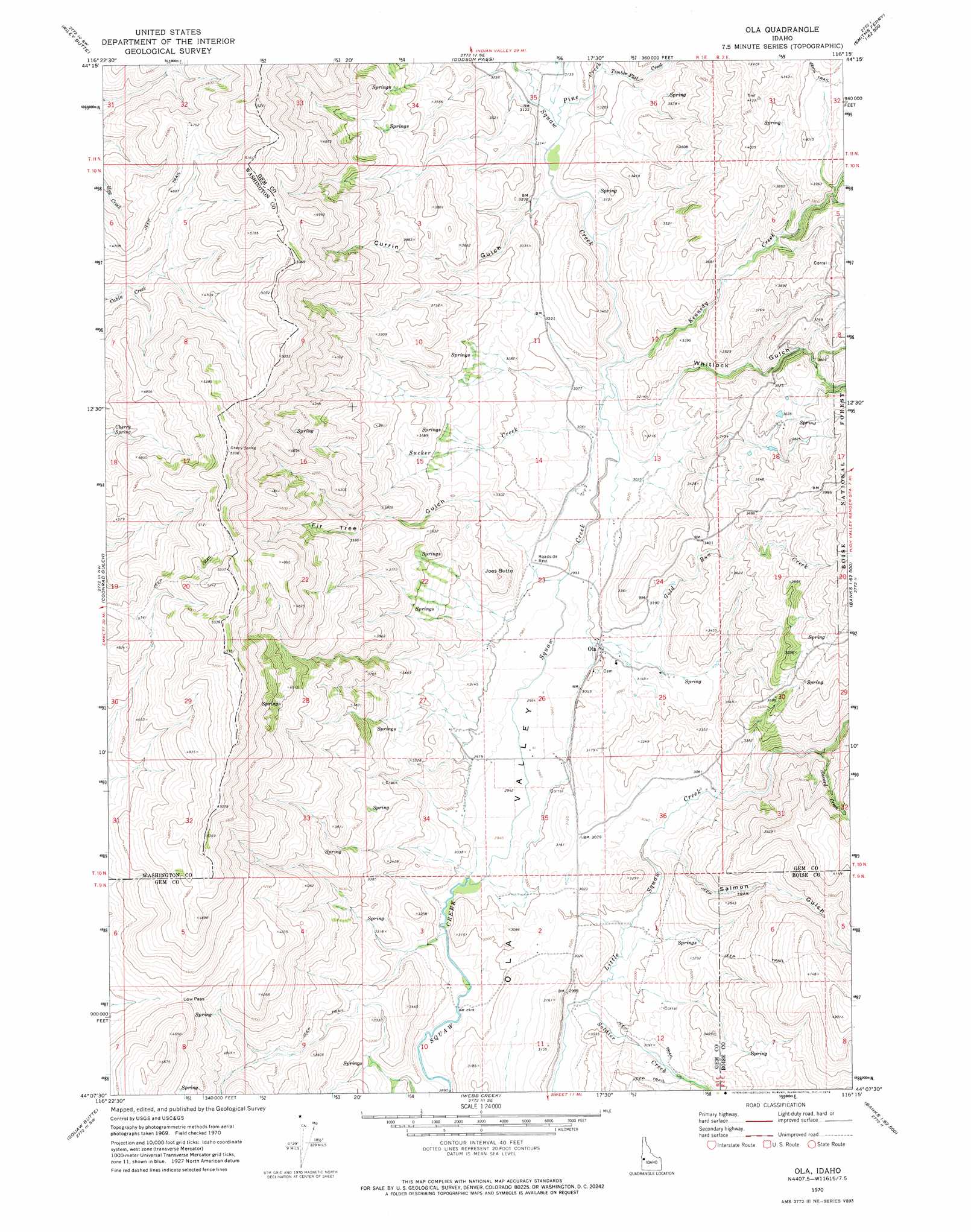
Ola Topo Map Idaho
To zoom in, hover over the map of Ola
USGS Topo Quad 44116b3 - 1:24,000 scale
| Topo Map Name: | Ola |
| USGS Topo Quad ID: | 44116b3 |
| Print Size: | ca. 21 1/4" wide x 27" high |
| Southeast Coordinates: | 44.125° N latitude / 116.25° W longitude |
| Map Center Coordinates: | 44.1875° N latitude / 116.3125° W longitude |
| U.S. State: | ID |
| Filename: | o44116b3.jpg |
| Download Map JPG Image: | Ola topo map 1:24,000 scale |
| Map Type: | Topographic |
| Topo Series: | 7.5´ |
| Map Scale: | 1:24,000 |
| Source of Map Images: | United States Geological Survey (USGS) |
| Alternate Map Versions: |
Ola ID 1970, updated 1974 Download PDF Buy paper map Ola ID 2011 Download PDF Buy paper map Ola ID 2013 Download PDF Buy paper map |
| FStopo: | US Forest Service topo Ola is available: Download FStopo PDF Download FStopo TIF |
1:24,000 Topo Quads surrounding Ola
Hog Creek Butte |
Granger Butte |
Twin Sisters |
Tripod Peak |
Alpha |
Crane Creek Reservoir |
Riley Butte |
Dodson Pass |
Sage Hen Reservoir |
Smiths Ferry |
Paddock Valley Reservoir |
Coonrod Gulch |
Ola |
High Valley |
Packer John Mountain |
Hog Cove Butte |
Squaw Butte |
Webb Creek |
Dry Buck Valley |
Banks |
Northwest Emmett |
Northeast Emmett |
Montour |
Horseshoe Bend |
Harris Creek Summit |
> Back to 44116a1 at 1:100,000 scale
> Back to 44116a1 at 1:250,000 scale
> Back to U.S. Topo Maps home
Ola topo map: Gazetteer
Ola: Populated Places
Ola elevation 917m 3008′Ola: Springs
Cherry Spring elevation 1340m 4396′Ola: Streams
Gold Run Creek elevation 918m 3011′Havord Creek elevation 973m 3192′
Kennedy Creek elevation 927m 3041′
Pine Creek elevation 945m 3100′
Soldier Creek elevation 892m 2926′
Sucker Creek elevation 923m 3028′
Timber Flat Creek elevation 963m 3159′
Ola: Summits
Joes Butte elevation 1038m 3405′Ola: Valleys
Currin Gulch elevation 952m 3123′Fir Tree Gulch elevation 927m 3041′
Salmon Gulch elevation 928m 3044′
Whitlock Gulch elevation 927m 3041′
Ola digital topo map on disk
Buy this Ola topo map showing relief, roads, GPS coordinates and other geographical features, as a high-resolution digital map file on DVD: