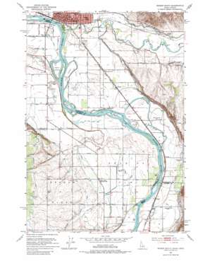
Weiser South Topo Map Oregon
To zoom in, hover over the map of Weiser South
USGS Topo Quad 44116b8 - 1:24,000 scale
| Topo Map Name: | Weiser South |
| USGS Topo Quad ID: | 44116b8 |
| Print Size: | ca. 21 1/4" wide x 27" high |
| Southeast Coordinates: | 44.125° N latitude / 116.875° W longitude |
| Map Center Coordinates: | 44.1875° N latitude / 116.9375° W longitude |
| U.S. States: | OR, ID |
| Filename: | o44116b8.jpg |
| Download Map JPG Image: | Weiser South topo map 1:24,000 scale |
| Map Type: | Topographic |
| Topo Series: | 7.5´ |
| Map Scale: | 1:24,000 |
| Source of Map Images: | United States Geological Survey (USGS) |
| Alternate Map Versions: |
Weiser South ID 1951, updated 1953 Download PDF Buy paper map Weiser South ID 1951, updated 1971 Download PDF Buy paper map Weiser South ID 1951, updated 1982 Download PDF Buy paper map Weiser South ID 1974, updated 1975 Download PDF Buy paper map Weiser South ID 1998, updated 2002 Download PDF Buy paper map Weiser South ID 2011 Download PDF Buy paper map Weiser South ID 2013 Download PDF Buy paper map |
1:24,000 Topo Quads surrounding Weiser South
> Back to 44116a1 at 1:100,000 scale
> Back to 44116a1 at 1:250,000 scale
> Back to U.S. Topo Maps home
Weiser South topo map: Gazetteer
Weiser South: Airports
Weiser Municipal Airport elevation 643m 2109′Weiser South: Areas
Oregon Slope elevation 699m 2293′Weiser South: Canals
Annex Canal elevation 642m 2106′Coyote Drain elevation 654m 2145′
Lower Payette Ditch elevation 658m 2158′
Middle Ditch elevation 667m 2188′
Upper Ditch elevation 672m 2204′
Weiser South: Flats
Dead Ox Flat elevation 656m 2152′Weiser South: Guts
Buttermilk Slough elevation 644m 2112′Weiser South: Islands
Larson Island elevation 643m 2109′Long Island elevation 642m 2106′
Patch Island elevation 643m 2109′
Smith Island elevation 645m 2116′
Wildcat Island elevation 641m 2103′
Weiser South: Populated Places
Annex elevation 641m 2103′Crystal elevation 644m 2112′
Feltham elevation 647m 2122′
Wood elevation 651m 2135′
Weiser South: Post Offices
Mosquite Post Office (historical) elevation 664m 2178′Weiser South: Streams
Mann Creek elevation 652m 2139′Monroe Creek elevation 644m 2112′
Weiser River elevation 639m 2096′
Weiser South: Valleys
Coyote Gulch elevation 660m 2165′Shepherd Gulch elevation 647m 2122′
Weiser South digital topo map on disk
Buy this Weiser South topo map showing relief, roads, GPS coordinates and other geographical features, as a high-resolution digital map file on DVD:


