Twin Sisters Topo Map Idaho
To zoom in, hover over the map of Twin Sisters
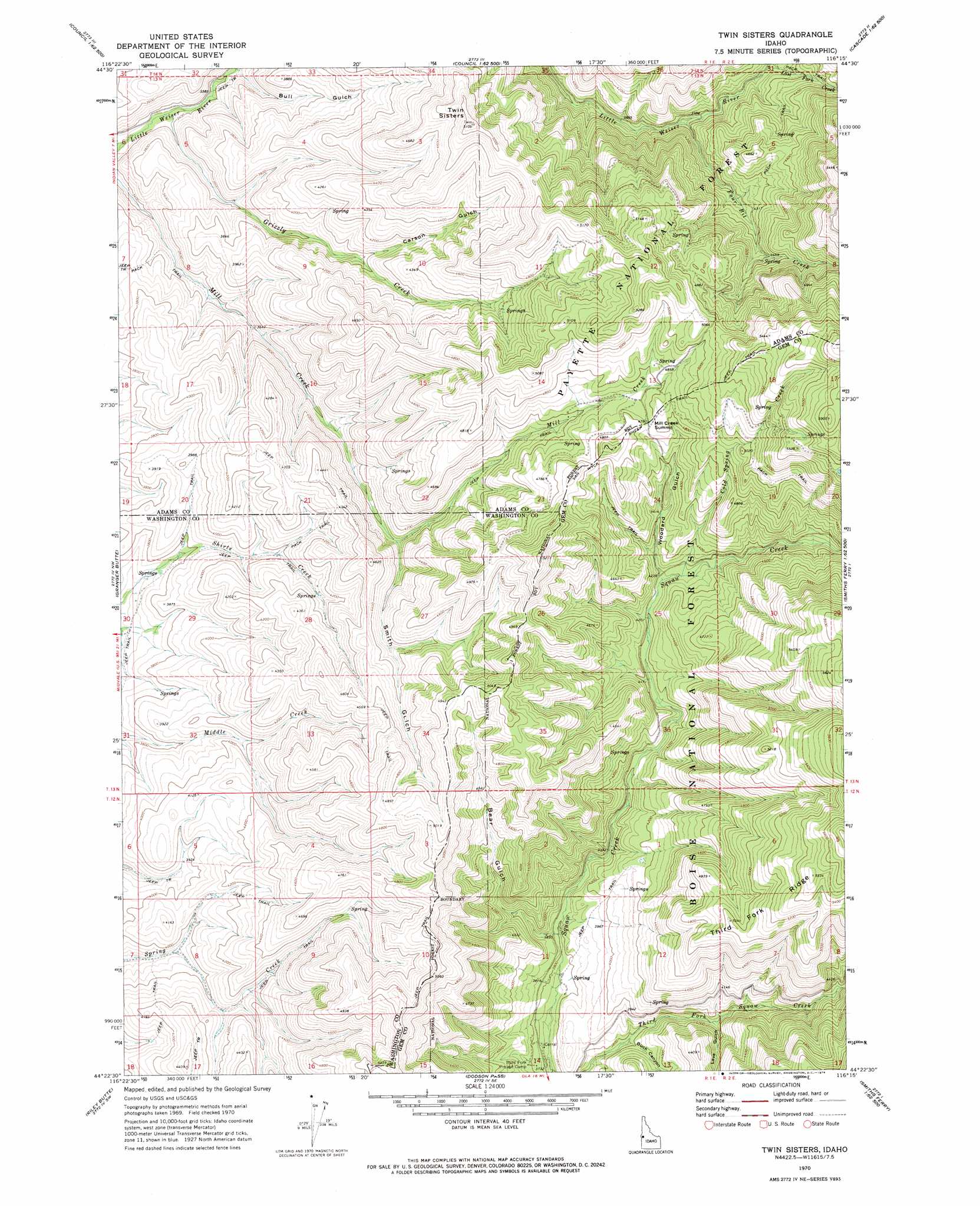
USGS Topo Quad 44116d3 - 1:24,000 scale
| Topo Map Name: | Twin Sisters |
| USGS Topo Quad ID: | 44116d3 |
| Print Size: | ca. 21 1/4" wide x 27" high |
| Southeast Coordinates: | 44.375° N latitude / 116.25° W longitude |
| Map Center Coordinates: | 44.4375° N latitude / 116.3125° W longitude |
| U.S. State: | ID |
| Filename: | o44116d3.jpg |
| Download Map JPG Image: | Twin Sisters topo map 1:24,000 scale |
| Map Type: | Topographic |
| Topo Series: | 7.5´ |
| Map Scale: | 1:24,000 |
| Source of Map Images: | United States Geological Survey (USGS) |
| Alternate Map Versions: |
Twin Sisters ID 1970, updated 1974 Download PDF Buy paper map Twin Sisters ID 2004, updated 2007 Download PDF Buy paper map Twin Sisters ID 2011 Download PDF Buy paper map Twin Sisters ID 2013 Download PDF Buy paper map |
| FStopo: | US Forest Service topo Twin Sisters is available: Download FStopo PDF Download FStopo TIF |
1:24,000 Topo Quads surrounding Twin Sisters
Goodrich |
Council |
Council Mountain |
Lone Tree |
Donnelly |
East Of Cambridge |
Indian Valley |
King Hill Creek |
Cold Spring Ridge |
Cascade |
Hog Creek Butte |
Granger Butte |
Twin Sisters |
Tripod Peak |
Alpha |
Crane Creek Reservoir |
Riley Butte |
Dodson Pass |
Sage Hen Reservoir |
Smiths Ferry |
Paddock Valley Reservoir |
Coonrod Gulch |
Ola |
High Valley |
Packer John Mountain |
> Back to 44116a1 at 1:100,000 scale
> Back to 44116a1 at 1:250,000 scale
> Back to U.S. Topo Maps home
Twin Sisters topo map: Gazetteer
Twin Sisters: Streams
Cold Spring Creek elevation 1299m 4261′Four Bit Creek elevation 1207m 3959′
Grizzly Creek elevation 1023m 3356′
Twin Sisters: Summits
Mill Creek Summit elevation 1458m 4783′Twin Sisters elevation 1530m 5019′
Twin Sisters: Valleys
Bear Gulch elevation 1158m 3799′Buck Canyon elevation 1147m 3763′
Bull Gulch elevation 1051m 3448′
Carson Gulch elevation 1209m 3966′
Lava Gulch elevation 1202m 3943′
Smith Gulch elevation 1242m 4074′
Woodard Gulch elevation 1291m 4235′
Twin Sisters digital topo map on disk
Buy this Twin Sisters topo map showing relief, roads, GPS coordinates and other geographical features, as a high-resolution digital map file on DVD: