Midvale Topo Map Idaho
To zoom in, hover over the map of Midvale
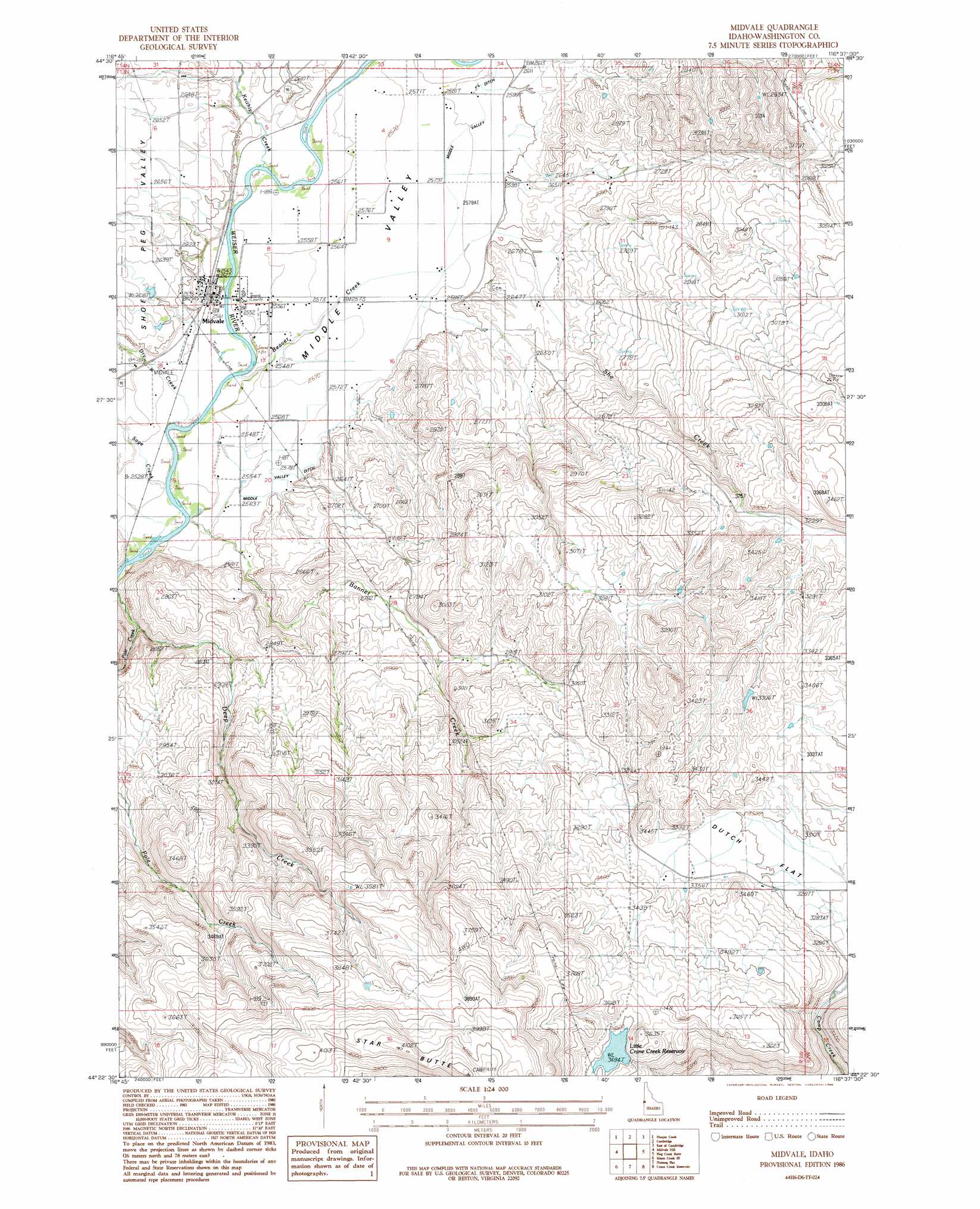
USGS Topo Quad 44116d6 - 1:24,000 scale
| Topo Map Name: | Midvale |
| USGS Topo Quad ID: | 44116d6 |
| Print Size: | ca. 21 1/4" wide x 27" high |
| Southeast Coordinates: | 44.375° N latitude / 116.625° W longitude |
| Map Center Coordinates: | 44.4375° N latitude / 116.6875° W longitude |
| U.S. State: | ID |
| Filename: | o44116d6.jpg |
| Download Map JPG Image: | Midvale topo map 1:24,000 scale |
| Map Type: | Topographic |
| Topo Series: | 7.5´ |
| Map Scale: | 1:24,000 |
| Source of Map Images: | United States Geological Survey (USGS) |
| Alternate Map Versions: |
Midvale ID 1986, updated 1986 Download PDF Buy paper map Midvale ID 2010 Download PDF Buy paper map Midvale ID 2013 Download PDF Buy paper map |
1:24,000 Topo Quads surrounding Midvale
Neil Gulch |
Advent Gulch |
Rush Peak |
Goodrich |
Council |
Sturgill Peak |
Hopper Creek |
Cambridge |
East Of Cambridge |
Indian Valley |
Mann Creek Nw |
Midvale Hill |
Midvale |
Hog Creek Butte |
Granger Butte |
Weiser North |
Mann Creek Se |
Nutmeg Flat |
Crane Creek Reservoir |
Riley Butte |
Weiser South |
Weiser Cove |
Holland Gulch |
Paddock Valley Reservoir |
Coonrod Gulch |
> Back to 44116a1 at 1:100,000 scale
> Back to 44116a1 at 1:250,000 scale
> Back to U.S. Topo Maps home
Midvale topo map: Gazetteer
Midvale: Dams
Little Crane Creek Dam elevation 1066m 3497′Midvale: Populated Places
Midvale elevation 775m 2542′Midvale: Reservoirs
Little Crane Creek Reservoir elevation 1066m 3497′Midvale: Streams
Banner Creek elevation 768m 2519′Beaver Creek elevation 771m 2529′
Dry Creek elevation 770m 2526′
Keithly Creek elevation 778m 2552′
Pole Creek elevation 786m 2578′
Sage Creek elevation 769m 2522′
She Creek elevation 782m 2565′
Midvale: Summits
Star Butte elevation 1258m 4127′Midvale: Valleys
Middle Valley elevation 785m 2575′Midvale digital topo map on disk
Buy this Midvale topo map showing relief, roads, GPS coordinates and other geographical features, as a high-resolution digital map file on DVD: