Council Mountain Topo Map Idaho
To zoom in, hover over the map of Council Mountain
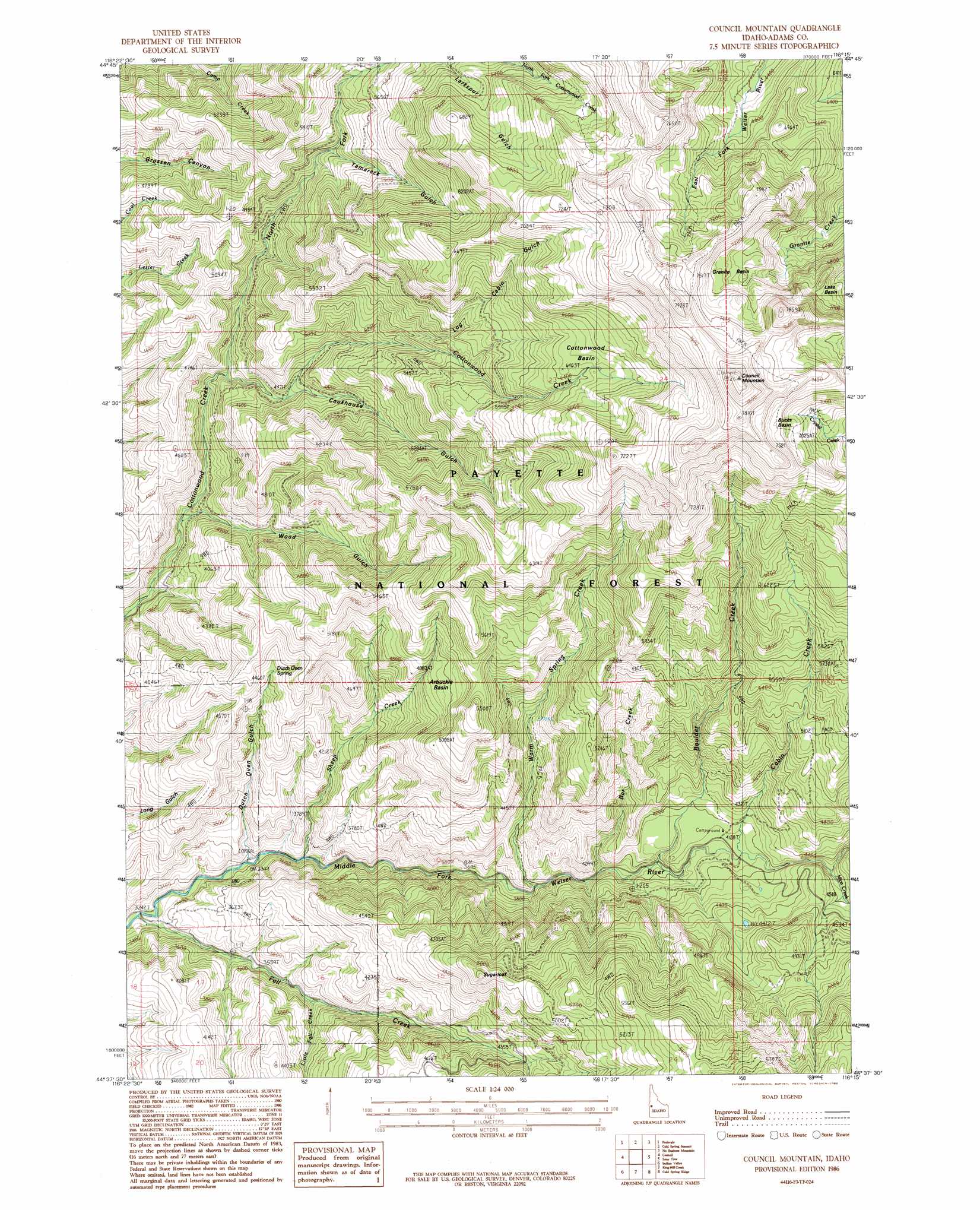
USGS Topo Quad 44116f3 - 1:24,000 scale
| Topo Map Name: | Council Mountain |
| USGS Topo Quad ID: | 44116f3 |
| Print Size: | ca. 21 1/4" wide x 27" high |
| Southeast Coordinates: | 44.625° N latitude / 116.25° W longitude |
| Map Center Coordinates: | 44.6875° N latitude / 116.3125° W longitude |
| U.S. State: | ID |
| Filename: | o44116f3.jpg |
| Download Map JPG Image: | Council Mountain topo map 1:24,000 scale |
| Map Type: | Topographic |
| Topo Series: | 7.5´ |
| Map Scale: | 1:24,000 |
| Source of Map Images: | United States Geological Survey (USGS) |
| Alternate Map Versions: |
Council Mountain ID 1986, updated 1986 Download PDF Buy paper map Council Mountain ID 2004, updated 2007 Download PDF Buy paper map Council Mountain ID 2011 Download PDF Buy paper map Council Mountain ID 2013 Download PDF Buy paper map |
| FStopo: | US Forest Service topo Council Mountain is available: Download FStopo PDF Download FStopo TIF |
1:24,000 Topo Quads surrounding Council Mountain
Weasel Gulch |
Tamarack |
New Meadows |
Meadows |
Mccall |
Peck Mountain |
Fruitvale |
Cold Spring Summit |
No Business Mountain |
Lake Fork |
Goodrich |
Council |
Council Mountain |
Lone Tree |
Donnelly |
East Of Cambridge |
Indian Valley |
King Hill Creek |
Cold Spring Ridge |
Cascade |
Hog Creek Butte |
Granger Butte |
Twin Sisters |
Tripod Peak |
Alpha |
> Back to 44116e1 at 1:100,000 scale
> Back to 44116a1 at 1:250,000 scale
> Back to U.S. Topo Maps home
Council Mountain topo map: Gazetteer
Council Mountain: Basins
Arbuckle Basin elevation 1518m 4980′Bucks Basin elevation 2171m 7122′
Cottonwood Basin elevation 1982m 6502′
Granite Basin elevation 2147m 7043′
Lake Basin elevation 2111m 6925′
Council Mountain: Mines
Mica Mine elevation 1345m 4412′Council Mountain: Springs
Dutch Oven Spring elevation 1355m 4445′Hot Springs elevation 1370m 4494′
Council Mountain: Streams
Bar Creek elevation 1172m 3845′Boulder Creek elevation 1204m 3950′
Cabin Creek elevation 1256m 4120′
Fall Creek elevation 988m 3241′
Little Fall Creek elevation 1134m 3720′
Mica Creek elevation 1308m 4291′
North Fork Cottonwood Creek elevation 1285m 4215′
Sheep Creek elevation 1061m 3480′
Warm Spring Creek elevation 1140m 3740′
Council Mountain: Summits
Council Mountain elevation 2475m 8120′Sugarloaf elevation 1602m 5255′
Council Mountain: Trails
Cabin Creek Trail elevation 1789m 5869′Cottonwood Basin Trail elevation 1904m 6246′
Granite Creek Trail elevation 2057m 6748′
Mill Creek Trail elevation 2158m 7080′
Council Mountain: Valleys
Cookhouse Gulch elevation 1370m 4494′Dutch Oven Gulch elevation 1065m 3494′
Log Cabin Gulch elevation 1586m 5203′
Tamarack Gulch elevation 1582m 5190′
Wood Gulch elevation 1191m 3907′
Council Mountain digital topo map on disk
Buy this Council Mountain topo map showing relief, roads, GPS coordinates and other geographical features, as a high-resolution digital map file on DVD: