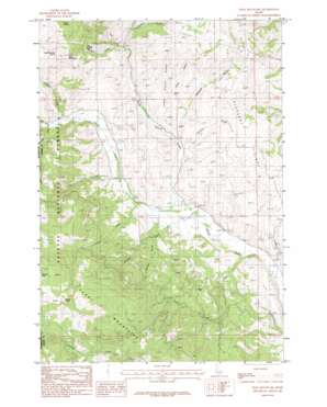
Peck Mountain Topo Map Idaho
To zoom in, hover over the map of Peck Mountain
USGS Topo Quad 44116g5 - 1:24,000 scale
| Topo Map Name: | Peck Mountain |
| USGS Topo Quad ID: | 44116g5 |
| Print Size: | ca. 21 1/4" wide x 27" high |
| Southeast Coordinates: | 44.75° N latitude / 116.5° W longitude |
| Map Center Coordinates: | 44.8125° N latitude / 116.5625° W longitude |
| U.S. State: | ID |
| Filename: | o44116g5.jpg |
| Download Map JPG Image: | Peck Mountain topo map 1:24,000 scale |
| Map Type: | Topographic |
| Topo Series: | 7.5´ |
| Map Scale: | 1:24,000 |
| Source of Map Images: | United States Geological Survey (USGS) |
| Alternate Map Versions: |
Peck Mountain ID 1986, updated 1986 Download PDF Buy paper map Peck Mountain ID 2004, updated 2007 Download PDF Buy paper map Peck Mountain ID 2011 Download PDF Buy paper map Peck Mountain ID 2013 Download PDF Buy paper map |
| FStopo: | US Forest Service topo Peck Mountain is available: Download FStopo PDF Download FStopo TIF |
1:24,000 Topo Quads surrounding Peck Mountain
> Back to 44116e1 at 1:100,000 scale
> Back to 44116a1 at 1:250,000 scale
> Back to U.S. Topo Maps home
Peck Mountain topo map: Gazetteer
Peck Mountain: Airports
Flying Y Ranch Airport elevation 967m 3172′Peck Mountain: Dams
Ellsworth-Middle Dam elevation 1158m 3799′Peck Mountain: Flats
Horse Flat elevation 1296m 4251′Peck Mountain: Ridges
Long Gulch Ridge elevation 1282m 4206′Pleasant Ridge elevation 1149m 3769′
Peck Mountain: Springs
Grouse Spring elevation 1273m 4176′Horse Spring elevation 1438m 4717′
Peck Mountain Spring elevation 1465m 4806′
Peck Mountain: Streams
Dry Creek elevation 1199m 3933′Fir Creek elevation 1059m 3474′
Hanson Creek elevation 977m 3205′
Lakey Creek elevation 1039m 3408′
Left Fork North Hornet Creek elevation 1112m 3648′
Mill Creek elevation 1205m 3953′
North Hornet Creek elevation 988m 3241′
Pearl Creek elevation 1172m 3845′
Pole Creek elevation 957m 3139′
Skunk Cabbage Flat elevation 1495m 4904′
Sonner Creek elevation 1073m 3520′
Peck Mountain: Summits
Peck Mountain elevation 1563m 5127′Stony Point elevation 1869m 6131′
Peck Mountain: Valleys
Badger Gulch elevation 1133m 3717′Long Gulch elevation 1074m 3523′
Robison Gulch elevation 1030m 3379′
Timber Gulch elevation 1147m 3763′
Traction Gulch elevation 1028m 3372′
Peck Mountain digital topo map on disk
Buy this Peck Mountain topo map showing relief, roads, GPS coordinates and other geographical features, as a high-resolution digital map file on DVD:


