Brownlee Dam Topo Map Oregon
To zoom in, hover over the map of Brownlee Dam
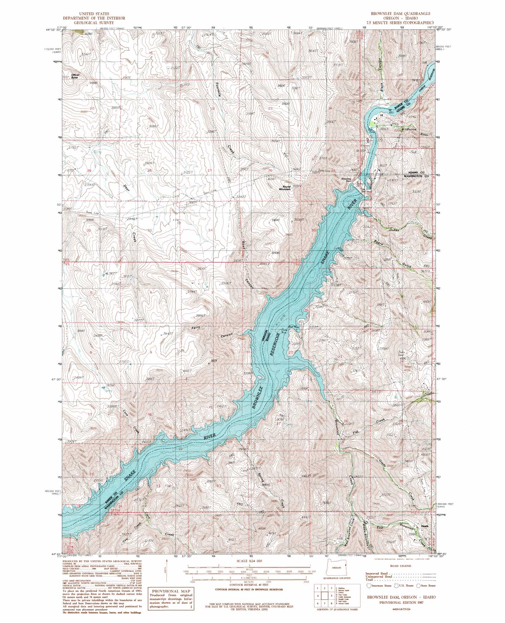
USGS Topo Quad 44116g8 - 1:24,000 scale
| Topo Map Name: | Brownlee Dam |
| USGS Topo Quad ID: | 44116g8 |
| Print Size: | ca. 21 1/4" wide x 27" high |
| Southeast Coordinates: | 44.75° N latitude / 116.875° W longitude |
| Map Center Coordinates: | 44.8125° N latitude / 116.9375° W longitude |
| U.S. States: | OR, ID |
| Filename: | o44116g8.jpg |
| Download Map JPG Image: | Brownlee Dam topo map 1:24,000 scale |
| Map Type: | Topographic |
| Topo Series: | 7.5´ |
| Map Scale: | 1:24,000 |
| Source of Map Images: | United States Geological Survey (USGS) |
| Alternate Map Versions: |
Brownlee Dam OR 1987, updated 1987 Download PDF Buy paper map Brownlee Dam OR 2011 Download PDF Buy paper map Brownlee Dam OR 2014 Download PDF Buy paper map |
| FStopo: | US Forest Service topo Brownlee Dam is available: Download FStopo PDF Download FStopo TIF |
1:24,000 Topo Quads surrounding Brownlee Dam
Cornucopia |
Deadman Point |
Duck Creek |
Homestead |
Cuprum |
Jimtown |
Halfway |
Mclain Gulch |
Oxbow |
Rocky Comfort Flat |
Richland |
Posy Valley |
Brownlee Dam |
Cuddy Mountain |
Crooked River Point |
Daly Creek |
Sturgill Creek |
Neil Gulch |
Advent Gulch |
Rush Peak |
Connor Creek |
Monroe Butte |
Sturgill Peak |
Hopper Creek |
Cambridge |
> Back to 44116e1 at 1:100,000 scale
> Back to 44116a1 at 1:250,000 scale
> Back to U.S. Topo Maps home
Brownlee Dam topo map: Gazetteer
Brownlee Dam: Dams
Brownlee Dam elevation 635m 2083′Brownlee Dam: Islands
Eagle Island elevation 550m 1804′Eagle Island elevation 550m 1804′
Oregon Island elevation 550m 1804′
Brownlee Dam: Populated Places
Brownlee elevation 690m 2263′Heath elevation 880m 2887′
Brownlee Dam: Post Offices
Brownlee Post Office (historical) elevation 690m 2263′Brownlee Dam: Rapids
Wildhorse Rapids elevation 550m 1804′Brownlee Dam: Reservoirs
Brownlee Reservoir elevation 635m 2083′Brownlee Dam: Springs
Densley Spring elevation 1117m 3664′Brownlee Dam: Streams
Brownlee Creek elevation 634m 2080′Cave Creek elevation 658m 2158′
Cave Creek elevation 633m 2076′
Cow Creek elevation 756m 2480′
Dukes Creek elevation 633m 2076′
East Brownlee Creek elevation 783m 2568′
Flat Creek elevation 680m 2230′
Grade Creek elevation 706m 2316′
Middle Brownlee Creek elevation 800m 2624′
Spring Creek elevation 633m 2076′
West Brownlee Creek elevation 784m 2572′
Wildhorse River elevation 552m 1811′
Brownlee Dam: Summits
Officer Butte elevation 1062m 3484′Road Mountain elevation 1178m 3864′
Brownlee Dam: Valleys
Black Canyon elevation 550m 1804′Board Gulch elevation 633m 2076′
Ferry Canyon elevation 656m 2152′
Road Canyon elevation 646m 2119′
Brownlee Dam digital topo map on disk
Buy this Brownlee Dam topo map showing relief, roads, GPS coordinates and other geographical features, as a high-resolution digital map file on DVD: