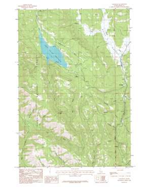
Tamarack Topo Map Idaho
To zoom in, hover over the map of Tamarack
USGS Topo Quad 44116h4 - 1:24,000 scale
| Topo Map Name: | Tamarack |
| USGS Topo Quad ID: | 44116h4 |
| Print Size: | ca. 21 1/4" wide x 27" high |
| Southeast Coordinates: | 44.875° N latitude / 116.375° W longitude |
| Map Center Coordinates: | 44.9375° N latitude / 116.4375° W longitude |
| U.S. State: | ID |
| Filename: | o44116h4.jpg |
| Download Map JPG Image: | Tamarack topo map 1:24,000 scale |
| Map Type: | Topographic |
| Topo Series: | 7.5´ |
| Map Scale: | 1:24,000 |
| Source of Map Images: | United States Geological Survey (USGS) |
| Alternate Map Versions: |
Tamarack ID 1986, updated 1986 Download PDF Buy paper map Tamarack ID 2011 Download PDF Buy paper map Tamarack ID 2013 Download PDF Buy paper map |
| FStopo: | US Forest Service topo Tamarack is available: Download FStopo PDF Download FStopo TIF |
1:24,000 Topo Quads surrounding Tamarack
> Back to 44116e1 at 1:100,000 scale
> Back to 44116a1 at 1:250,000 scale
> Back to U.S. Topo Maps home
Tamarack topo map: Gazetteer
Tamarack: Dams
Lost Valley Dam elevation 1454m 4770′Tamarack: Falls
Lost Creek Falls elevation 1337m 4386′Tamarack: Mines
IXL Mine elevation 1359m 4458′Tamarack: Populated Places
Evergreen elevation 1158m 3799′Pine Ridge elevation 1256m 4120′
Tamarack elevation 1258m 4127′
Woodland elevation 1227m 4025′
Tamarack: Reservoirs
Lost Valley Reservoir elevation 1454m 4770′Tamarack: Springs
Cold Spring elevation 1487m 4878′Tamarack: Streams
Beaver Creek elevation 1227m 4025′East Fork Lost Creek elevation 1463m 4799′
Filly Creek elevation 1192m 3910′
Finn Creek elevation 1135m 3723′
Lost Creek elevation 1078m 3536′
Mosquito Creek elevation 1259m 4130′
Railroad Creek elevation 1121m 3677′
Rough Creek elevation 1093m 3585′
Skern Creek elevation 1267m 4156′
Surprise Creek elevation 1195m 3920′
Woodland Creek elevation 1223m 4012′
Tamarack: Valleys
Bear Gulch elevation 1318m 4324′Meridian Gulch elevation 1213m 3979′
Price Valley elevation 1257m 4124′
Slaughterhouse Gulch elevation 1471m 4826′
Warm Spring Gulch elevation 1082m 3549′
Tamarack digital topo map on disk
Buy this Tamarack topo map showing relief, roads, GPS coordinates and other geographical features, as a high-resolution digital map file on DVD:


