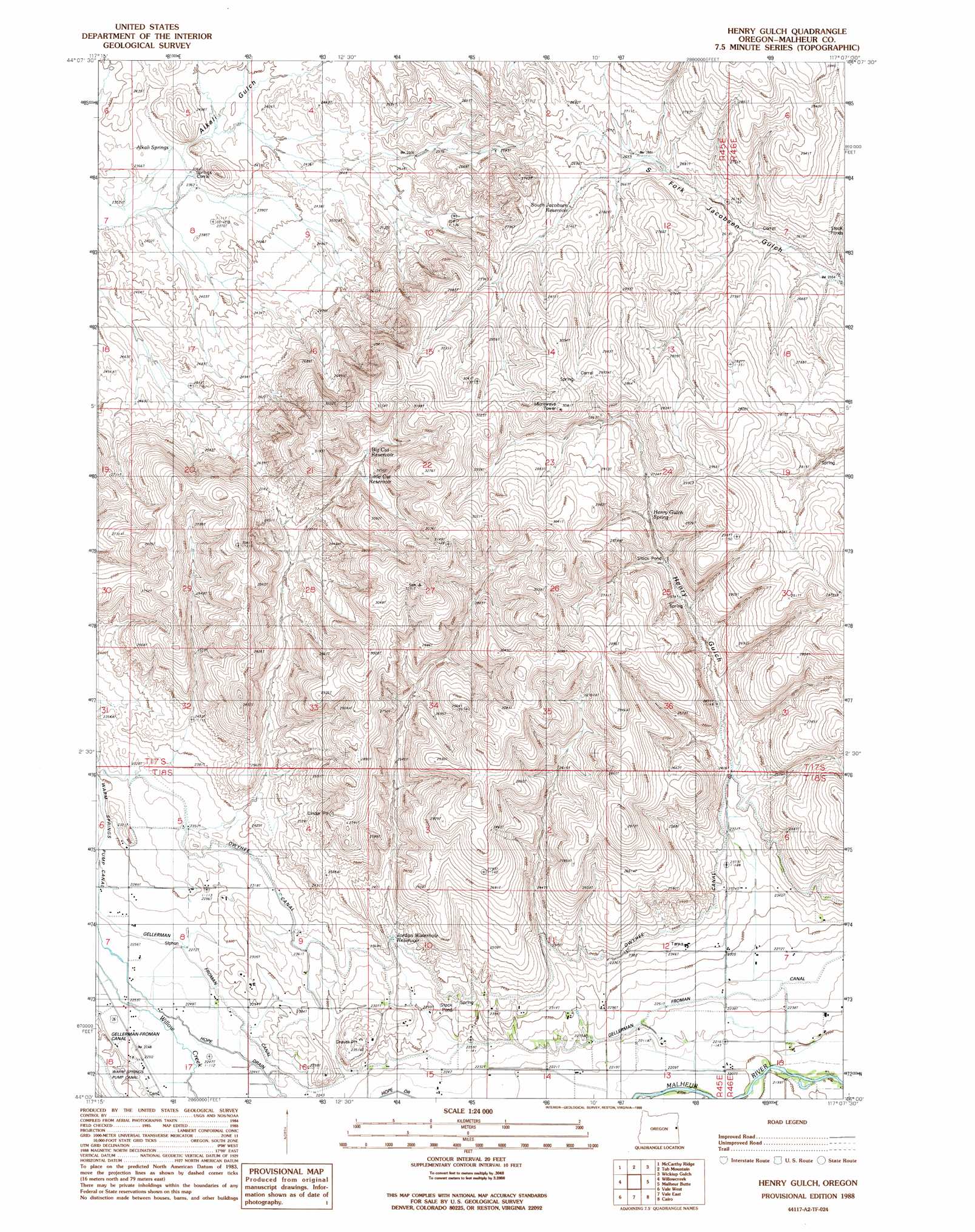
Henry Gulch Topo Map Oregon
To zoom in, hover over the map of Henry Gulch
USGS Topo Quad 44117a2 - 1:24,000 scale
| Topo Map Name: | Henry Gulch |
| USGS Topo Quad ID: | 44117a2 |
| Print Size: | ca. 21 1/4" wide x 27" high |
| Southeast Coordinates: | 44° N latitude / 117.125° W longitude |
| Map Center Coordinates: | 44.0625° N latitude / 117.1875° W longitude |
| U.S. State: | OR |
| Filename: | o44117a2.jpg |
| Download Map JPG Image: | Henry Gulch topo map 1:24,000 scale |
| Map Type: | Topographic |
| Topo Series: | 7.5´ |
| Map Scale: | 1:24,000 |
| Source of Map Images: | United States Geological Survey (USGS) |
| Alternate Map Versions: |
Henry Gulch OR 1988, updated 1988 Download PDF Buy paper map Henry Gulch OR 2011 Download PDF Buy paper map Henry Gulch OR 2014 Download PDF Buy paper map |
1:24,000 Topo Quads surrounding Henry Gulch
Birch Creek Meadow |
Huntington |
Olds Ferry |
Porters Flat |
Weiser North |
Jamieson |
Mccarthy Ridge |
Tub Mountain |
Moores Hollow |
Weiser South |
Hope Butte |
Willow Creek |
Henry Gulch |
Malheur Butte |
Payette |
Vines Hill |
Vale West |
Vale East |
Cairo |
Nyssa |
Kane Spring Gulch |
Double Mountain |
Mitchell Butte |
Owyhee |
Parma |
> Back to 44117a1 at 1:100,000 scale
> Back to 44116a1 at 1:250,000 scale
> Back to U.S. Topo Maps home
Henry Gulch topo map: Gazetteer
Henry Gulch: Canals
Hope Ditch elevation 684m 2244′Owyhee Canal elevation 723m 2372′
Henry Gulch: Flats
Alkali Flats elevation 727m 2385′Henry Gulch: Reservoirs
Big Cut Reservoir elevation 858m 2814′Channel Reservoir elevation 819m 2687′
Henry Gulch Reservoir elevation 842m 2762′
Jordan Waterhole Reservoir elevation 725m 2378′
Little Cut Reservoir elevation 856m 2808′
South Jacobsen Reservoir elevation 824m 2703′
Three Forks Reservoir elevation 794m 2604′
Willow Reservoir elevation 785m 2575′
Henry Gulch: Springs
Alkali Springs elevation 725m 2378′Henry Gulch Spring elevation 824m 2703′
Indian Spring elevation 725m 2378′
Henry Gulch: Valleys
Henry Gulch elevation 725m 2378′Willow Creek Valley elevation 685m 2247′
Henry Gulch digital topo map on disk
Buy this Henry Gulch topo map showing relief, roads, GPS coordinates and other geographical features, as a high-resolution digital map file on DVD: