Willow Creek Topo Map Oregon
To zoom in, hover over the map of Willow Creek
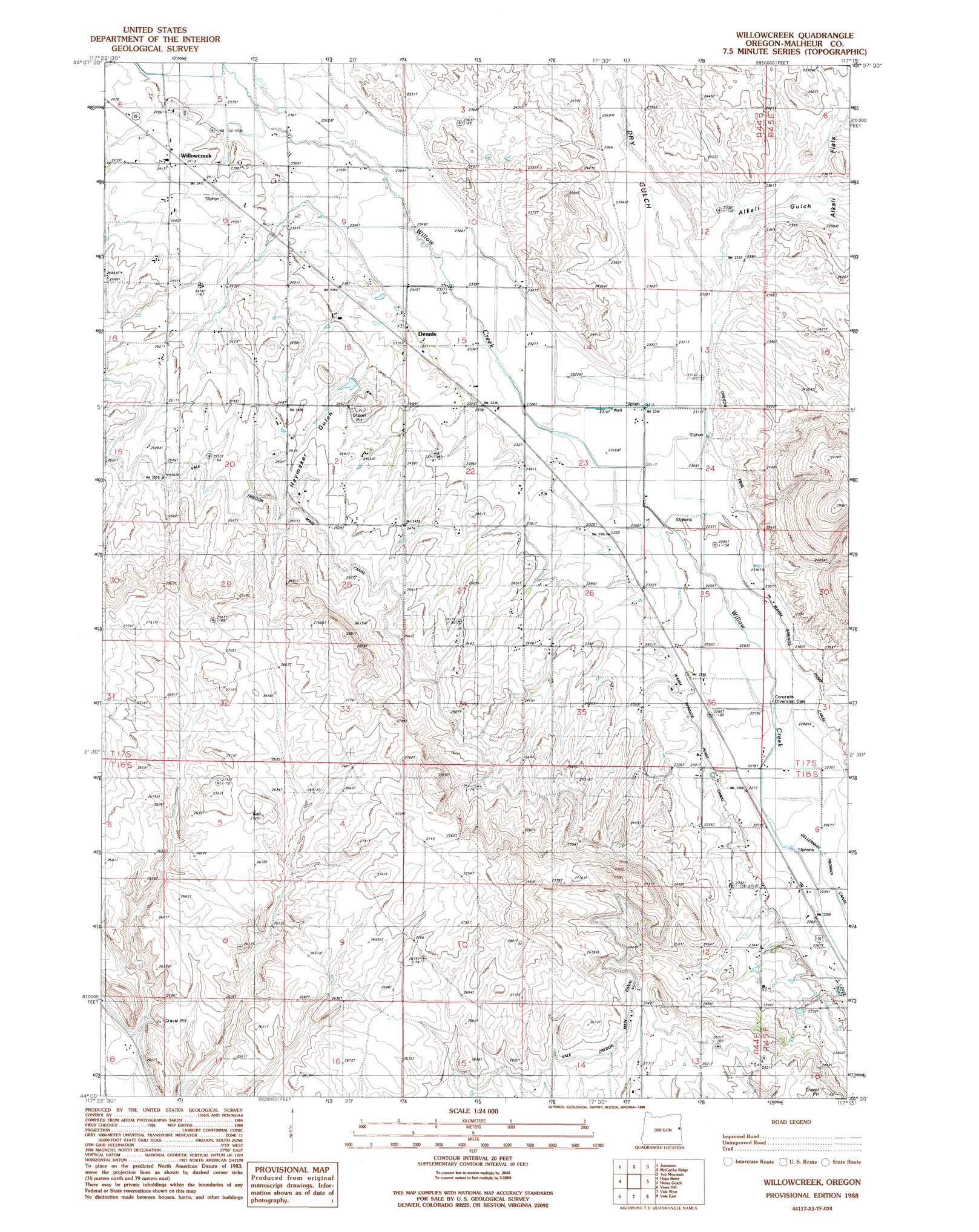
USGS Topo Quad 44117a3 - 1:24,000 scale
| Topo Map Name: | Willow Creek |
| USGS Topo Quad ID: | 44117a3 |
| Print Size: | ca. 21 1/4" wide x 27" high |
| Southeast Coordinates: | 44° N latitude / 117.25° W longitude |
| Map Center Coordinates: | 44.0625° N latitude / 117.3125° W longitude |
| U.S. State: | OR |
| Filename: | o44117a3.jpg |
| Download Map JPG Image: | Willow Creek topo map 1:24,000 scale |
| Map Type: | Topographic |
| Topo Series: | 7.5´ |
| Map Scale: | 1:24,000 |
| Source of Map Images: | United States Geological Survey (USGS) |
| Alternate Map Versions: |
Willowcreek OR 1987, updated 1988 Download PDF Buy paper map Willowcreek OR 1988, updated 1988 Download PDF Buy paper map Willowcreek OR 2011 Download PDF Buy paper map Willowcreek OR 2014 Download PDF Buy paper map |
1:24,000 Topo Quads surrounding Willow Creek
Becker Creek |
Birch Creek Meadow |
Huntington |
Olds Ferry |
Porters Flat |
Brogan |
Jamieson |
Mccarthy Ridge |
Tub Mountain |
Moores Hollow |
Swede Flat |
Hope Butte |
Willow Creek |
Henry Gulch |
Malheur Butte |
Little Valley |
Vines Hill |
Vale West |
Vale East |
Cairo |
Harper |
Kane Spring Gulch |
Double Mountain |
Mitchell Butte |
Owyhee |
> Back to 44117a1 at 1:100,000 scale
> Back to 44116a1 at 1:250,000 scale
> Back to U.S. Topo Maps home
Willow Creek topo map: Gazetteer
Willow Creek: Canals
Gellerman Canal elevation 694m 2276′Warm Springs Pump Canal elevation 705m 2312′
Willow Creek: Populated Places
Dennis elevation 722m 2368′Home (historical) elevation 711m 2332′
Willowcreek elevation 736m 2414′
Willow Creek: Post Offices
Glenn Post Office (historical) elevation 706m 2316′Home Post Office (historical) elevation 711m 2332′
Willowcreek Post Office (historical) elevation 736m 2414′
Willow Creek: Reservoirs
Association Reservoir elevation 761m 2496′Willow Creek: Valleys
Alkali Gulch elevation 709m 2326′Dry Gulch elevation 708m 2322′
Haymaker Gulch elevation 727m 2385′
Willow Creek digital topo map on disk
Buy this Willow Creek topo map showing relief, roads, GPS coordinates and other geographical features, as a high-resolution digital map file on DVD: