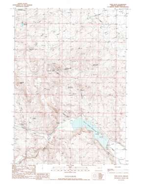
Hope Butte Topo Map Oregon
To zoom in, hover over the map of Hope Butte
USGS Topo Quad 44117a4 - 1:24,000 scale
| Topo Map Name: | Hope Butte |
| USGS Topo Quad ID: | 44117a4 |
| Print Size: | ca. 21 1/4" wide x 27" high |
| Southeast Coordinates: | 44° N latitude / 117.375° W longitude |
| Map Center Coordinates: | 44.0625° N latitude / 117.4375° W longitude |
| U.S. State: | OR |
| Filename: | o44117a4.jpg |
| Download Map JPG Image: | Hope Butte topo map 1:24,000 scale |
| Map Type: | Topographic |
| Topo Series: | 7.5´ |
| Map Scale: | 1:24,000 |
| Source of Map Images: | United States Geological Survey (USGS) |
| Alternate Map Versions: |
Hope Butte OR 1988, updated 1988 Download PDF Buy paper map Hope Butte OR 2011 Download PDF Buy paper map Hope Butte OR 2014 Download PDF Buy paper map |
1:24,000 Topo Quads surrounding Hope Butte
> Back to 44117a1 at 1:100,000 scale
> Back to 44116a1 at 1:250,000 scale
> Back to U.S. Topo Maps home
Hope Butte topo map: Gazetteer
Hope Butte: Canals
Hendrix Siphon elevation 745m 2444′Hope Butte: Dams
Bully Creek Dam elevation 744m 2440′Morrison Dam elevation 952m 3123′
Hope Butte: Flats
Hope Flat elevation 829m 2719′Hope Butte: Mines
Red Rock Quarry elevation 820m 2690′Hope Butte: Populated Places
Warm Springs (historical) elevation 774m 2539′Hope Butte: Post Offices
Llano Post Office (historical) elevation 810m 2657′Hope Butte: Reservoirs
Bully Creek Reservoir elevation 744m 2440′Hope Flat Reservoir elevation 840m 2755′
Lower Hope Butte Reservoir elevation 928m 3044′
Morrison Reservoir elevation 952m 3123′
Willow Creek Reservoir elevation 994m 3261′
Willow Creek Reservoir 1 elevation 813m 2667′
Willow Creek Reservoir 2 elevation 880m 2887′
Willow Creek Waterhole elevation 782m 2565′
Hope Butte: Springs
Cottonwood Spring elevation 1048m 3438′Coyote Spring elevation 865m 2837′
Foster Spring elevation 809m 2654′
Hope Butte Spring elevation 1012m 3320′
Hot Spring elevation 789m 2588′
Lower Kern Creek Spring elevation 981m 3218′
Lower Kern Spring elevation 875m 2870′
Hope Butte: Streams
Cottonwood Creek elevation 770m 2526′Rock Cabin Creek elevation 808m 2650′
Hope Butte: Summits
Hope Butte elevation 1089m 3572′Sugarloaf Butte elevation 1129m 3704′
Hope Butte digital topo map on disk
Buy this Hope Butte topo map showing relief, roads, GPS coordinates and other geographical features, as a high-resolution digital map file on DVD:


