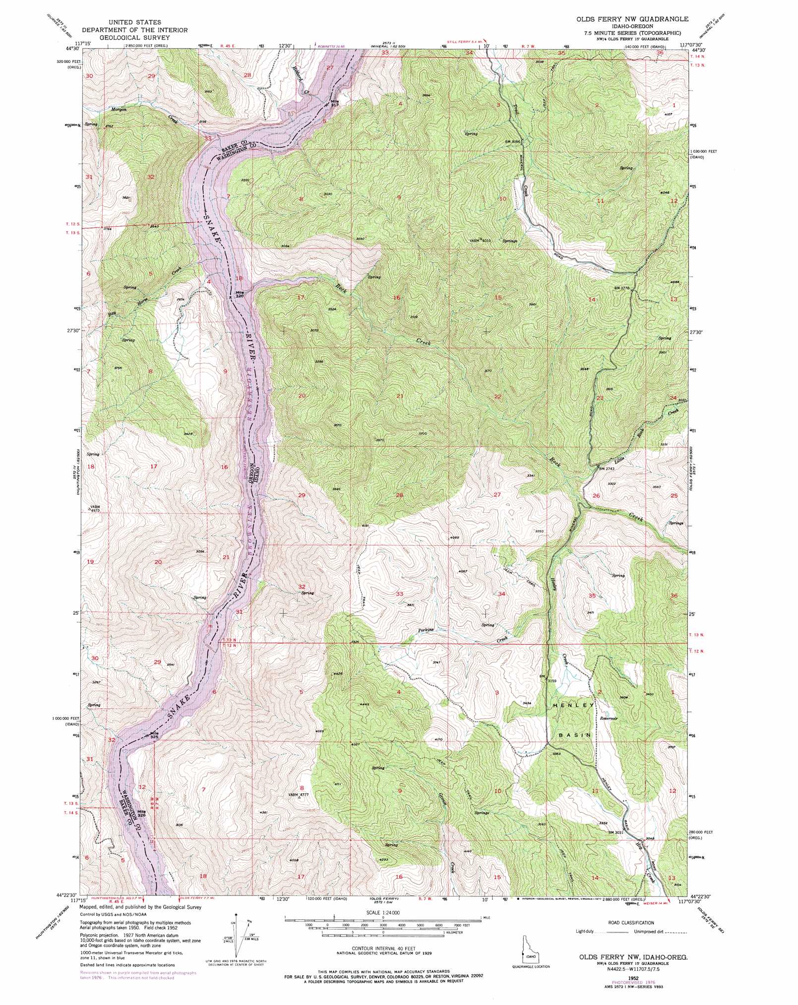
Henley Basin Topo Map Idaho
To zoom in, hover over the map of Henley Basin
USGS Topo Quad 44117d2 - 1:24,000 scale
| Topo Map Name: | Henley Basin |
| USGS Topo Quad ID: | 44117d2 |
| Print Size: | ca. 21 1/4" wide x 27" high |
| Southeast Coordinates: | 44.375° N latitude / 117.125° W longitude |
| Map Center Coordinates: | 44.4375° N latitude / 117.1875° W longitude |
| U.S. States: | ID, OR |
| Filename: | o44117d2.jpg |
| Download Map JPG Image: | Henley Basin topo map 1:24,000 scale |
| Map Type: | Topographic |
| Topo Series: | 7.5´ |
| Map Scale: | 1:24,000 |
| Source of Map Images: | United States Geological Survey (USGS) |
| Alternate Map Versions: |
Olds Ferry NW ID 1952, updated 1954 Download PDF Buy paper map Olds Ferry NW ID 1952, updated 1960 Download PDF Buy paper map Olds Ferry NW ID 1952, updated 1973 Download PDF Buy paper map Olds Ferry NW ID 1952, updated 1977 Download PDF Buy paper map Henley Basin ID 2011 Download PDF Buy paper map Henley Basin ID 2013 Download PDF Buy paper map |
1:24,000 Topo Quads surrounding Henley Basin
Lawrence Creek |
Little Lookout Mountain |
Daly Creek |
Sturgill Creek |
Neil Gulch |
Durkee |
Big Lookout Mountain |
Connor Creek |
Monroe Butte |
Sturgill Peak |
Rye Valley |
Lime |
Henley Basin |
Olds Ferry Ne |
Mann Creek Nw |
Birch Creek Meadow |
Huntington |
Olds Ferry |
Porters Flat |
Weiser North |
Jamieson |
Mccarthy Ridge |
Tub Mountain |
Moores Hollow |
Weiser South |
> Back to 44117a1 at 1:100,000 scale
> Back to 44116a1 at 1:250,000 scale
> Back to U.S. Topo Maps home
Henley Basin topo map: Gazetteer
Henley Basin: Basins
Henley Basin elevation 1009m 3310′Henley Basin: Parks
Spring Recreation Site elevation 629m 2063′Henley Basin: Post Offices
Gypsum Post Office (historical) elevation 629m 2063′Henley Basin: Streams
Bay Horse Creek elevation 629m 2063′Bear Creek elevation 647m 2122′
Deafy Creek elevation 752m 2467′
Henley Creek elevation 831m 2726′
Hibbard Creek elevation 629m 2063′
Little Rock Creek elevation 816m 2677′
Morgan Creek elevation 629m 2063′
Perkins Creek elevation 925m 3034′
Rock Creek elevation 629m 2063′
Trail Creek elevation 802m 2631′
Henley Basin: Valleys
Billy Gulch elevation 744m 2440′Louse Canyon elevation 716m 2349′
Ryan Gulch elevation 629m 2063′
Henley Basin digital topo map on disk
Buy this Henley Basin topo map showing relief, roads, GPS coordinates and other geographical features, as a high-resolution digital map file on DVD: