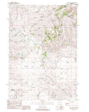
Rye Valley Topo Map Oregon
To zoom in, hover over the map of Rye Valley
USGS Topo Quad 44117d4 - 1:24,000 scale
| Topo Map Name: | Rye Valley |
| USGS Topo Quad ID: | 44117d4 |
| Print Size: | ca. 21 1/4" wide x 27" high |
| Southeast Coordinates: | 44.375° N latitude / 117.375° W longitude |
| Map Center Coordinates: | 44.4375° N latitude / 117.4375° W longitude |
| U.S. State: | OR |
| Filename: | o44117d4.jpg |
| Download Map JPG Image: | Rye Valley topo map 1:24,000 scale |
| Map Type: | Topographic |
| Topo Series: | 7.5´ |
| Map Scale: | 1:24,000 |
| Source of Map Images: | United States Geological Survey (USGS) |
| Alternate Map Versions: |
Rye Valley OR 1988, updated 1988 Download PDF Buy paper map Rye Valley OR 2011 Download PDF Buy paper map Rye Valley OR 2014 Download PDF Buy paper map |
1:24,000 Topo Quads surrounding Rye Valley
> Back to 44117a1 at 1:100,000 scale
> Back to 44116a1 at 1:250,000 scale
> Back to U.S. Topo Maps home
Rye Valley topo map: Gazetteer
Rye Valley: Canals
North Dixie Ditch elevation 1131m 3710′South Dixie Ditch elevation 1048m 3438′
Rye Valley: Flats
Bowman Flats elevation 1185m 3887′Buck Flat elevation 1270m 4166′
Rye Valley: Populated Places
Rye Valley elevation 972m 3188′Rye Valley: Post Offices
Rye Valley Post Office (historical) elevation 972m 3188′Rye Valley: Reservoirs
Buck Flat Waterhole elevation 1242m 4074′Rye Valley: Slopes
Shoestring Grade elevation 1273m 4176′Rye Valley: Springs
Abram Spring elevation 1328m 4356′Black Flat Spring elevation 1244m 4081′
Black Rock Spring elevation 1053m 3454′
Bog Spring elevation 1245m 4084′
Brown Gulch Spring elevation 1257m 4124′
Buck Spring elevation 1318m 4324′
Cloverleaf Spring Number Two elevation 1292m 4238′
Colton Spring elevation 1311m 4301′
Cosena Spring elevation 1220m 4002′
Dry Gulch Spring elevation 1101m 3612′
Fence Spring elevation 1438m 4717′
First Canyon Spring elevation 1221m 4005′
Juniper Spring elevation 1390m 4560′
L T Spring elevation 1150m 3772′
Miller Spring elevation 1212m 3976′
Mun Spring elevation 1238m 4061′
Quaker Spring elevation 1318m 4324′
Rye Valley Spring elevation 1320m 4330′
Suitter Spring elevation 1463m 4799′
Summit Spring elevation 1469m 4819′
Try Spring elevation 1233m 4045′
West Fork Road Spring elevation 1266m 4153′
Rye Valley: Streams
Beaver Creek elevation 888m 2913′Deer Creek elevation 1046m 3431′
North Fork Dixie Creek elevation 923m 3028′
South Fork Dixie Creek elevation 923m 3028′
Rye Valley: Summits
Cinder Butte elevation 1478m 4849′Fur Mountain elevation 1563m 5127′
Juniper Mountain elevation 1589m 5213′
Pedro Mountain elevation 1236m 4055′
Table Rock elevation 1445m 4740′
Weatherby Mountain elevation 1504m 4934′
Rye Valley: Valleys
Brouchaux Gulch elevation 1070m 3510′Brown Draw elevation 969m 3179′
Clough Gulch elevation 1025m 3362′
Dumas Gulch elevation 808m 2650′
East Fork Rattlesnake Gulch elevation 976m 3202′
Kitchen Gulch elevation 994m 3261′
Lower Turner Gulch elevation 855m 2805′
Opal Mine Draw elevation 915m 3001′
Pole Gulch elevation 1045m 3428′
Rye Valley elevation 938m 3077′
Spring Gulch elevation 960m 3149′
Upper Turner Gulch elevation 854m 2801′
Weber Gulch elevation 1053m 3454′
Rye Valley: Wells
Cinder Butte Well elevation 1335m 4379′Table Mountain Well elevation 1315m 4314′
Rye Valley digital topo map on disk
Buy this Rye Valley topo map showing relief, roads, GPS coordinates and other geographical features, as a high-resolution digital map file on DVD:


