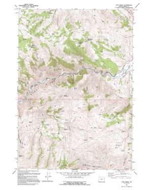
Lost Basin Topo Map Oregon
To zoom in, hover over the map of Lost Basin
USGS Topo Quad 44117e5 - 1:24,000 scale
| Topo Map Name: | Lost Basin |
| USGS Topo Quad ID: | 44117e5 |
| Print Size: | ca. 21 1/4" wide x 27" high |
| Southeast Coordinates: | 44.5° N latitude / 117.5° W longitude |
| Map Center Coordinates: | 44.5625° N latitude / 117.5625° W longitude |
| U.S. State: | OR |
| Filename: | o44117e5.jpg |
| Download Map JPG Image: | Lost Basin topo map 1:24,000 scale |
| Map Type: | Topographic |
| Topo Series: | 7.5´ |
| Map Scale: | 1:24,000 |
| Source of Map Images: | United States Geological Survey (USGS) |
| Alternate Map Versions: |
Lost Basin OR 1967, updated 1971 Download PDF Buy paper map Lost Basin OR 1967, updated 1971 Download PDF Buy paper map Lost Basin OR 1994, updated 1994 Download PDF Buy paper map Lost Basin OR 2011 Download PDF Buy paper map Lost Basin OR 2014 Download PDF Buy paper map |
| FStopo: | US Forest Service topo Lost Basin is available: Download FStopo PDF Download FStopo TIF |
1:24,000 Topo Quads surrounding Lost Basin
> Back to 44117e1 at 1:100,000 scale
> Back to 44116a1 at 1:250,000 scale
> Back to U.S. Topo Maps home
Lost Basin topo map: Gazetteer
Lost Basin: Basins
Lost Basin elevation 1441m 4727′Lost Basin: Canals
Chambeam Ditch elevation 828m 2716′Lost Basin: Lakes
Benchmark Waterhole elevation 1205m 3953′Coyote Waterhole elevation 1288m 4225′
Lost Basin: Mines
Cutting Mine elevation 1573m 5160′Lost Basin: Reservoirs
Kirby Reservoir elevation 1520m 4986′True Blue Reservoir elevation 960m 3149′
Lost Basin: Springs
Brattan Spring elevation 826m 2709′Celia Spring elevation 1509m 4950′
Fleming Spring elevation 1288m 4225′
Powell Spring elevation 1384m 4540′
Steep Slope Spring elevation 1602m 5255′
Lost Basin: Streams
Cave Creek elevation 943m 3093′Deer Creek elevation 938m 3077′
Eddy Slough elevation 1630m 5347′
Powell Creek elevation 854m 2801′
Reagan Creek elevation 1064m 3490′
Sinker Creek elevation 862m 2828′
Lost Basin: Summits
Sheep Mountain elevation 1610m 5282′Lost Basin: Valleys
Burnt River Canyon elevation 830m 2723′Hooker Gulch elevation 930m 3051′
True Blue Gulch elevation 958m 3143′
Lost Basin digital topo map on disk
Buy this Lost Basin topo map showing relief, roads, GPS coordinates and other geographical features, as a high-resolution digital map file on DVD:


