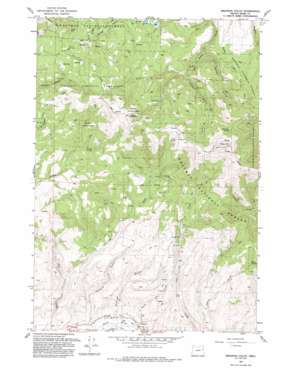
Brannan Gulch Topo Map Oregon
To zoom in, hover over the map of Brannan Gulch
USGS Topo Quad 44117e8 - 1:24,000 scale
| Topo Map Name: | Brannan Gulch |
| USGS Topo Quad ID: | 44117e8 |
| Print Size: | ca. 21 1/4" wide x 27" high |
| Southeast Coordinates: | 44.5° N latitude / 117.875° W longitude |
| Map Center Coordinates: | 44.5625° N latitude / 117.9375° W longitude |
| U.S. State: | OR |
| Filename: | o44117e8.jpg |
| Download Map JPG Image: | Brannan Gulch topo map 1:24,000 scale |
| Map Type: | Topographic |
| Topo Series: | 7.5´ |
| Map Scale: | 1:24,000 |
| Source of Map Images: | United States Geological Survey (USGS) |
| Alternate Map Versions: |
Brannan Gulch OR 1967, updated 1972 Download PDF Buy paper map Brannan Gulch OR 1967, updated 1980 Download PDF Buy paper map Brannan Gulch OR 1967, updated 1985 Download PDF Buy paper map Brannan Gulch OR 1993, updated 1993 Download PDF Buy paper map Brannan Gulch OR 2011 Download PDF Buy paper map Brannan Gulch OR 2014 Download PDF Buy paper map |
| FStopo: | US Forest Service topo Brannan Gulch is available: Download FStopo PDF Download FStopo TIF |
1:24,000 Topo Quads surrounding Brannan Gulch
> Back to 44117e1 at 1:100,000 scale
> Back to 44116a1 at 1:250,000 scale
> Back to U.S. Topo Maps home
Brannan Gulch topo map: Gazetteer
Brannan Gulch: Canals
Cleary Ditch elevation 1087m 3566′Reed Ditch elevation 1084m 3556′
Brannan Gulch: Mines
Elliot Mine elevation 1235m 4051′Brannan Gulch: Springs
Bald Mountain Spring elevation 1804m 5918′Frog Spring elevation 1780m 5839′
Snag Spring elevation 1517m 4977′
Brannan Gulch: Streams
Cow Creek elevation 1160m 3805′Reeds Creek elevation 1083m 3553′
Brannan Gulch: Summits
Bald Mountain elevation 2026m 6646′Little Bald Mountain elevation 1955m 6414′
Brannan Gulch: Valleys
Brannan Gulch elevation 1090m 3576′Browns Gulch elevation 1094m 3589′
Buffalo Gulch elevation 1363m 4471′
Hervey Gulch elevation 1314m 4311′
Brannan Gulch digital topo map on disk
Buy this Brannan Gulch topo map showing relief, roads, GPS coordinates and other geographical features, as a high-resolution digital map file on DVD:


