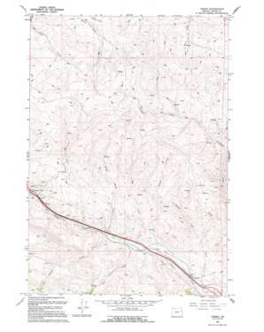
Oxman Topo Map Oregon
To zoom in, hover over the map of Oxman
USGS Topo Quad 44117f5 - 1:24,000 scale
| Topo Map Name: | Oxman |
| USGS Topo Quad ID: | 44117f5 |
| Print Size: | ca. 21 1/4" wide x 27" high |
| Southeast Coordinates: | 44.625° N latitude / 117.5° W longitude |
| Map Center Coordinates: | 44.6875° N latitude / 117.5625° W longitude |
| U.S. State: | OR |
| Filename: | o44117f5.jpg |
| Download Map JPG Image: | Oxman topo map 1:24,000 scale |
| Map Type: | Topographic |
| Topo Series: | 7.5´ |
| Map Scale: | 1:24,000 |
| Source of Map Images: | United States Geological Survey (USGS) |
| Alternate Map Versions: |
Oxman OR 1987, updated 1987 Download PDF Buy paper map Oxman OR 1994, updated 1994 Download PDF Buy paper map Oxman OR 2011 Download PDF Buy paper map Oxman OR 2014 Download PDF Buy paper map |
| FStopo: | US Forest Service topo Oxman is available: Download FStopo PDF Download FStopo TIF |
1:24,000 Topo Quads surrounding Oxman
> Back to 44117e1 at 1:100,000 scale
> Back to 44116a1 at 1:250,000 scale
> Back to U.S. Topo Maps home
Oxman topo map: Gazetteer
Oxman: Reservoirs
A Reservoir elevation 1124m 3687′Ant Waterhole elevation 1218m 3996′
Bug Waterhole elevation 1201m 3940′
Cow Waterhole elevation 1194m 3917′
D Reservoir elevation 1114m 3654′
F Reservoir elevation 1213m 3979′
G Reservoir elevation 1217m 3992′
J Reservoir elevation 1259m 4130′
K Reservoir elevation 1157m 3795′
L Reservoir elevation 1133m 3717′
N Reservoir elevation 1209m 3966′
O Reservoir elevation 1029m 3375′
P Reservoir elevation 1085m 3559′
Pierce Waterhole elevation 1369m 4491′
Q Reservoir elevation 1255m 4117′
R Reservoir elevation 1149m 3769′
S Reservoir elevation 1158m 3799′
Sheep Waterhole elevation 1166m 3825′
T Reservoir elevation 1281m 4202′
Truscot Waterhole elevation 1316m 4317′
Wendt Reservoir elevation 1242m 4074′
Oxman: Streams
Hill Creek elevation 998m 3274′Holman Creek elevation 997m 3270′
Kitchen Creek elevation 1034m 3392′
Low Creek elevation 998m 3274′
Straw Ranch Creek elevation 1026m 3366′
Unity Creek elevation 956m 3136′
Oxman digital topo map on disk
Buy this Oxman topo map showing relief, roads, GPS coordinates and other geographical features, as a high-resolution digital map file on DVD:


