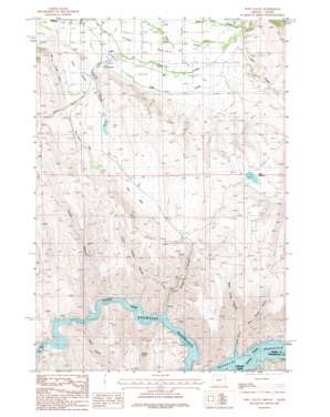
Posy Valley Topo Map Oregon
To zoom in, hover over the map of Posy Valley
USGS Topo Quad 44117g1 - 1:24,000 scale
| Topo Map Name: | Posy Valley |
| USGS Topo Quad ID: | 44117g1 |
| Print Size: | ca. 21 1/4" wide x 27" high |
| Southeast Coordinates: | 44.75° N latitude / 117° W longitude |
| Map Center Coordinates: | 44.8125° N latitude / 117.0625° W longitude |
| U.S. States: | OR, ID |
| Filename: | o44117g1.jpg |
| Download Map JPG Image: | Posy Valley topo map 1:24,000 scale |
| Map Type: | Topographic |
| Topo Series: | 7.5´ |
| Map Scale: | 1:24,000 |
| Source of Map Images: | United States Geological Survey (USGS) |
| Alternate Map Versions: |
Posy Valley OR 1987, updated 1987 Download PDF Buy paper map Posy Valley OR 2011 Download PDF Buy paper map Posy Valley OR 2014 Download PDF Buy paper map |
| FStopo: | US Forest Service topo Posy Valley is available: Download FStopo PDF Download FStopo TIF |
1:24,000 Topo Quads surrounding Posy Valley
> Back to 44117e1 at 1:100,000 scale
> Back to 44116a1 at 1:250,000 scale
> Back to U.S. Topo Maps home
Posy Valley topo map: Gazetteer
Posy Valley: Canals
McMullen Ditch elevation 768m 2519′Posy Valley: Dams
F M Crow Dam elevation 950m 3116′Laird Dam elevation 841m 2759′
Posy Valley: Flats
The Sag elevation 870m 2854′Posy Valley: Populated Places
Pine elevation 785m 2575′Robinette elevation 633m 2076′
Posy Valley: Post Offices
Pine Post Office (historical) elevation 785m 2575′Robinette Post Office (historical) elevation 633m 2076′
Posy Valley: Reservoirs
Crow Reservoir elevation 951m 3120′Densley Reservoir elevation 1119m 3671′
F M Crow Reservoir elevation 950m 3116′
Gulch Reservoir elevation 1091m 3579′
Laird Reservoir elevation 841m 2759′
Timber Canyon Waterhole elevation 1007m 3303′
Posy Valley: Springs
Tarter Spring elevation 1147m 3763′Timber Canyon Spring elevation 1011m 3316′
Posy Valley: Streams
Clear Creek elevation 745m 2444′Cottonwood Creek elevation 633m 2076′
Deer Creek elevation 743m 2437′
Dry Creek elevation 736m 2414′
East Pine Creek elevation 755m 2477′
Lee Creek elevation 814m 2670′
Sag Creek elevation 761m 2496′
Posy Valley: Valleys
Deer Gulch elevation 791m 2595′East Tarter Gulch elevation 730m 2395′
Foster Gulch elevation 633m 2076′
Little Timber Canyon elevation 633m 2076′
Pine Valley elevation 759m 2490′
Posy Valley elevation 824m 2703′
Road Gulch elevation 830m 2723′
Ruth Gulch elevation 633m 2076′
Tarter Gulch elevation 649m 2129′
Timber Canyon elevation 633m 2076′
West Tarter Gulch elevation 730m 2395′
Posy Valley digital topo map on disk
Buy this Posy Valley topo map showing relief, roads, GPS coordinates and other geographical features, as a high-resolution digital map file on DVD:


