Sawtooth Ridge Topo Map Oregon
To zoom in, hover over the map of Sawtooth Ridge
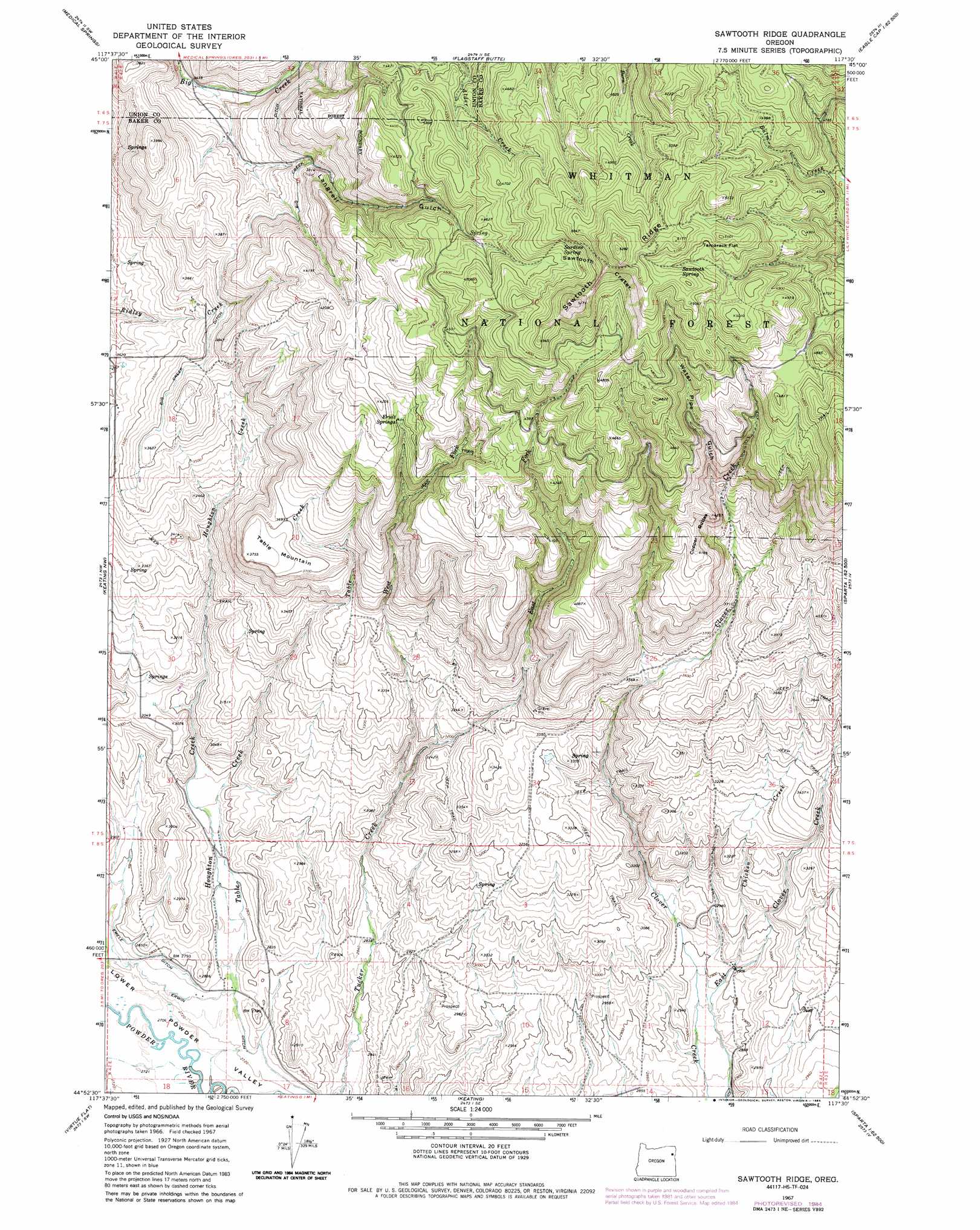
USGS Topo Quad 44117h5 - 1:24,000 scale
| Topo Map Name: | Sawtooth Ridge |
| USGS Topo Quad ID: | 44117h5 |
| Print Size: | ca. 21 1/4" wide x 27" high |
| Southeast Coordinates: | 44.875° N latitude / 117.5° W longitude |
| Map Center Coordinates: | 44.9375° N latitude / 117.5625° W longitude |
| U.S. State: | OR |
| Filename: | o44117h5.jpg |
| Download Map JPG Image: | Sawtooth Ridge topo map 1:24,000 scale |
| Map Type: | Topographic |
| Topo Series: | 7.5´ |
| Map Scale: | 1:24,000 |
| Source of Map Images: | United States Geological Survey (USGS) |
| Alternate Map Versions: |
Sawtooth Ridge OR 1967, updated 1971 Download PDF Buy paper map Sawtooth Ridge OR 1967, updated 1985 Download PDF Buy paper map Sawtooth Ridge OR 2011 Download PDF Buy paper map Sawtooth Ridge OR 2014 Download PDF Buy paper map |
| FStopo: | US Forest Service topo Sawtooth Ridge is available: Download FStopo PDF Download FStopo TIF |
1:24,000 Topo Quads surrounding Sawtooth Ridge
Union |
Little Catherine Creek |
China Cap |
Steamboat Lake |
Eagle Cap |
Telocaset |
Medical Springs |
Flagstaff Butte |
Bennet Peak |
Krag Peak |
Magpie Peak |
Keating Nw |
Sawtooth Ridge |
Balm Creek Reservoir |
Sparta Butte |
Baker |
Virtue Flat |
Keating |
Glasgow Butte |
Sparta |
Bowen Valley |
Encina |
Oxman |
Lawrence Creek |
Little Lookout Mountain |
> Back to 44117e1 at 1:100,000 scale
> Back to 44116a1 at 1:250,000 scale
> Back to U.S. Topo Maps home
Sawtooth Ridge topo map: Gazetteer
Sawtooth Ridge: Canals
Big Creek Ditch elevation 1108m 3635′Sawtooth Ridge: Flats
Tamarack Flat elevation 1522m 4993′Sawtooth Ridge: Gaps
Sawtooth Crater elevation 1527m 5009′Sawtooth Ridge: Populated Places
Erwin (historical) elevation 839m 2752′Sawtooth Ridge: Post Offices
Burkemont Post Office (historical) elevation 1027m 3369′Erwin Post Office (historical) elevation 839m 2752′
Sawtooth Ridge: Ridges
Sawtooth Ridge elevation 1600m 5249′Sawtooth Ridge: Springs
Fruit Springs elevation 1251m 4104′Sardine Spring elevation 1460m 4790′
Sawtooth Spring elevation 1522m 4993′
Sawtooth Ridge: Streams
Chicken Creek elevation 885m 2903′East Fork Tucker Creek elevation 920m 3018′
Houghton Creek elevation 837m 2746′
Table Creek elevation 836m 2742′
West Fork Tucker Creek elevation 914m 2998′
Sawtooth Ridge: Summits
Copper Buttes elevation 1288m 4225′Table Mountain elevation 1145m 3756′
Sawtooth Ridge: Valleys
Langrell Gulch elevation 1117m 3664′Water Pipe Gulch elevation 1215m 3986′
Sawtooth Ridge digital topo map on disk
Buy this Sawtooth Ridge topo map showing relief, roads, GPS coordinates and other geographical features, as a high-resolution digital map file on DVD: