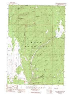
Logan Valley East Topo Map Oregon
To zoom in, hover over the map of Logan Valley East
USGS Topo Quad 44118b5 - 1:24,000 scale
| Topo Map Name: | Logan Valley East |
| USGS Topo Quad ID: | 44118b5 |
| Print Size: | ca. 21 1/4" wide x 27" high |
| Southeast Coordinates: | 44.125° N latitude / 118.5° W longitude |
| Map Center Coordinates: | 44.1875° N latitude / 118.5625° W longitude |
| U.S. State: | OR |
| Filename: | o44118b5.jpg |
| Download Map JPG Image: | Logan Valley East topo map 1:24,000 scale |
| Map Type: | Topographic |
| Topo Series: | 7.5´ |
| Map Scale: | 1:24,000 |
| Source of Map Images: | United States Geological Survey (USGS) |
| Alternate Map Versions: |
Logan Valley East OR 1988, updated 1988 Download PDF Buy paper map Logan Valley East OR 1999, updated 2002 Download PDF Buy paper map Logan Valley East OR 2011 Download PDF Buy paper map Logan Valley East OR 2014 Download PDF Buy paper map |
| FStopo: | US Forest Service topo Logan Valley East is available: Download FStopo PDF Download FStopo TIF |
1:24,000 Topo Quads surrounding Logan Valley East
> Back to 44118a1 at 1:100,000 scale
> Back to 44118a1 at 1:250,000 scale
> Back to U.S. Topo Maps home
Logan Valley East topo map: Gazetteer
Logan Valley East: Basins
Corral Basin elevation 1955m 6414′Logan Valley East: Flats
Summit Prairie elevation 1621m 5318′Logan Valley East: Springs
Basket Spring elevation 1609m 5278′Conroy Spring elevation 1697m 5567′
Engineers Springs (historical) elevation 1675m 5495′
Joice Spring elevation 1817m 5961′
Wickiup Spring elevation 1619m 5311′
Logan Valley East: Streams
Bosonberg Creek elevation 1512m 4960′Conroy Creek elevation 1554m 5098′
Corral Basin Creek elevation 1623m 5324′
Larch Creek elevation 1514m 4967′
Little Logan Creek elevation 1561m 5121′
Meadow Fork Big Creek elevation 1690m 5544′
Snowshoe Creek elevation 1745m 5725′
Tamarack Creek elevation 1606m 5269′
Wickiup Creek elevation 1549m 5082′
Logan Valley East: Valleys
Keystone Gulch elevation 1562m 5124′Logan Valley elevation 1513m 4963′
Logan Valley East digital topo map on disk
Buy this Logan Valley East topo map showing relief, roads, GPS coordinates and other geographical features, as a high-resolution digital map file on DVD:


