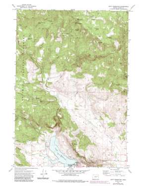
Unity Reservoir Topo Map Oregon
To zoom in, hover over the map of Unity Reservoir
USGS Topo Quad 44118e2 - 1:24,000 scale
| Topo Map Name: | Unity Reservoir |
| USGS Topo Quad ID: | 44118e2 |
| Print Size: | ca. 21 1/4" wide x 27" high |
| Southeast Coordinates: | 44.5° N latitude / 118.125° W longitude |
| Map Center Coordinates: | 44.5625° N latitude / 118.1875° W longitude |
| U.S. State: | OR |
| Filename: | o44118e2.jpg |
| Download Map JPG Image: | Unity Reservoir topo map 1:24,000 scale |
| Map Type: | Topographic |
| Topo Series: | 7.5´ |
| Map Scale: | 1:24,000 |
| Source of Map Images: | United States Geological Survey (USGS) |
| Alternate Map Versions: |
Unity Reservoir OR 1972, updated 1976 Download PDF Buy paper map Unity Reservoir OR 1972, updated 1985 Download PDF Buy paper map Unity Reservoir OR 2011 Download PDF Buy paper map Unity Reservoir OR 2014 Download PDF Buy paper map |
| FStopo: | US Forest Service topo Unity Reservoir is available: Download FStopo PDF Download FStopo TIF |
1:24,000 Topo Quads surrounding Unity Reservoir
> Back to 44118e1 at 1:100,000 scale
> Back to 44118a1 at 1:250,000 scale
> Back to U.S. Topo Maps home
Unity Reservoir topo map: Gazetteer
Unity Reservoir: Canals
Big Flat Ditch elevation 1202m 3943′China Creek Ditch elevation 1250m 4101′
Thompson Ditch elevation 1223m 4012′
Unity Reservoir: Dams
Unity Dam elevation 1166m 3825′Unity Reservoir: Flats
Big Flat elevation 1201m 3940′Head Meadow elevation 1191m 3907′
Unity Reservoir: Lakes
China Lake elevation 1444m 4737′Dooley Gulch Pond elevation 1268m 4160′
Mud Spring Pond elevation 1567m 5141′
Unity Reservoir: Populated Places
Audrey (historical) elevation 1201m 3940′Unity Reservoir: Post Offices
Audrey Post Office (historical) elevation 1201m 3940′Unity Reservoir: Reservoirs
Hanby Reservoir elevation 1243m 4078′Unity Reservoir elevation 1166m 3825′
Unity Reservoir: Springs
Badger Hole Spring elevation 1471m 4826′Barrel Spring elevation 1505m 4937′
China Creek Spring elevation 1658m 5439′
Curran Mountain Spring elevation 1555m 5101′
Day Spring elevation 1662m 5452′
Derringer Spring elevation 1546m 5072′
Fourth Creek Trail Spring elevation 1402m 4599′
King Spring elevation 1310m 4297′
Lower First Creek Spring elevation 1541m 5055′
Max Spring elevation 1519m 4983′
Mud Spring elevation 1691m 5547′
Second Creek Spring elevation 1461m 4793′
Third Creek Spring elevation 1291m 4235′
Upper First Creek Spring elevation 1605m 5265′
Unity Reservoir: Streams
Antelope Creek elevation 1202m 3943′China Creek elevation 1198m 3930′
Cottonwood Creek elevation 1152m 3779′
First Creek elevation 1204m 3950′
Lick Creek elevation 1226m 4022′
Middle Fork Burnt River elevation 1166m 3825′
North Fork Burnt River elevation 1169m 3835′
Pine Creek elevation 1142m 3746′
Second Creek elevation 1219m 3999′
Sheep Creek elevation 1226m 4022′
Third Creek elevation 1226m 4022′
West Fork Burnt River elevation 1169m 3835′
Unity Reservoir: Summits
Cottonwood Buttes elevation 1696m 5564′King Mountain elevation 1510m 4954′
Unity Reservoir: Valleys
Dooley Gulch elevation 1184m 3884′Thompson Gulch elevation 1223m 4012′
Unity Reservoir digital topo map on disk
Buy this Unity Reservoir topo map showing relief, roads, GPS coordinates and other geographical features, as a high-resolution digital map file on DVD:


