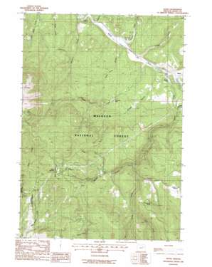
Bates Topo Map Oregon
To zoom in, hover over the map of Bates
USGS Topo Quad 44118e5 - 1:24,000 scale
| Topo Map Name: | Bates |
| USGS Topo Quad ID: | 44118e5 |
| Print Size: | ca. 21 1/4" wide x 27" high |
| Southeast Coordinates: | 44.5° N latitude / 118.5° W longitude |
| Map Center Coordinates: | 44.5625° N latitude / 118.5625° W longitude |
| U.S. State: | OR |
| Filename: | o44118e5.jpg |
| Download Map JPG Image: | Bates topo map 1:24,000 scale |
| Map Type: | Topographic |
| Topo Series: | 7.5´ |
| Map Scale: | 1:24,000 |
| Source of Map Images: | United States Geological Survey (USGS) |
| Alternate Map Versions: |
Bates OR 1988, updated 1988 Download PDF Buy paper map Bates OR 1996, updated 1998 Download PDF Buy paper map Bates OR 2011 Download PDF Buy paper map Bates OR 2014 Download PDF Buy paper map |
| FStopo: | US Forest Service topo Bates is available: Download FStopo PDF Download FStopo TIF |
1:24,000 Topo Quads surrounding Bates
> Back to 44118e1 at 1:100,000 scale
> Back to 44118a1 at 1:250,000 scale
> Back to U.S. Topo Maps home
Bates topo map: Gazetteer
Bates: Areas
Bridge Creek Meadow elevation 1512m 4960′Bates: Dams
Bates Dam elevation 1266m 4153′Bates: Gaps
Dixie Summit elevation 1611m 5285′Bates: Mines
Dixie Trail Mine elevation 1529m 5016′Bates: Populated Places
Bates elevation 1238m 4061′Bates: Post Offices
Bates Post Office elevation 1238m 4061′Bates: Reservoirs
Bates Pond elevation 1248m 4094′Bates: Springs
Dixie Spring elevation 2037m 6683′Huckleberry Spring elevation 1644m 5393′
Bates: Streams
Bridge Creek elevation 1257m 4124′Caribou Creek elevation 1214m 3982′
Clear Creek elevation 1238m 4061′
Davis Creek elevation 1221m 4005′
Deerhorn Creek elevation 1207m 3959′
Easy Creek elevation 1525m 5003′
Lunch Creek elevation 1408m 4619′
North Fork Bridge Creek elevation 1472m 4829′
Vincent Creek elevation 1219m 3999′
Vinegar Creek elevation 1224m 4015′
Bates: Trails
Davis Creek Trail elevation 1398m 4586′Reynolds Creek Trail elevation 1556m 5104′
Bates: Valleys
Dead Cow Gulch elevation 1221m 4005′Placer Gulch elevation 1231m 4038′
Bates digital topo map on disk
Buy this Bates topo map showing relief, roads, GPS coordinates and other geographical features, as a high-resolution digital map file on DVD:


