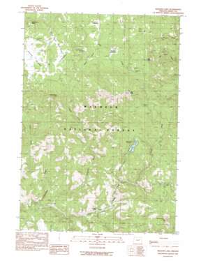
Magone Lake Topo Map Oregon
To zoom in, hover over the map of Magone Lake
USGS Topo Quad 44118e8 - 1:24,000 scale
| Topo Map Name: | Magone Lake |
| USGS Topo Quad ID: | 44118e8 |
| Print Size: | ca. 21 1/4" wide x 27" high |
| Southeast Coordinates: | 44.5° N latitude / 118.875° W longitude |
| Map Center Coordinates: | 44.5625° N latitude / 118.9375° W longitude |
| U.S. State: | OR |
| Filename: | o44118e8.jpg |
| Download Map JPG Image: | Magone Lake topo map 1:24,000 scale |
| Map Type: | Topographic |
| Topo Series: | 7.5´ |
| Map Scale: | 1:24,000 |
| Source of Map Images: | United States Geological Survey (USGS) |
| Alternate Map Versions: |
Magone Lake OR 1990, updated 1990 Download PDF Buy paper map Magone Lake OR 1999, updated 2002 Download PDF Buy paper map Magone Lake OR 2011 Download PDF Buy paper map Magone Lake OR 2014 Download PDF Buy paper map |
| FStopo: | US Forest Service topo Magone Lake is available: Download FStopo PDF Download FStopo TIF |
1:24,000 Topo Quads surrounding Magone Lake
> Back to 44118e1 at 1:100,000 scale
> Back to 44118a1 at 1:250,000 scale
> Back to U.S. Topo Maps home
Magone Lake topo map: Gazetteer
Magone Lake: Flats
Clark Meadow elevation 1659m 5442′Flood Meadow elevation 1567m 5141′
Harper Meadow elevation 1594m 5229′
Morrow Meadow elevation 1784m 5853′
Magone Lake: Lakes
Magone Lake elevation 1522m 4993′Magone Lake: Springs
Allen Spring elevation 1605m 5265′Buck Spring elevation 1741m 5711′
Cold Spring elevation 1680m 5511′
Deadman Spring elevation 1688m 5538′
Deep Spring elevation 1656m 5433′
Fir Spring elevation 1756m 5761′
Hi Yu Spring elevation 1609m 5278′
Huckleberry Spring elevation 1670m 5479′
Porcupine Spring elevation 1640m 5380′
Telephone Spring elevation 1639m 5377′
Magone Lake: Streams
Jugow Creek elevation 1578m 5177′Lake Creek elevation 1338m 4389′
McClellan Creek elevation 1179m 3868′
Nipple Creek elevation 1401m 4596′
Thompson Creek elevation 1169m 3835′
Tinker Creek elevation 1371m 4498′
Magone Lake: Summits
Big Rock elevation 1829m 6000′Huckleberry Butte elevation 1856m 6089′
Jonas Mountain elevation 1845m 6053′
Lake Butte elevation 1894m 6213′
Nipple Butte elevation 1865m 6118′
Round Top elevation 1695m 5561′
Magone Lake: Trails
Sulphur Creek Trail elevation 1725m 5659′Magone Lake digital topo map on disk
Buy this Magone Lake topo map showing relief, roads, GPS coordinates and other geographical features, as a high-resolution digital map file on DVD:


