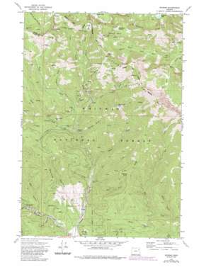
Bourne Topo Map Oregon
To zoom in, hover over the map of Bourne
USGS Topo Quad 44118g2 - 1:24,000 scale
| Topo Map Name: | Bourne |
| USGS Topo Quad ID: | 44118g2 |
| Print Size: | ca. 21 1/4" wide x 27" high |
| Southeast Coordinates: | 44.75° N latitude / 118.125° W longitude |
| Map Center Coordinates: | 44.8125° N latitude / 118.1875° W longitude |
| U.S. State: | OR |
| Filename: | o44118g2.jpg |
| Download Map JPG Image: | Bourne topo map 1:24,000 scale |
| Map Type: | Topographic |
| Topo Series: | 7.5´ |
| Map Scale: | 1:24,000 |
| Source of Map Images: | United States Geological Survey (USGS) |
| Alternate Map Versions: |
Bourne OR 1972, updated 1976 Download PDF Buy paper map Bourne OR 1972, updated 1985 Download PDF Buy paper map Bourne OR 1972, updated 1985 Download PDF Buy paper map Bourne OR 2011 Download PDF Buy paper map Bourne OR 2014 Download PDF Buy paper map |
| FStopo: | US Forest Service topo Bourne is available: Download FStopo PDF Download FStopo TIF |
1:24,000 Topo Quads surrounding Bourne
> Back to 44118e1 at 1:100,000 scale
> Back to 44118a1 at 1:250,000 scale
> Back to U.S. Topo Maps home
Bourne topo map: Gazetteer
Bourne: Basins
Western Union Basin elevation 2219m 7280′Bourne: Dams
Killamacue Dam elevation 2178m 7145′Bourne: Lakes
Killamacue Lake elevation 2178m 7145′Bourne: Mines
Amazon Mine elevation 1651m 5416′Analulu Mine elevation 1710m 5610′
Argonaut Mine elevation 2126m 6975′
Brooklyn Mine elevation 1703m 5587′
Buckeye Mine elevation 2249m 7378′
Bunker Hill Mine elevation 1768m 5800′
Chloride Mine elevation 1837m 6026′
Columbia Mine elevation 1794m 5885′
E and E Mine elevation 1717m 5633′
Esmeralda Mine elevation 2112m 6929′
Golconda Mine elevation 1712m 5616′
Kelly Mine elevation 2341m 7680′
Molly Gibson Mine elevation 2165m 7103′
Morning Star Mine elevation 2101m 6893′
Mountain Belle Mine elevation 1681m 5515′
Mountain View Mine elevation 2217m 7273′
North Pole Mine elevation 2141m 7024′
Silver Dick Mine elevation 1569m 5147′
South Pole Mine elevation 2115m 6938′
Western Union Mine elevation 2214m 7263′
Bourne: Populated Places
Bourne elevation 1638m 5374′Cracker City (historical) elevation 1783m 5849′
Bourne: Post Offices
Bourne Post Office (historical) elevation 1638m 5374′Chloride Post Office (historical) elevation 1854m 6082′
Cracker Post Office (historical) elevation 1783m 5849′
Eureka Post Office (historical) elevation 1592m 5223′
Hanover Post Office (historical) elevation 1522m 4993′
Bourne: Reservoirs
Sumpter Reservoir elevation 1413m 4635′Bourne: Ridges
Chloride Ridge elevation 2605m 8546′Pole Creek Ridge elevation 2024m 6640′
Spaulding Ridge elevation 1893m 6210′
Bourne: Springs
Pinegrass Spring elevation 1864m 6115′Bourne: Streams
East Fork Pole Creek elevation 1423m 4668′Fruit Creek elevation 1533m 5029′
Horse Creek elevation 1797m 5895′
Little Cracker Creek elevation 1643m 5390′
North Fork Rock Creek elevation 1716m 5629′
Pole Creek elevation 1412m 4632′
Sheep Creek elevation 1470m 4822′
Silver Creek elevation 1520m 4986′
Slim Creek elevation 1411m 4629′
Wind Creek elevation 1433m 4701′
Bourne: Summits
Columbia Hill elevation 2469m 8100′Elkhorn Mountains elevation 2263m 7424′
Wind Creek Peak elevation 2330m 7644′
Bourne: Swamps
Mayflower Meadow elevation 2278m 7473′Bourne: Trails
Rock Creek Lake Trail elevation 2039m 6689′Bourne: Valleys
Bear Canyon elevation 1375m 4511′Borden Gulch elevation 1511m 4957′
Buck Gulch elevation 1386m 4547′
Corey Gulch elevation 1374m 4507′
Sardine Gulch elevation 1851m 6072′
Snell Hollow elevation 1580m 5183′
Spaulding Gulch elevation 1369m 4491′
Wahoo Gulch elevation 1440m 4724′
Bourne: Wells
Flowing Well elevation 1665m 5462′Bourne digital topo map on disk
Buy this Bourne topo map showing relief, roads, GPS coordinates and other geographical features, as a high-resolution digital map file on DVD:


